First, I apologize for delays in releasing my blog post. It is not due to a lack of effort. It is due to technology. I am on the Navajo Indian Reservation and the upload speed is 0.27 Mbps. Web browsing works, but photos and videos load excruciatingly slowly or not at all.
To provide a feel for traveling by motorcycle in the Southwest, my trip from Window Rock, AZ to Canyon de Chelly (70 Miles) on Wednesday was in 50+ MPH winds and snow flurries. Add passing trucks going 70 MPH and you have a very dangerous situation. But, you slow down, white knuckle the bike and push on. I love the open road.
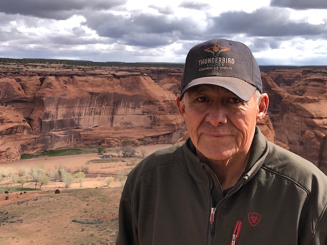
Canyon de Chelly (pronounced Canyon de Che) National Monument is a vast park in northeastern Arizona, on Navajo tribal lands. It has been inhabited for millennium by the Anasazi, Hopi, and Navajo people. The Canyon is known for towering cliffs, ancient Indian ruins and ancient rock carvings called petroglyphs. It made my lists of destinations as my brother-in-law and sister-in-law, Jim and Cynthia Bell highly recommended it. And they were absolutely correct. It is a site that inspires.
But, the experience would not have been the same without a bit of drama. I was to spend the entire day in the Canyon. But when I woke up, I was informed that the Canyon was closed due to high water in Chinle Creek, the creek that runs through the canyon. My disappointment was huge. So, the outfitter informed me that there was a morning rim tour that I could join and that I could check back in the afternoon and see if the Canyon was open.
So, drama turned to fortune as I did the rim tour in the morning, and the Canyon opened in the afternoon. This gave me an opportunity to see the Canyon, with a Navajo guide, from the rim, and inside the Canyon.
My morning guide – David (obviously not his Navajo name) giving me an overview.Looking into the Canyon – 800 ft High Cliff WallsSpider Rock in Canyon de ChellyThe temperature was 35º, wind blowing 20+ MPH and snow flurries – but, when the sun came out…David told me that in early AD thousands of Anasazi lived in the Canyon. Today, 25 to 50 Navajo families still live in the Canyon and farm with no electricity or running water. David’s grandfather passed away three years ago at the age of 97 and lived his entire life in the Canyon
Canyon de Chelly has seen history from the Anasazi who existed here from approximately 100 to 1600 AD, the Hopi, and the Navajo. It has seen the Spanish Conquistadors and their missionaries. It stood witness to The Long Walk of the Navajo in 1864 where Navajos were forced to walk 400 miles from their Arizona home to eastern New Mexico. And it stands today as a beautiful monument to nature and the Indian tribes who protect it.
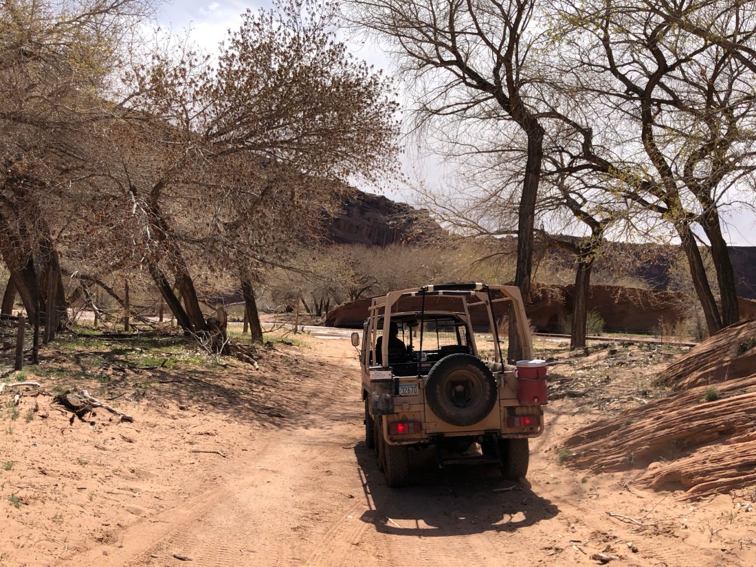
For the aftrernoon, we entered the Canyon in this impressive 6-wheel drive jeep.Our Canyon Guide Howard (not his Navajo name) was very dedicated and has worked with the Parks Department and archaeologists to better understand the meaning of the petroglyphs and ruinsWe crossed Chinle Creek dozens of times as we worked our way down the Canyon – Sometimes up to the floorboards.Our first sightings were petroglyphs high up on the canyon walls. Each one had meaning from the hands that represented the clans to the snake that represented “the snake dance” or defiance. The flute player, I was told, represented fertility. There were many of these as we moved through the canyon.We started to see cliff dwellings very early – 100 feet in the air where the Anasazi built thousands of years ago. The Hopi used cave dwellings to a degree and the Navajo did not.And the ruins became more elaborate with housing on the right and left and the Kiva (round) in the middle used for ritual rites.
Canyon de Chelly is a historic treasure and a site that inspires a love for the history of this area. It is rugged and beautiful at the same time. I cannot express the sense of history that the Canyon provides.
Today, I leave for Monument Valley and the four corners area. I look forward to seeing the area that Director John Ford made famous in his John Wayne films and to continue my visit with the Navajo people.
This Blog was to be issued yesterday. But due to the technical difficulty, it went out this morning.
Today’s (Tuesday, April 9) motorcycle ride was 187 miles from Eagar, AZ to the Petrified Forest National Park, through the Park and then onto Window Rock, AZ., which is on the Navajo Indian Reservation and on the border of New Mexico.
The Green Dot is Eagar, AZ where I slept last night, and the checkered flag dot is where I am sleeping tonight, Window Rock, AZ
While the winds that I reported yesterday were an issue, they were not insurmountable as I left at 7:30 AM before the winds picked up and arrived in Window Rock around 3 PM, in a dust storm. The good news is that I am no longer riding alone. I have joined a motorcycle gang and we now ride as one…
The area I rode today was what may be called “Wide Open Spaces”. The topography and the solitude were what I am seeking. Parts of the ride were so quiet that the silence was deafening.
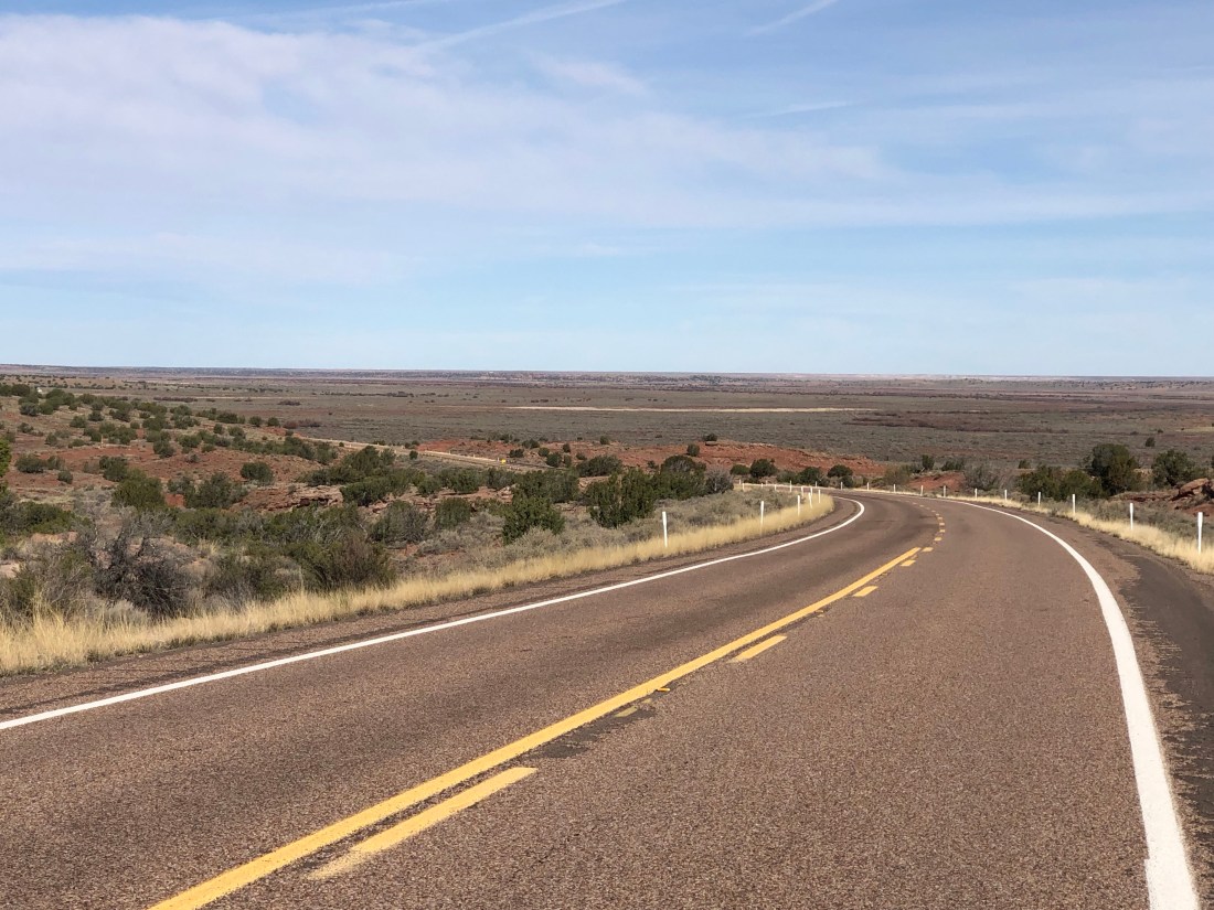
Route 180 from Eager to the Petrified Forest gave me views of many miles without a sole in sight. I rode through a high desert with views that went on forever. And, once in the Petrified Forest, I learned amazing things.
For instance, and some of you may know this, but billions of years ago, there existed one continent called Pangaea. Pangaea consisted of all the continents that we have today. And, as all the continents were one and rotated, Arizona resided at the equator and was similar to the Amazon basin. Over the years, the continents broke up and traveled to their current locations.
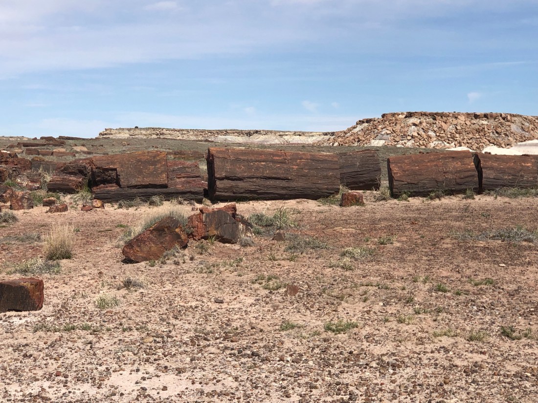
As Arizona migrated north, the large trees that existed in what is now Arizona died. The logs soaked up groundwater and silica from volcanic ash and over time crystallized into quartz and petrified. This process created a rainbow of colors that can be seen in the wood rings.
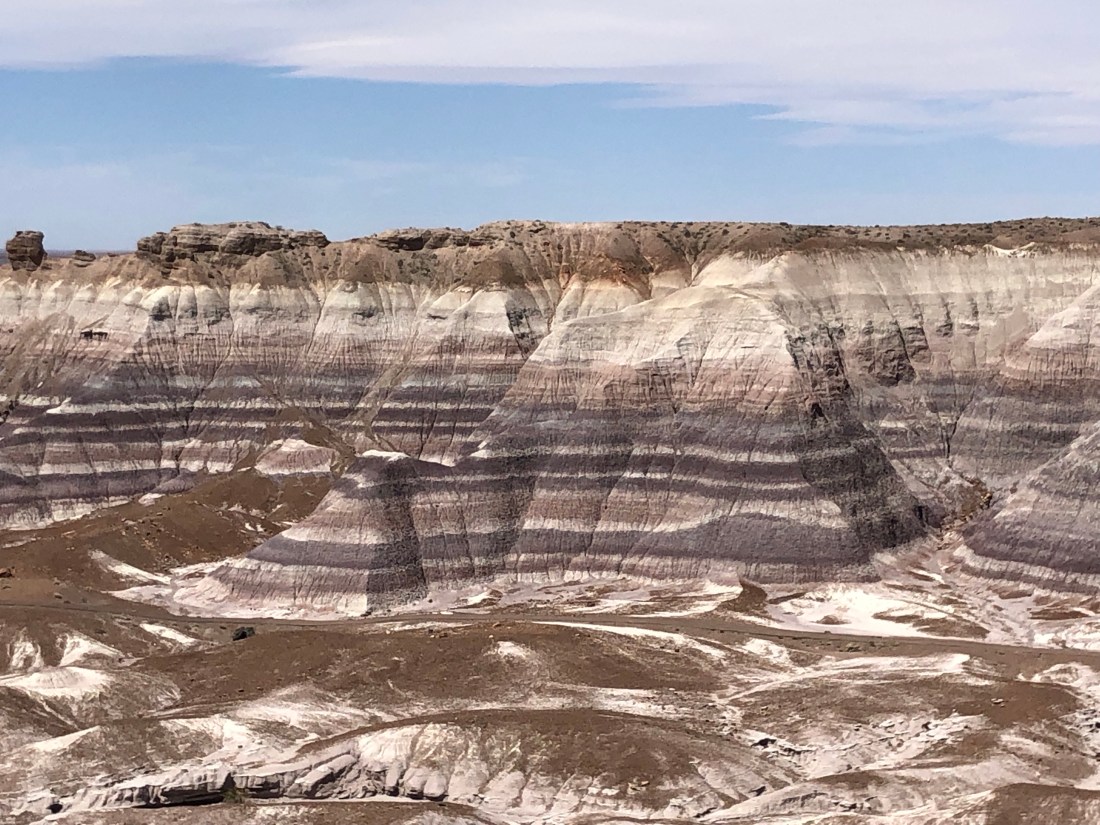
In addition, as this process took billions of years, the many changes in the environment can be seen in the colored layers of the plateaus. The Petrified Forest, like the rest of our National Parks, is a National treasure that must be supported and protected as they are a window back in time.
Solitude on the Road to the Petrified Forest at 7:30 AM with a view for miles and miles. Come to think about it, looks a lot like the beginning of Hwy 191 yesterday.
Hwy 180 Eagar to Petrified Forest – The quiet was deafeningA Petrified Tree Trunk in the National ForestThe remnants of trees were over a wide areaThe picture does not do justice to the reds, golds, blues, etc that can be seen in their rings
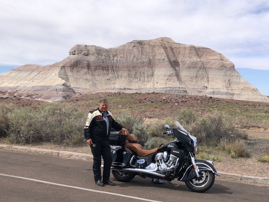
This shows the layers built upon the plateaus that are thousands of feet high – Each layer an ecological eventThe expansive views were impressiveA self-serving picture to prove that I am on the road and not in my living room making this all up 🙂
I woke up this morning, Wednesday, April 10 to 42º weather and winds still blowing 20 MPH+. After three days of 70º, 80º and 90º – this is a cruel reminder of what riding the open road is all about.
I have a quick one-hour run over to Chinle, AZ where I will be exploring Canyon de Chelly. And I am happy it is only one hour as riding in the 40º weather is a challenge.
Stay tuned for Canyon de Chelly (pronounced – Canyon de Che).
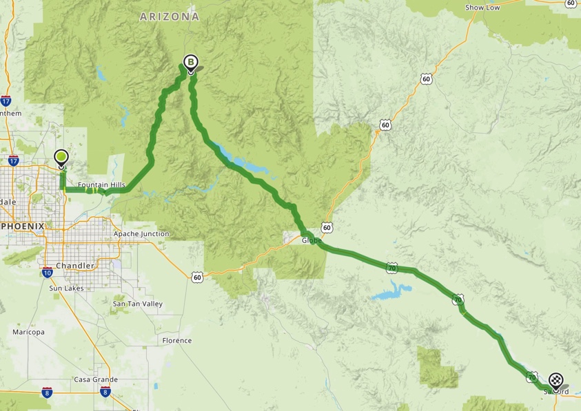
Today, Monday, April 8th I rode 165 Miles from Safford, AZ to Eagar, AZ along US Route 191 – Called the Devil’s Highway.
There are a number of stories as to how the road earned its name. One story, shared with me by Gary France, who inspired me to travel by Motorcycle around the United States and blog, is that it was originally called US Hwy 666. But the road signs were being stolen too often. By the way, check out Gary at http://www.garysfrance.com/france-in-america/
Another story is that the hairpin turns, sudden bad weather and the dangerous rock falls make it the Devil’s workshop. Also, it is a 90 mile stretch with no services on the road.
Today I was very lucky. The weather was perfect and I had to only deal with the turns and rock falls and gravel on the road.
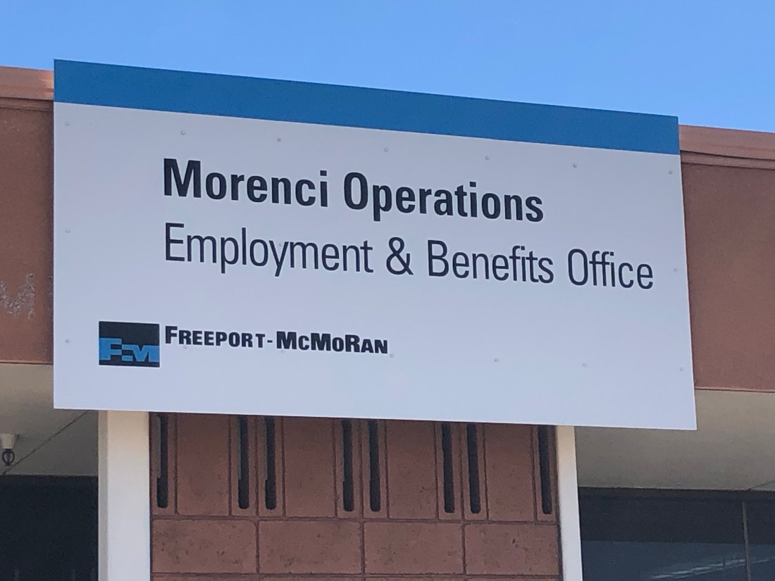
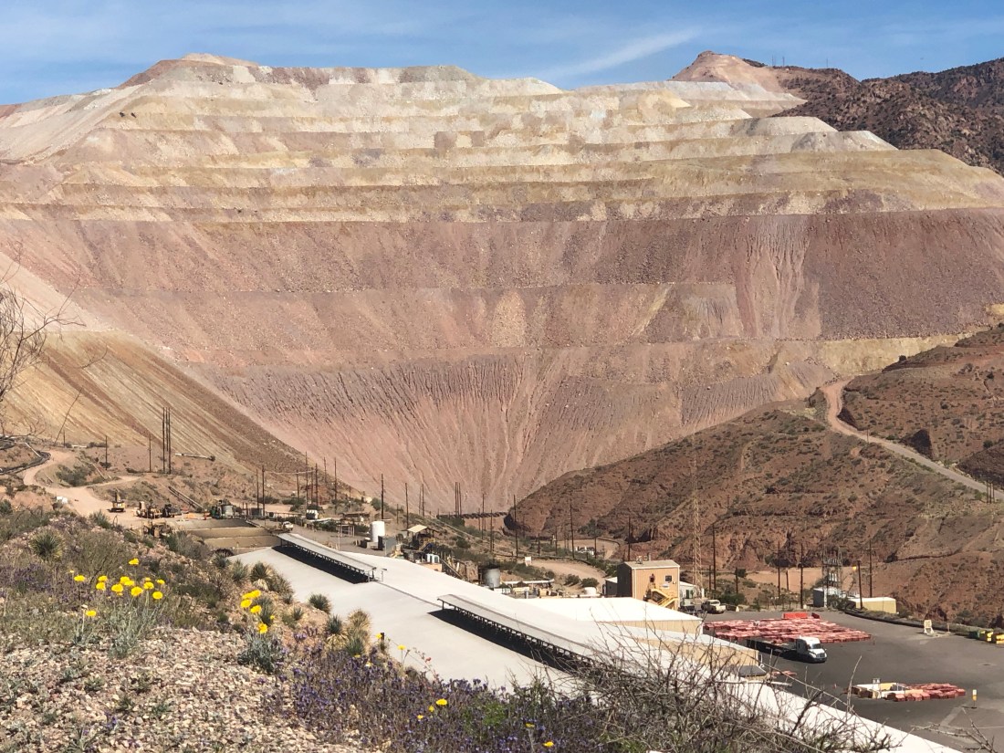
US 191, going north from Safford to Alpine, is an amazing road as it starts out in the desert and is straight as an arrow. It then meanders into foothills and you arrive at the Morenci Mine.
The Morenci Mine is a large, make that HUGE, copper mine. Morenci represents one of the largest copper reserves in the United States and in the world.
You then past the mine and enter the Apache National Forest and the highway turns into a Bikers dream (in good weather) with lots of twists and turns and beautiful Vistas.
Entering US 191 from Safford.
The Southern Start to US 191
High desert and straight as an arrow
The Morenci Mine.
First, I dropped off my resume – They told me I was not qualifiedIt is an incredible operation – The initial underground mining began in 1881 and the mine later transitioned to open-pit mining beginning in 1937.
And this is what comes out.
Once past the mine, 191 becomes a beautiful road with breathtaking vistas.
Tight twisting corners
Steep switch backs
A view from US 191
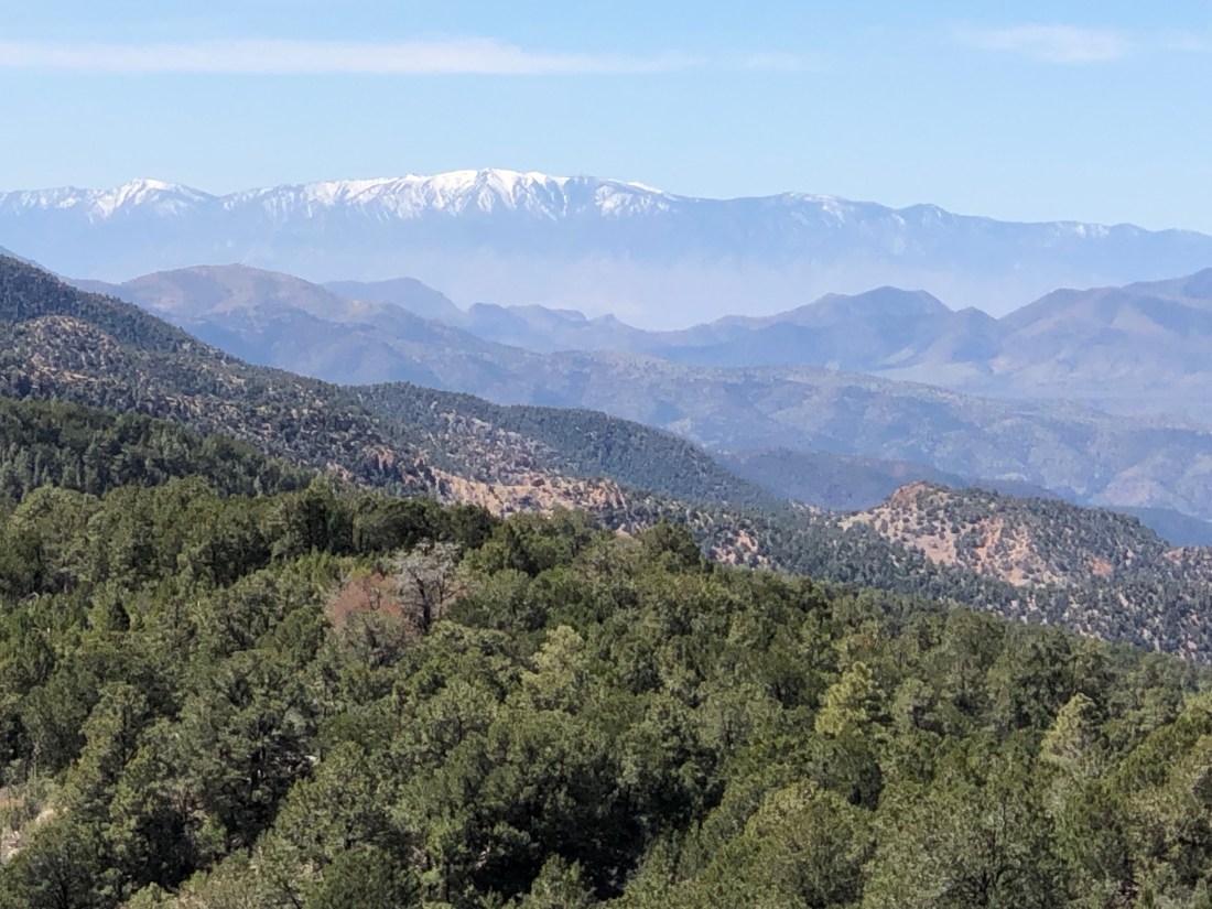
Once I got through the twists and turns, the road meandered through the mountains that still had quite a bit of snow on the ground.
And the subsequent runoff created beautiful streams.
A long day in the saddle – 165 miles took me over 7 hours due to the nature of US 191. My average speed was approximately 30 – 35 MPH. And, I must admit, I only brought one bottle of water and by the end, I was hurting. I won’t let that happen again!
Another sunny and warm day to enjoy the adventure. However, changes are coming. Tomorrow the forecast is…
Wind Advisory in effect from Tuesday, 9:00 AM MST until Wednesday, 5:00 PM MST. Source: U.S. National Weather Service
WINDS…Southwest 25 to 35 mph with gusts from 40 to 55 mph on Tuesday, switching to the northwest on Wednesday. Stronger, but localized wind gusts, are possible Tuesday night.
Tomorrow, Tuesday, I planned to ride 166 miles to Window Rock, AZ along Route 180 and visit the Petrified Forest. We will see if I can accomplish that goal with the wind conditions. At least there is no rain in the forecast for tomorrow. That comes on Wednesday.
What a great start to my Southwest Ride. I arrived in Phoenix around 9:30 AM this past Friday, April 5 and spent two days with my brother Jon and my sister-in-law Amy. It could not have been better. Jon and Amy were the best – Friday night dinner at their house and Saturday night dinner at Parma Italian Roots in Phoenix with Jon, Amy and my cousin Jay and his girlfriend Jill.
Quick background on Jay. Jay and I grew up together in Eastchester, NY where we were in the same grade and hung out 100% of the time. Since I retired in March of last year, I have seen Jay twice, which is twice as much as I had seen him in the past 10 – 15 years. Did I mention retirement is great!
Jon and Amy – the perfect hosts – so much funJon, Amy, Jay, and Jill – getting together and sharing really great memories
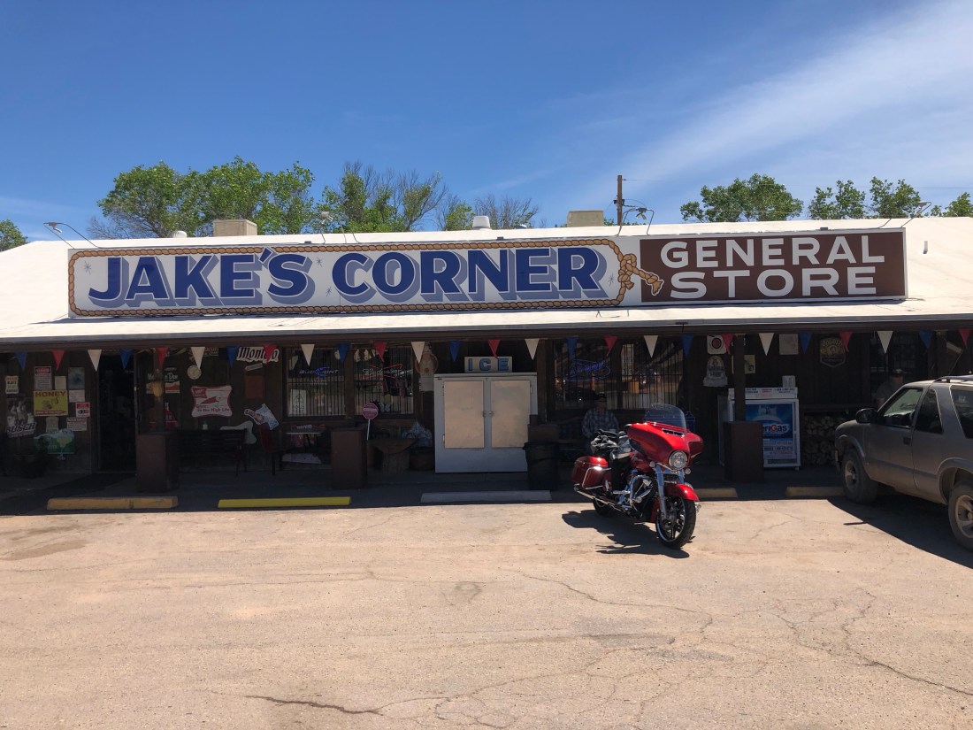
While I could have spent many more days in Phoenix with this crew, I am here to explore the Southwest. So, at approximately 10 AM this morning (Sunday, April 7) I said goodbye and started my trip by riding 205 miles from Phoenix to Jakes Corner, AZ and then onto Safford, AZ.
205 Miles – AZ Route 87 North to Jakes Corner (B) – AZ 188 East to 70 East to Safford, AZ
The ride was through Tonto National Forest. Tonto National Forest, encompassing 2,873,200 acres, is the largest of the six national forests in Arizona and is the fifth largest national forest in the United States. Calling it a forest, for Easterners, is a misnomer as it is a high desert with few trees – mostly scrub. But, the vistas were beautiful and the mountains still have snow on them.
A scene from AZ Route 188
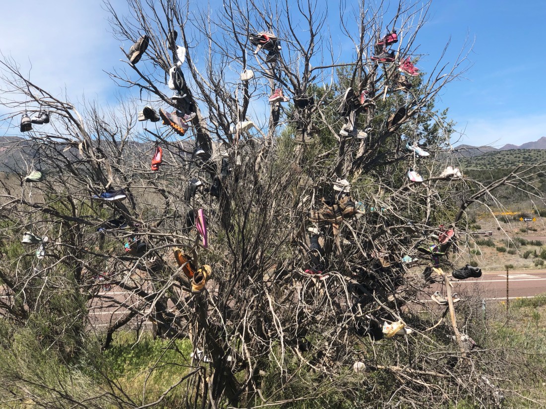
Jakes Corner – this is it – Nothing else to be found at Jake’sBut, I did find the area to have its humor as well – the “SHOE TREE” – along Route 70
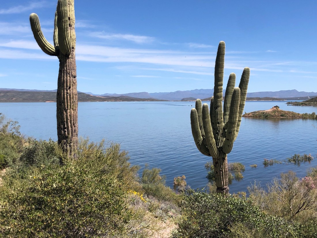
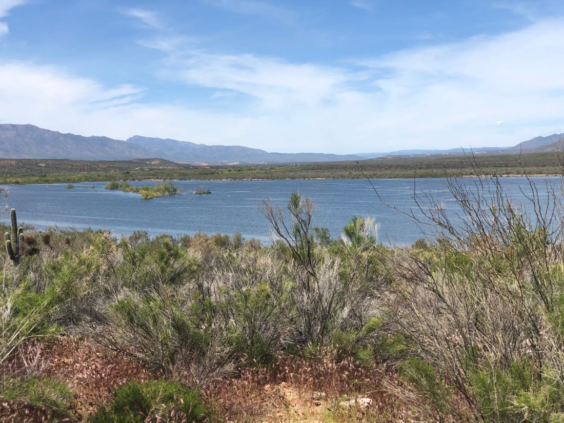
If you look closely at the above map, you see that I rode along a very large lake called Theodore Roosevelt Lake. Theodore Roosevelt Lake is a large reservoir formed by Theodore Roosevelt Dam on the Salt River. Located roughly 80 miles northeast of Phoenix in the Salt River Valley, Theodore Roosevelt is the largest lake or reservoir located entirely within the state of Arizona.
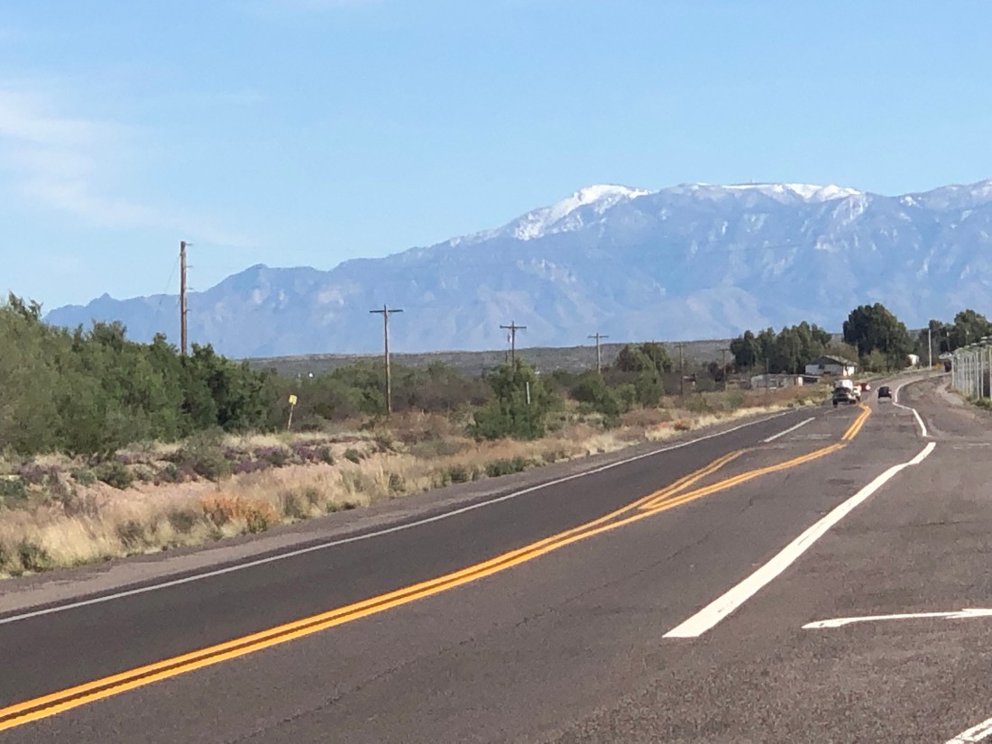
As I entered Safford, AZ, I was greeted by snow-capped mountains.
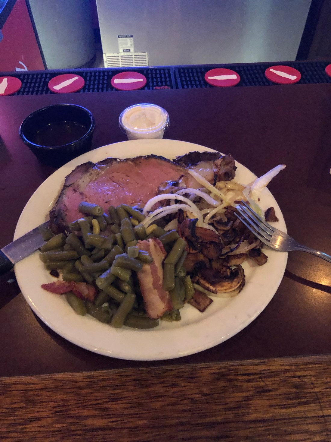
Finally, to cap off day one, I had dinner at the Manor House where I enjoyed a $2.00 Budweiser and a $12.99 Prime Rib Dinner. Cannot beat the prices!
A Manor House 12.99 Prime Rib Dinner with Onions, Mushrooms and Green Beans w/ Bacon – Defibrillator was extra
Tomorrow I am off to take on AZ Route 191 – Coronado Trail Road, or, as an old biker told me today, the Devil’s Highway – Yeeha!
As I write this blog, I am sitting on an American Airlines flight heading to Phoenix for the beginning of my one-month exploration of the Southwest. To say I am excited is an understatement.
I was so excited last night that I could not sleep. I may have slept for 2 or 3 hours all night. However, like last year’s Southeast ride, the excitement was mixed with a little trepidation. Things like being away for a month, missing some big changes in my daughters’ lives, leaving Catherine and, the challenges that can present themselves on a ride such as this. Speaking of Catherine, my wonderful wife of 33 years, Catherine, I again say thank you for your support and encouragement. I love you.
People ask me if I am doing this trip on my own and the answer is yes. Then they wonder why. My answer consists of a number of reasons. First, after 40 years of having to gain consensus on almost every decision I have made, it is liberating to chart my own course, make my own decisions and, come and go as I please. Next, I found last year when a did a similar trip in the Southeast, the time I was alone allowed me to truly get in touch with myself. I had the opportunity to re-establish life’s priorities, take time to be introspective, and consider how to be a better person. It is hard to do that in a group situation.
I encourage my friends to take a little time to be by oneself, to appreciate who you are as an individual and to recalibrate your bearings. I don’t recommend it as a constant state, but I think a little alone time is healthy.
When I land in Phoenix, my brother Jon will be picking me up at the airport. I am spending today and tomorrow with Jon and his wife Amy in Phoenix before starting my motorcycle ride on Sunday.
Under the heading of introspection, I am thinking of my relationship with my brother Jon, how strong it is today and, the amount of time we wasted being estranged. Jon and I spent more years than I care to remember not talking. What a terrible waste. I am so happy that we overcame our challenges and now can enjoy each others’ company. It is a blessing. I really look forward to the next two days.
Sunday I will start my motorcycle trip by riding approximately 200 miles east to Safford, AZ. I will take a detour to Jake’s Corner (B) so that I can ride through Tonto National Forest and then onto Safford.
Safford was my selection for day one as it is a good jump off point for my Monday ride north on Route 191. Route 191 is called the Coronado Trail Road and it is ranked as one of the 10 best Motorcycle roads in the United States by Motorcycle Roads – A digital site.
As Richard Starkey wrote, “Got to Pay Your Dues If You Wanna Sing The Blues”!
Now, First and foremost, I am not complaining. Even though it may sound like it.
The observation that I had was that if you want to do something different, it will take a bit of work and effort. No disrespect to people who like to take ocean cruises, visit a Caribbean Island, or just drive to the coast for a getaway, you book the travel and go. And, it is great.
Electing to ride a motorcycle, your own motorcycle, through the desert and canyons of Arizona, Utah, Nevada, and New Mexico, well, it don’t come easy.
Quick background, to pursue my dream of riding the southwest, I need to get my motorcycle from Connecticut to Phoenix, AZ, in February/March, for my Southwest adventure in April. And, you know it don’t come easy.
Two days ago, Wednesday, February 8th, I left Naples, Florida on a 9:30 AM plane and landed in Newark, NJ around 12:30. This was the change in the environment:
Remember, not complaining – the weather in Newark/Tri-State New York, was great, given the time of the year. I was unbelievably lucky!
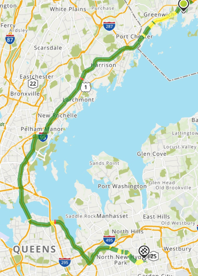
On Thursday, February 9th, I was scheduled to ride my motorcycle from Riverside, CT to one of the best, if not THE best, Indian Motorcycle Dealerships in the country, “Mineolamoto”, in Mineola Long Island ( I am not receiving any compensation from Mineolamoto – they are just good people). Mineolamoto is holding my bike until Keyboard Shipping picks it up to carry it to Arizona.
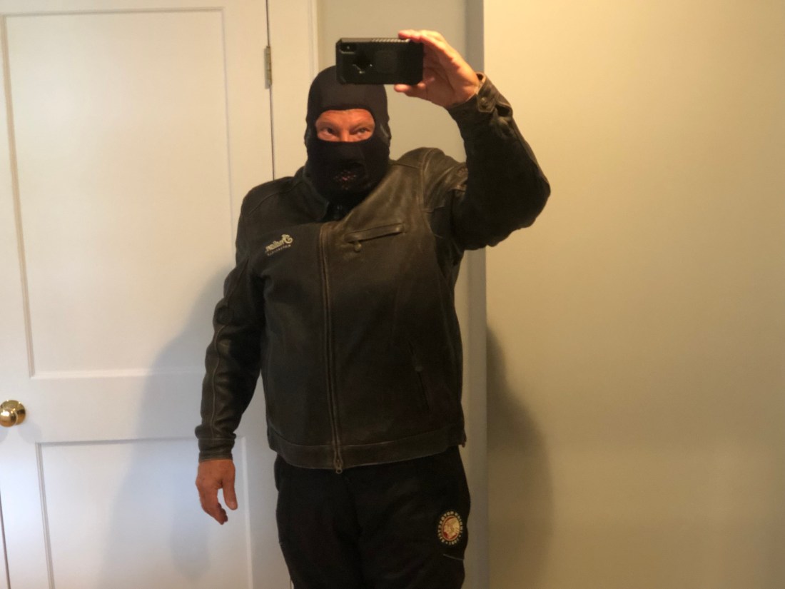
I have done this one hour ride a dozen times, over the years but in 60°+ weather. The temperature I rode in on Thursday was 43°. Now, NOT COMPLAINING, the windchill on the bike, at an average of 65 MPH, was between 20° and 25°. In this weather, you cannot allow any skin to be exposed, or you will experience frostbite. So, I prepared myself to 1) ride my Indian Motorcycle to Mineola, or 2) Rob a Bank (thank you, Mel):
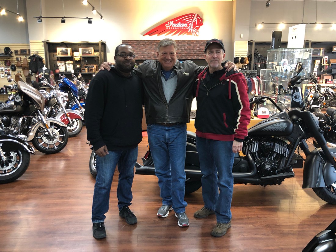
Since I am writing this blog, all went well and I was greeted, as usual, by my welcoming friends at Mineolamoto – Phil, and Ernst.
So, with my Indian Roadmaster safe in Mineola and waiting for Keyboard trucking to pick her up and truck her to Arizona, I had the opportunity to Uber back to Connecticut and meet up with my friends Mel and Peter, for dinner at Boxcar Cantina. After many laughs and a good dinner last evening, I caught a 7:30 AM flight back to Naples, Florida, this morning, February 8th at 7:30 AM.
So, to give you a quick synopsis, leave Naples at 9:30 AM on the February 6th, ride my Indian Roadmaster from Riverside CT to Miniolamoto on February 7th so that Keyboard Shipping can pick her up the week of February 11th and fly back to Naples, Florida on the 8th at 7:30 AM.
YOU KNOW IT DONT COME EASY (no complaining – loved every minute)
Keep Wheeling and speak to you from Arizona in April.
It has been over a month since I last posted and things have changed as they always do – remember the concept of flexibility.
It is late January and I am in Naples, Florida (not a bad place to be in late January). However, my Indian Motorcycle is in Riverside, CT. The reason for this is a long story and I will not go there at this time (or ever). This creates logistical challenges that I will get to.
For the past few weeks, I have been planning and re-planning my itinerary for my 2019 Southwest ride. Per my previous blog, I was planning to ride from New Orleans to San Diego – 1,816 approx. miles. Unfortunately, that will not work as it would not allow enough time to explore the sites that I want to explore. So, staying flexible, I have elected to start and finish my ride in Phoenix, AZ.
Phoenix, AZ, besides being the winter home of my brother Jon, is centrally located to many of the sites I want to experience including national parks, renowned motorcycle roads, historic routes, and famous scenery. My current itinerary, subject to change looks like this:
I am starting in Phoenix, AZ on April 7th and going east to Safford, AZ (B) to catch the southern end of the Coronado Trail, Route 191, to the Northern end in Springerville, AZ (C). This is rated as one of the best Motorcycle Roads in the West. From Springerville, I am continuing north to St Michaels, AZ (D) to explore an area called the Petrified Forest. The Petrified Forest is known for its fossils, especially fallen trees, and unique colors.
From St Michaels, I am continuing north to Chinle, AZ (E) to explore Canyon de Chelly which is known for its ruins and towering canyon walls. After a one day stop in Canyon de Chelly, I am continuing to Kayenta, AZ (F) to explore and experience Monument Valley.
From Monument Valley, I continue my trek north into Utah to Moab (G) to explore Arches and Canyonlands National Parks. I am planning, subject to change, to spend two days experiencing these famous sites. From Moab, I change direction from North to West and head to Bryce Canyon City, UT (H) to explore Bryce Canyon National Park. From Bryce Canyon, I will continue southwest to Springdale, UT (I) to experience Zion National Park and then onto Las Vegas (J).
From Las Vegas, I head south to Topock, AZ (K) to spend a day riding what is known as the Will Rogers Highway, the Main Street of America or the Mother Road, Route 66, one of the original highways in the U.S. Highway system. Route 66, for me, ends in Seligman (L). I will then head southeast to Sedona (M) and the famous Red Rock Country. My ride will end back in Phoenix after a quick trip to Tucson, AZ to visit with some dear friends and catch-up.
It is interesting that the mileage of this ride is approximately 1,857 miles, close to the distance from New Orleans to San Diego.
But, before I can start my ride, I need to get my trusty Roadmaster from Connecticut to Arizona. This is no easy feat. Again, I am leaning on Mineola Moto, a great Indian dealership in Mineola, New York to help. I am flying back to NYC on February 6th, praying for no snow or rain on the 7th, and driving my Roadmaster in the freezing cold from my house to Kenny Zagarek’s Indian Dealership. There, the shipping company will pick up the bike and deliver it to Go AZ Indian Motorcycle in Scottsdale, AZ.
If all goes well, I will be heading to Phoenix Arizona on Friday the 5th of April and starting my ride on the 7th. That is if all goes well. Wish me luck and keep wheeling.
Hello – I hope the past year has been good to all of you and that this blog finds one and all in good health and good spirits. Merry Christmas, Happy Chanukah and wishing everybody a Happy and Healthy New Year!
This Blog is as much a reintroduction to “Wheeling with Kramer” as it is a motivation to get my arse into gear and start planning my year two pilgrimage.
When I first considered my “retirement”, I knew that it consisted of exploring, first the United States and then broader geographies. Last year I rode my faithful Indian Roadmaster from New Orleans, LA, back to Connecticut via, Lousiana, Missippi, Alabama, Florida, Georgia, South Carolina, North Carolina, Virginia, Maryland, Pensylvania, New Jersey, New York, and Connecticut.
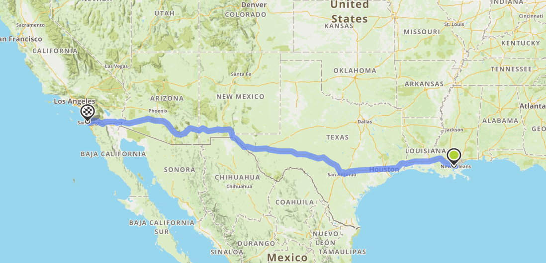
This coming year, I plan to explore the west. I look forward to riding, again from New Orleans, LA through Texas, New Mexico, Arizona, Nevada, and California. As last year, with the help of John and Denise Kuendig, I am once again leaning on my friends. This time it is my friends Dan and Cindi Treadwell, who have a home in San Diego. Dan and Cindi’s home is my destination target. But, as I referenced in last year’s blog, I must remain flexible and ready to compromise my goals, based on time and what is reasonable.
New Orleans, LA to San Diego, CA
There are so many places that I want to explore including parts of Route 66, Big Bend, Canyonlands, Bryce, Zion, Monument Valley, the Grand Canyon to name just a few. I will not be able to get to all of them as my time is limited to April 5th to May 7th (32 Days). Why the restriction on time? Because I am blessed with so many exciting things to enjoy in my life and a family that, thank God, enjoys sharing the excitement with me. In this case, our beautiful boat, Wakely, needs to come home for the summer.
So, like last year, I am just starting to plan my ride west from New Orleans. I have fear (not knowing where I am going at this time), excitement (the adventure and planning) and anticipation (meeting new people) and I am just beginning the journey.
After traversing the Gulf and Atlantic Coast for the past weeks, I took a left-hand turn and went into the mountains of North Carolina.
Green is Savannah, GA, “B” is Augusta, GA “C” in Highlands, NC, “D” is Robbinsville, NC, “E” Cherokee, NC, “F” is Little Switzerland, NC and the checkered flag is Glade Valley, NC
The reason I rode into the mountains was that there were very specific motorcycle adventures I wanted to check off the bucket list and I am excited to have accomplished them all, with one minor refinement.
Background, the mountains of North Carolina are a motorcycle mecca. An area that attracts motorcycle riders with beautiful vistas, twisty and challenging roads and hospitality that caters to the motorcycle rider.
My first stop after leaving Augusta was Highlands, NC. Highlands, NC lies in the Southern Appalachians within the Nantahala National Forest at an elevation of 4,118 ft. As I approached Highlands, I knew that I was about to experience something special.
The view from the road leading to Highlands, NC
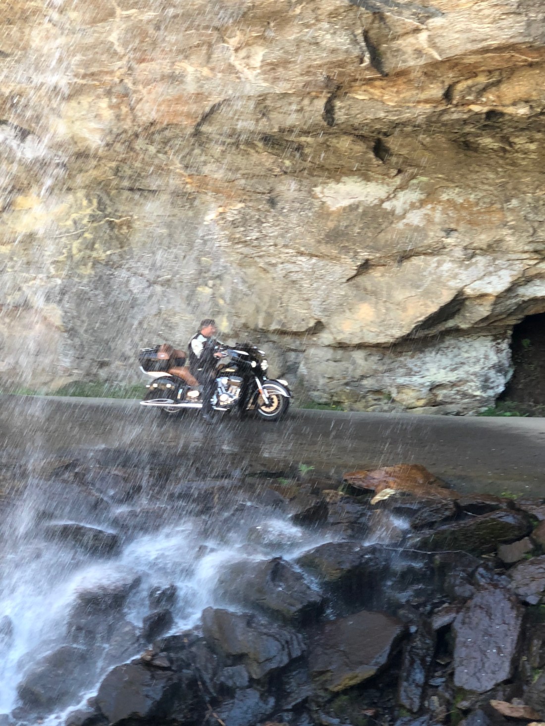
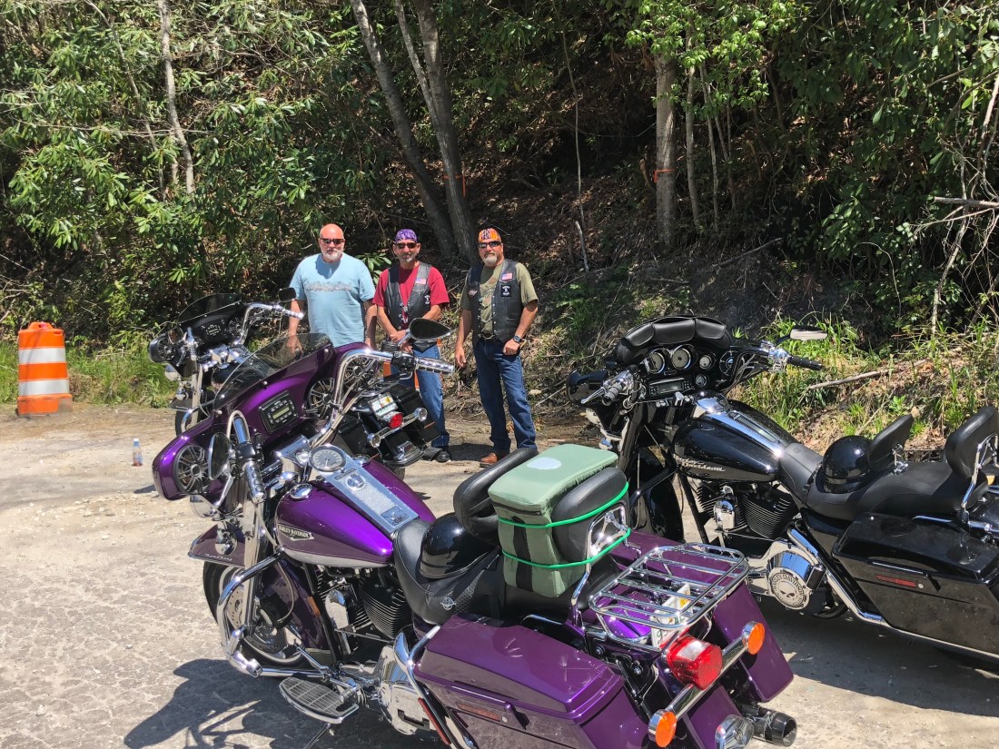
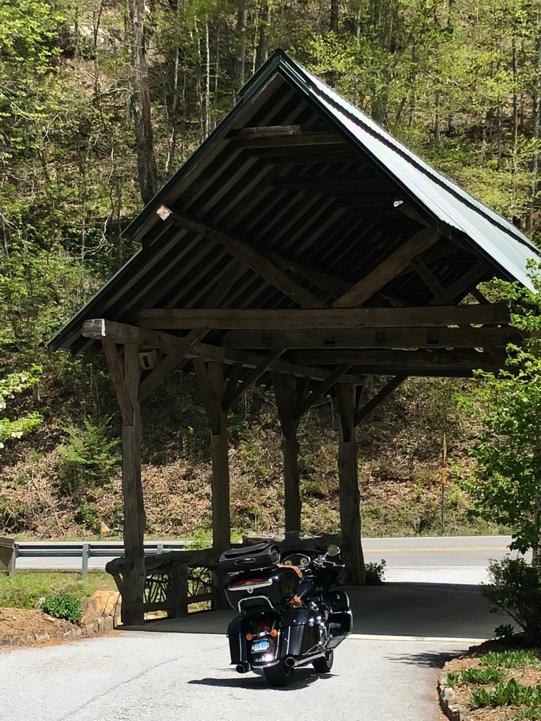
The motorcycle appeal of Highlands was a destination called Bridal Veil Falls. The other appeal was the beautiful scenery and people known for the area. Bridal Veil Falls is a waterfall that literally flows over the road so that motorcycles can ride under the falls.
And my new best friends I met at the falls – Love the purple Harley
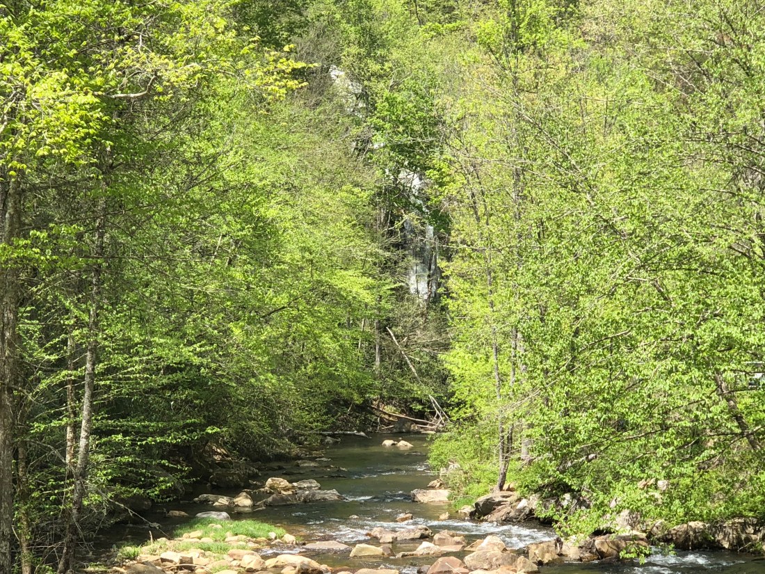
Highlands also features covered bridges and beautiful streams.
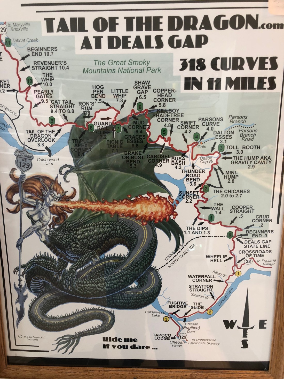
Having achieved the Bridal Veil Falls goal, I was off to Robbinsville, NC and the dreaded “Tail of the Dragon.” The 11-mile Dragon is said to have 318 curves. Some of the Dragon’s sharpest curves have names like Copperhead Corner, Wheelie Hell, Sunset Corner, Beginner’s End, and Brake or Bust Bend. The road earned its name from its curves being said to resemble a dragon’s tail.
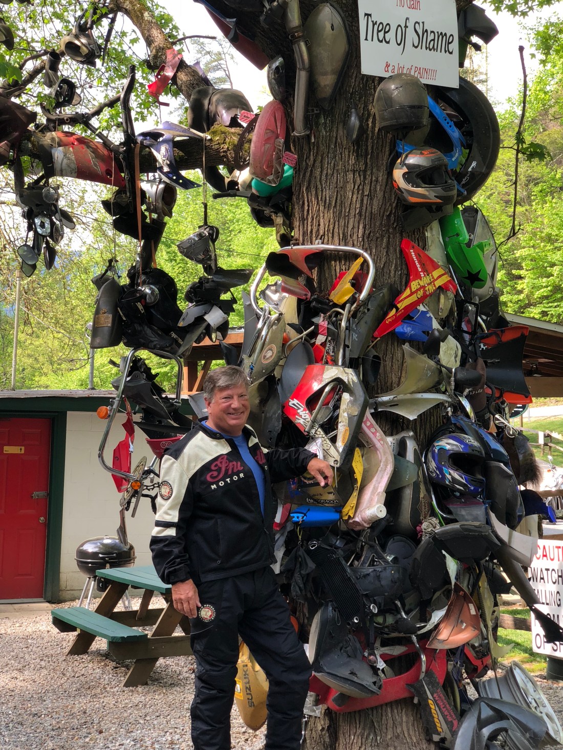
At the mouth of the Dragon is the “Tree of Shame”. When a motorcycle crashes on the Tail, the bits and pieces are added to the tree. Happy to report that I added no parts to the Tree of Shame.
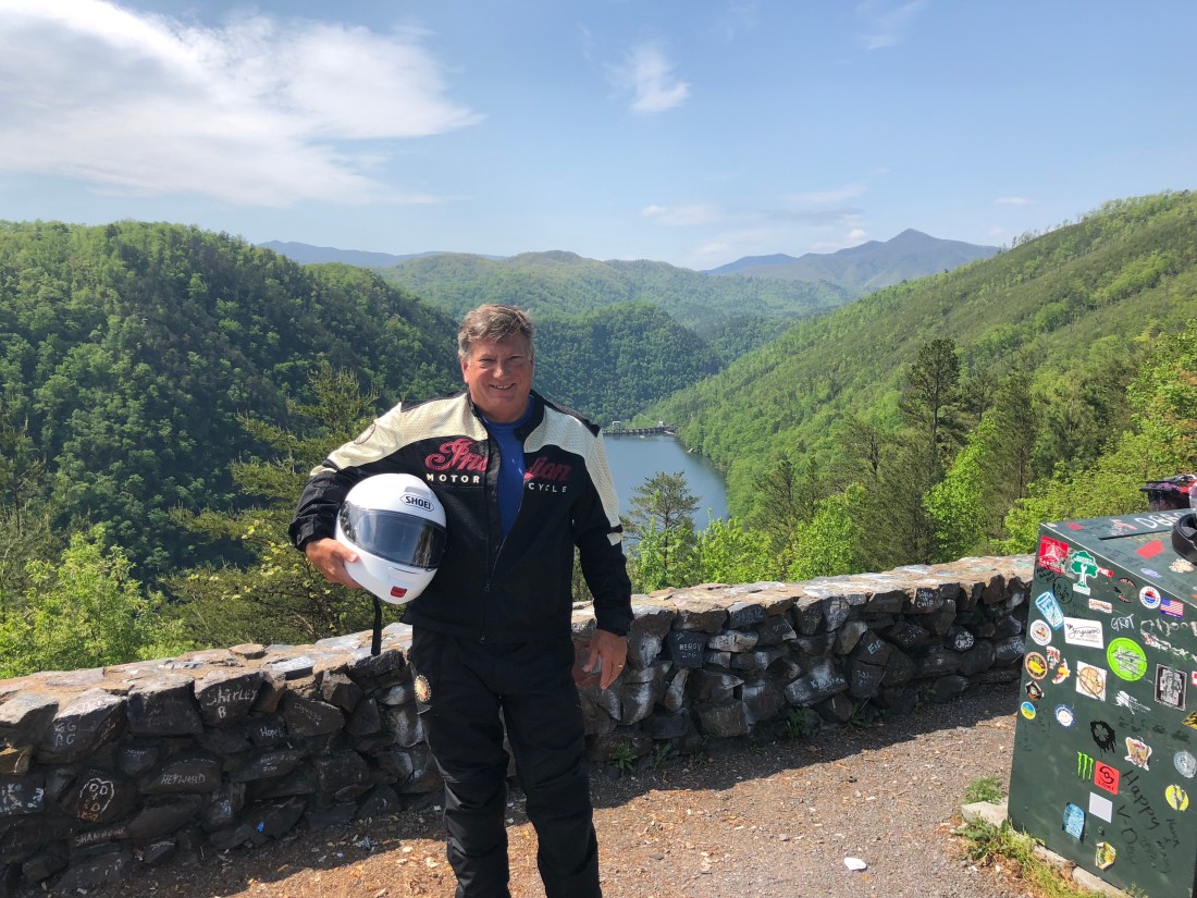
At the end of the Dragon is an overlook that captures Cheoah Dam. This is the dam that Harrison Ford jumps off at the end of the Fugitive movie. Happy to say that I made it to the overlook.
Cheoah Dam is over my left shoulder
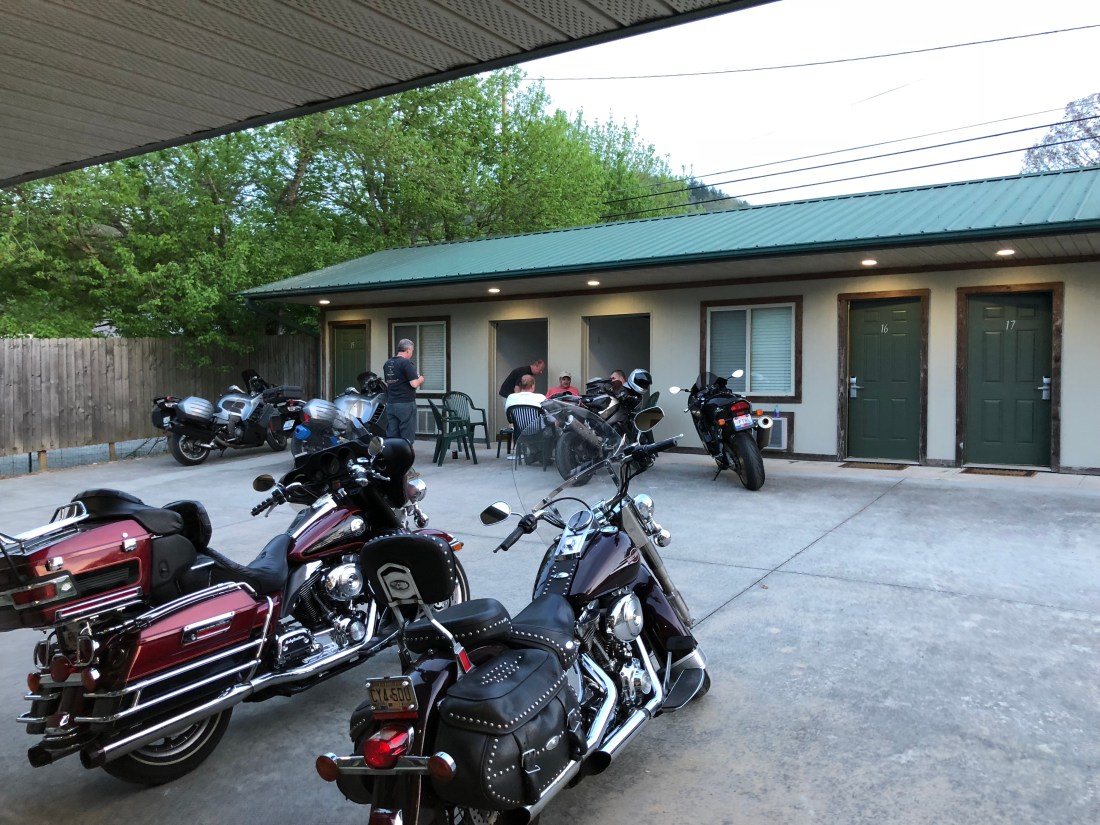
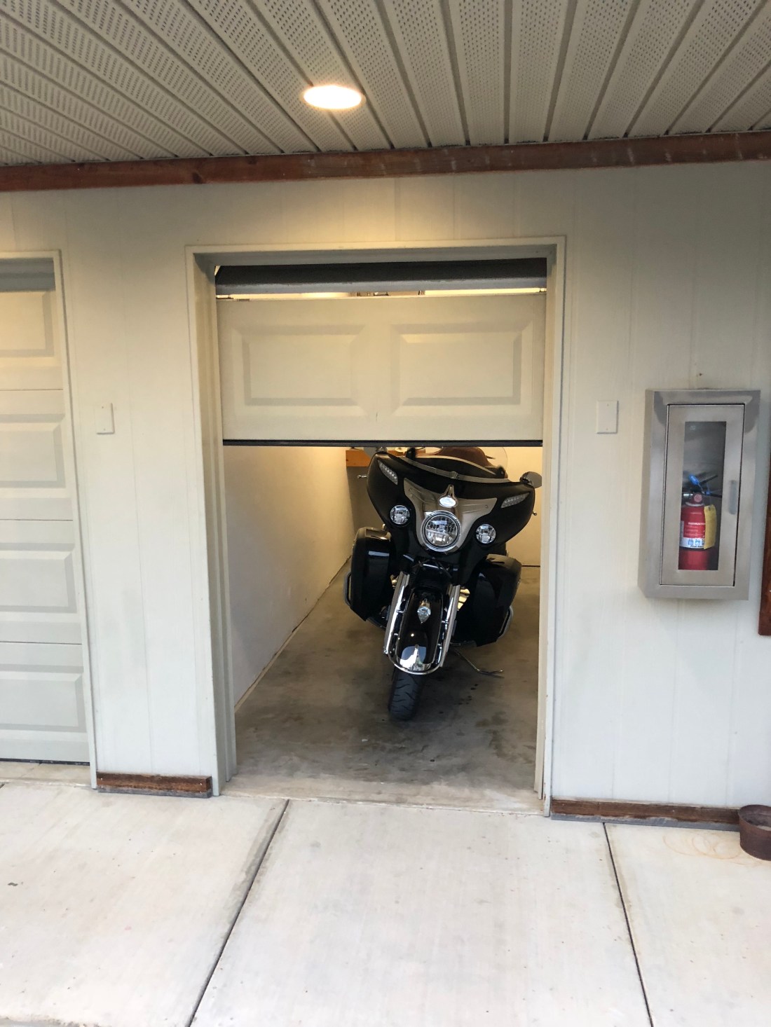
As I have mentioned, the riding is great. But just as great is the people you meet along the way. In Robbinsville, I stayed at the Two Wheel Inn, which is a motel that caters to bikers by offering every room a motorcycle “garage.”
Bikers sharing their stories at the end of the day, the twisties they rode, the vistas they saw, the mechanical challenges, and the accidents they avoidedMy Indian being put to sleep after a hard day on the Dragon
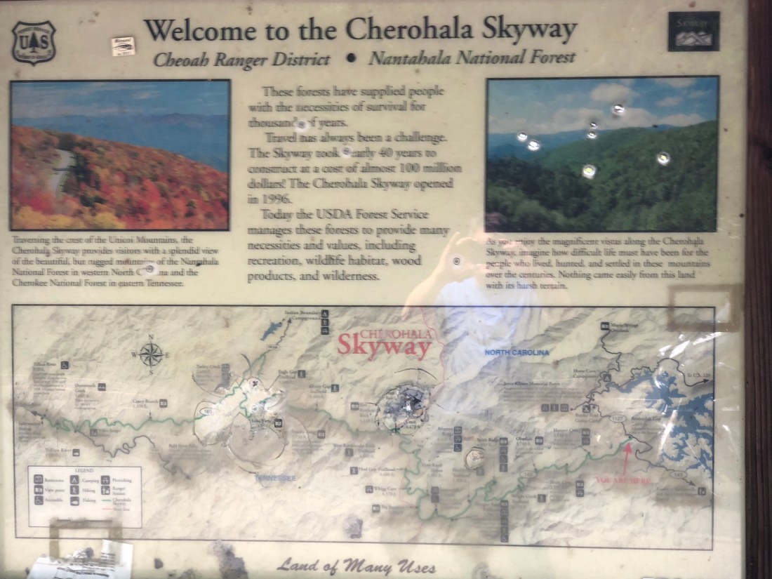
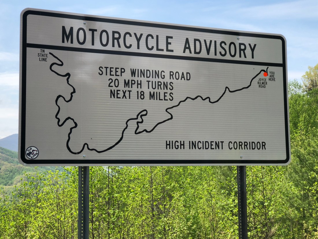
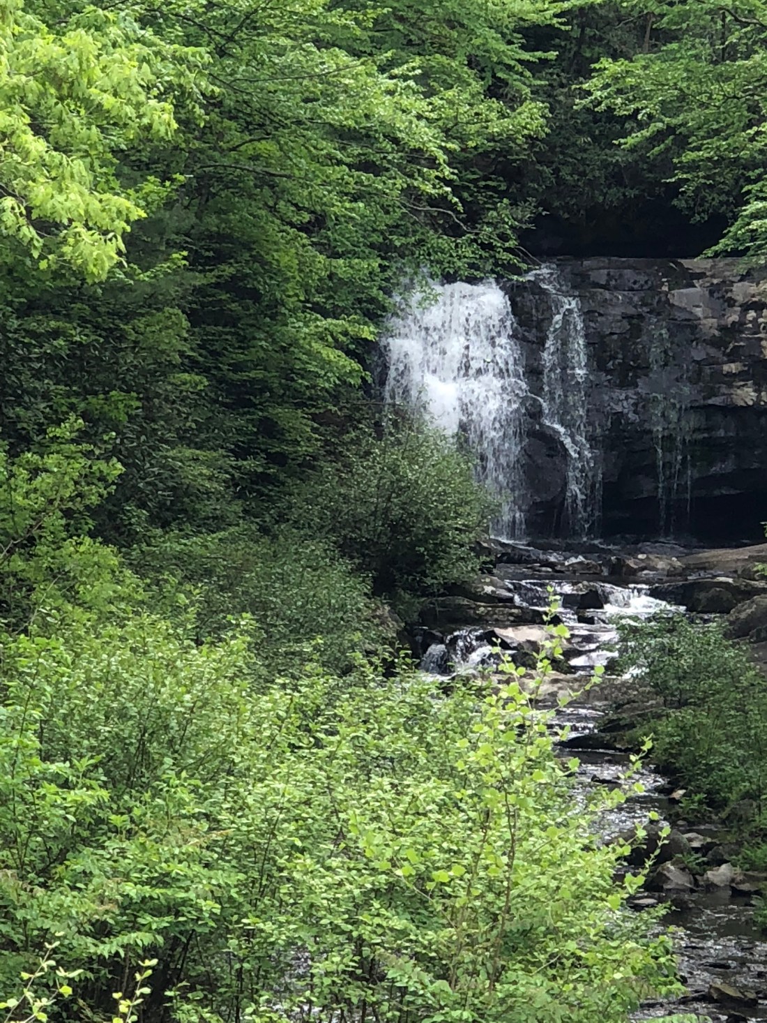
Before leaving Robbinsville, I had wanted to ride a road called Moonshiners 28. This is a 28-mile road Moonshiners used to bring their illegal “hooch” out of the mountains. However, I was informed that a more picturesque ride was the Cherohala Skyway. The Cherohala Skyway is a 43-mile National Scenic Byway that connects Tellico Plains, Tennessee, to Robbinsville, North Carolina.
Yes, those are bullet holesOh, Did I mention that the road has a lot of twisties and the lowest elevation is just above 900 ft. and the highest point is 5,400 ft.Pictures do not do justice to the beauty of the vistasPictures do not do justice to the beauty of the vistas.
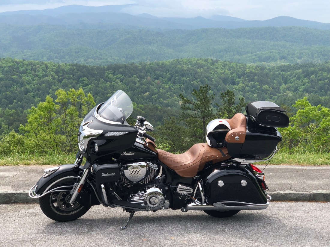
Having ridden The Tail of the Dragon and Cherohala Skyway and met some really interesting bikers, I was off to Cherokee, NC which is the Southernmost point of the Blue Ridge Parkway. My last bucket list item for this trip was to ride the entire Blue Ridge Parkway. Starting in Cherokee, NC and ending in Afton, VA. The Blue Ridge Parkway is 469 miles.
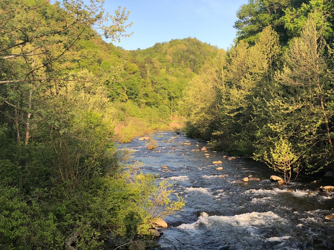
To get to Cherokee, I elected to ride through the Great Smokey Mountain National Park which was another surprising thrill.
Beautiful Streams running through the mountainsWaterfalls right off the roadAnd getting above the clouds
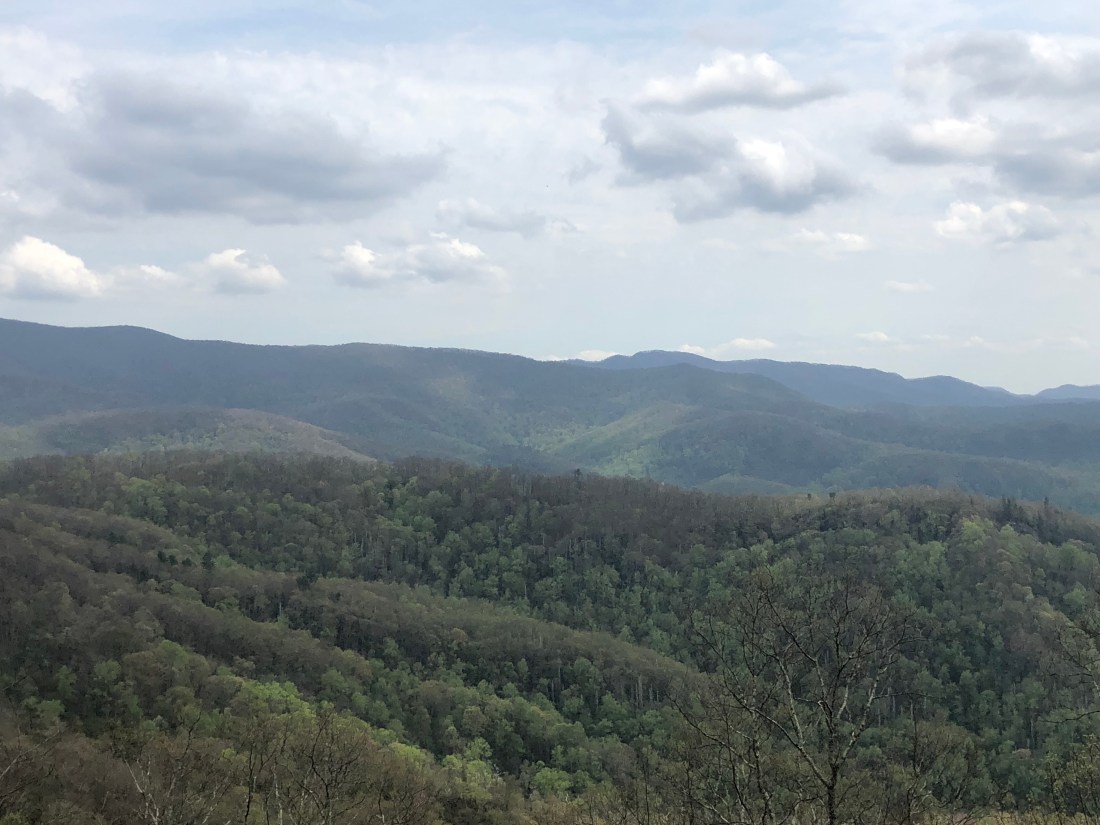
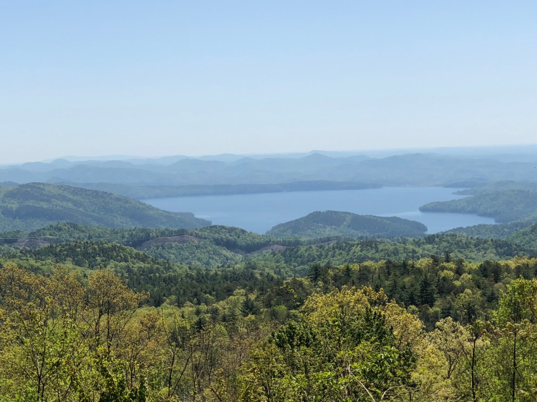
Today finds me on my 2nd day on the Blue Ridge Parkway. The Parkway offers more beautiful vistas and, so far, interesting lodging.
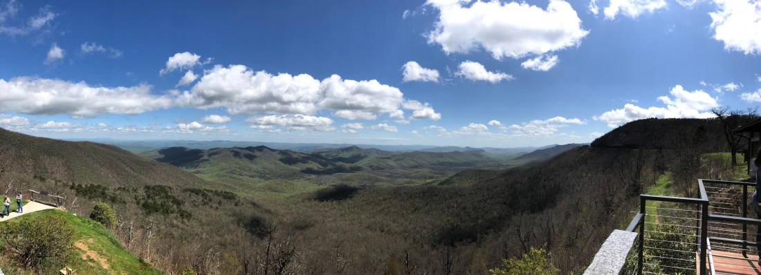
Let me comment on the fact that for days I have been at elevations that allow me to see for hundreds of miles. The feeling of “Being a Little Closer to Heaven” is real. At times it is spiritual. A place of peace and contentment. “Great things are done when men and mountains meet; This is not done by jostling in the street.” – William Blake.
A panoramic view from the Pisgah Inn
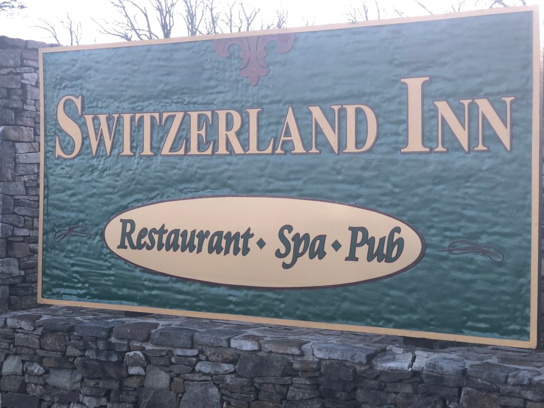
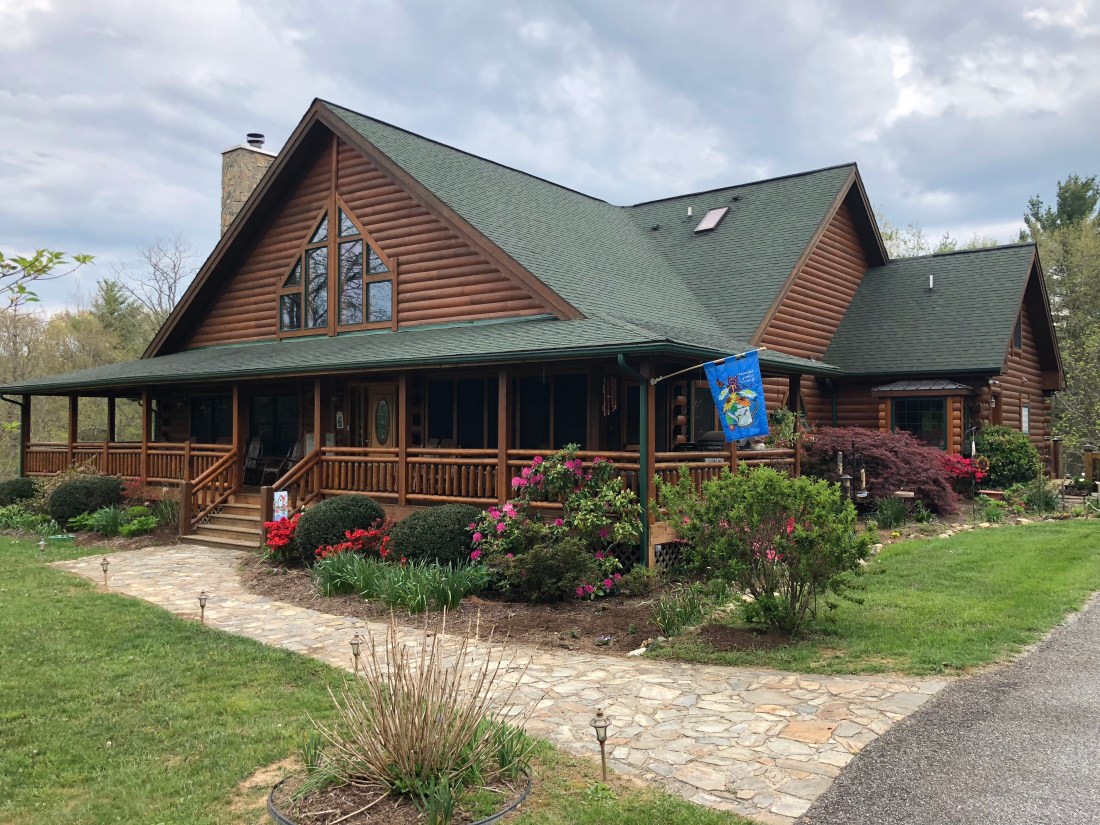
The Parkway has very few cars and no commercialism is allowed on the parkway. There are no “motels” near the Parkway and last evening I stayed in Little Switzerland Inn and tonight finds me in Glade Valley Bed and Breakfast owned by Jim and Margaret Connor.
The “backdoor” view from the Little Switzerland Inn
And cozier is the Glade Valley B&B
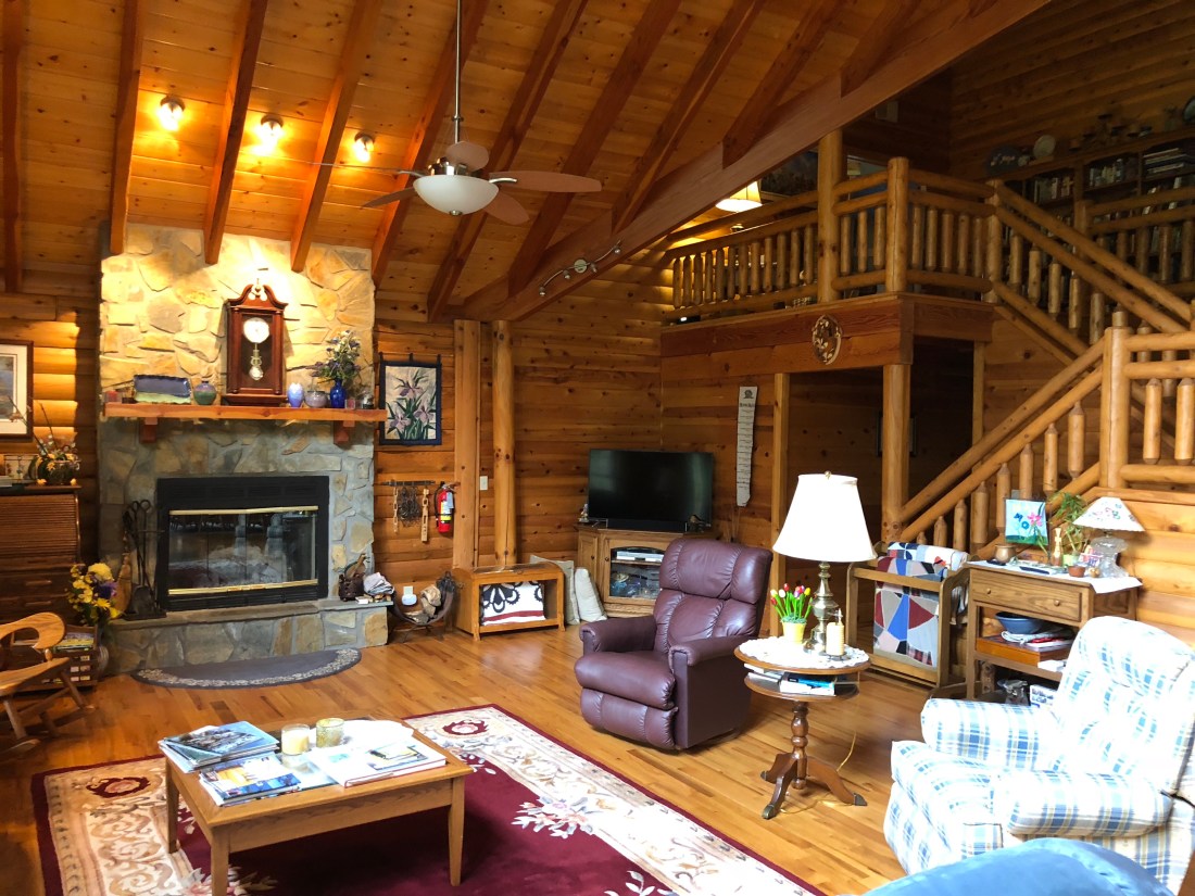
This is Jim and Margaret Connor’s HomeTheir living roomAnd, they even saved a spot for my Indian
It has been an incredible past week. I have had the opportunity to see beautiful country, test my motorcycle driving skills and raise my adrenaline levels – which is what makes one feel alive. I have met interesting people and enjoyed their company. Bikers, like horseback riders, share a brotherhood. A brotherhood of understanding the thrill and zen of motorcycling.
Over the past months, I have seen another part of America that not many of us have the opportunity to experience. You can call it Middle-America, call it Trump’s America or call it the South. Whatever you call it, it is America and deserves the same respect and attention as any other part of the USA. I deeply enjoyed meeting people in Louisiana, Mississippi, Alabama, Florida, Georgia and North Carolina.
They are a proud and spirited people. They have a rich heritage of state pride. And, I have earned a new respect for them.
I am reaching the end of this motorcycle journey ( I plan many more in the future). It has been a thrill. But now I am ready to get home and be with my family. Traveling is great, but so is coming home and I am ready to come home.
I have enjoyed blogging and I hope you have enjoyed reading them. I may have one more blog in me before I return home this Saturday. Thank you for being a gracious audience and as I say, Keep Wheeling.
I rode my Indian Motorcycle into Savannah yesterday morning, April 29th, and spent a large part of the day exploring what I found to be one of the most beautiful historic districts of any city I have ever seen.
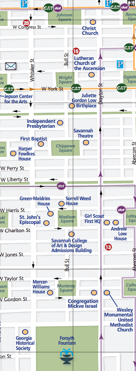
Savannah was founded in 1733, by James Edward Oglethorpe on the Savannah River and lies between Jacksonville, FL, and Charleston, SC. The new Georgia colony was authorized under a grant from King George II of England.
Oglethorpe developed a town plan in which the basic design unit was the ward. Wards were composed of four residential blocks and four civic blocks, arrayed around a central square. These square “wards” were also designed to protect the city from first, Indians and later the Spanish. As I had limited time, I explored the center of the historic district starting in Forsyth Park and working my way north past Monterey, Madison, Chippewa, and Wright Square.
As I mentioned, one of the contributing factors to Savannah’s beauty is the fact that the city was one of the only ones left standing during Sherman’s famous ‘March to the Sea.” This allowed many of the city’s Federal and Georgian designed homes to survive today.
This home was used by General William Tecumseh Sherman as his headquartersSavannah continues a number of quaint customs
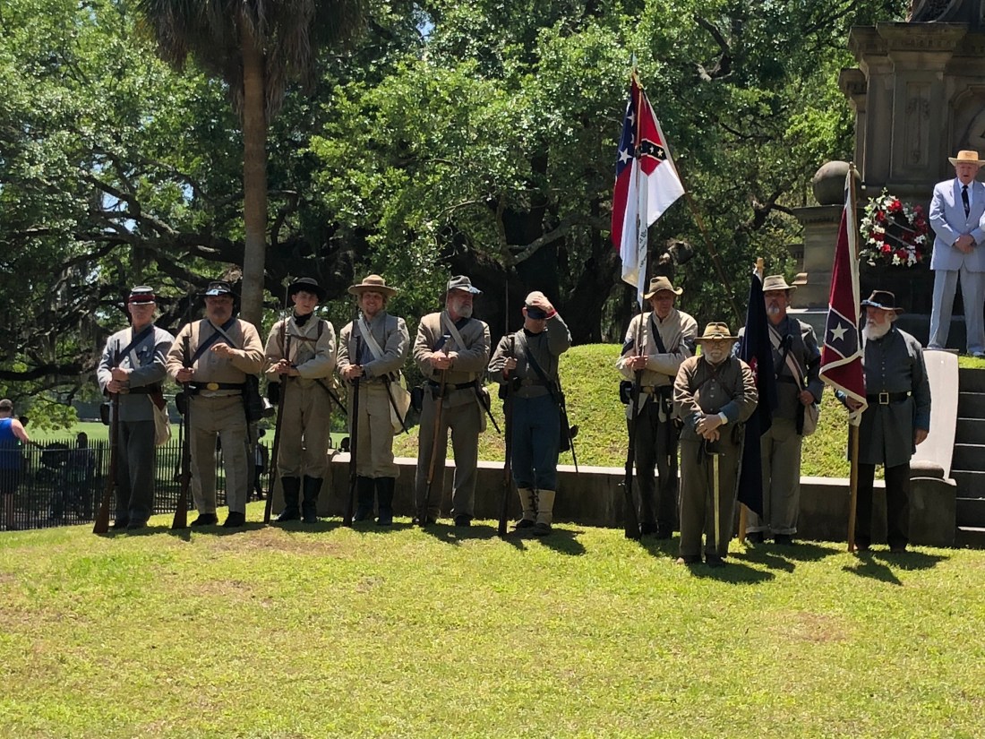
As I have referenced in my past blogs, the South maintains a strong sense of heritage when it comes to the “War of Southern Independence. I was fortunate to have arrived in Savannah on Confederate Memorial Day. Confederate Memorial Day is a holiday observed in several Southern states since the end of the American Civil War to remember the estimated 258,000 Confederate soldiers and sailors who died fighting against the Union. When I entered Forsyth Park, I found a Confederate Memorial Day service in the process and it reinforced that there is still a lot of pride in the South.
“Respect, Protect and Save our Confederate Monuments”
A statement regarding “Politically Correct”
Active Confederate Units
Singing “Dixie” with a “Rebel Yell”
21 Gun Salute to the fallen
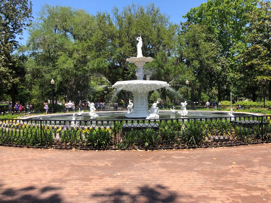
Turning back to the beauty of Savannah, each Square’s Park was unique in its own way.
The most photographed fountain in Forsyth Park. The fountain was erected in 1858.
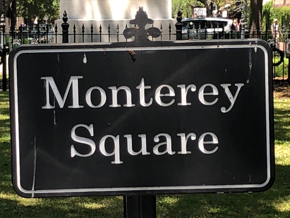
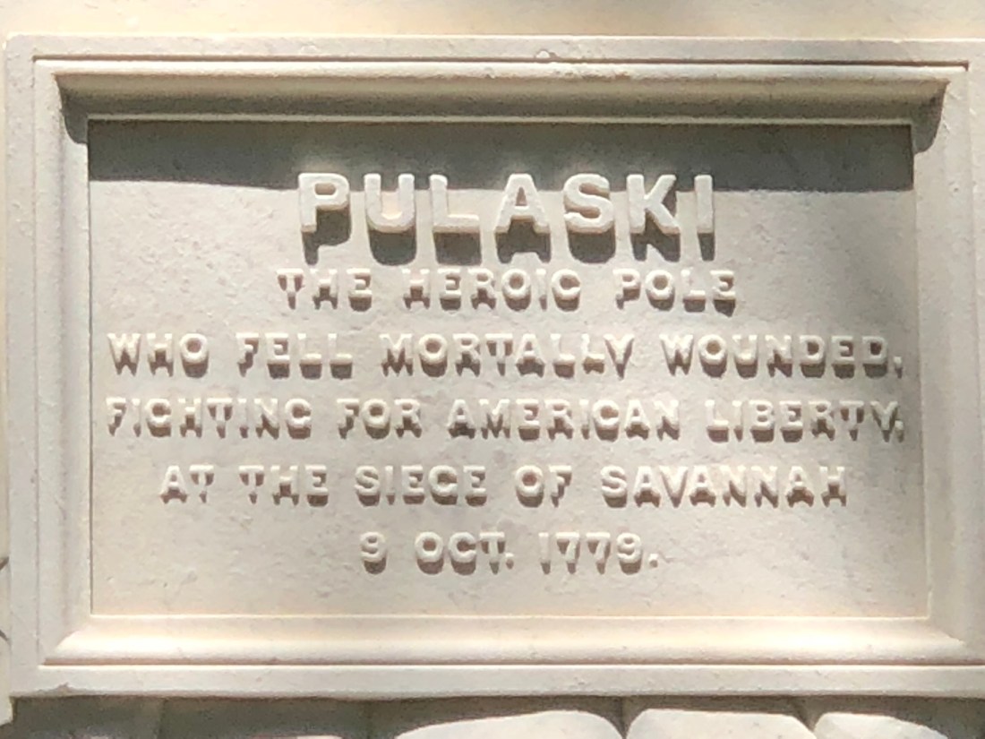
Casimir Pulaski was killed in Savannah in 1779 and is honored in Monterey Square. The Pulaski Skyway is a bridge in New Jersey also honoring this great patriot.
And finally, Chippewa Square, known for Forrest Gump and his park bench. Unfortunately, they removed the bench and it is now at the Savannah History Museum.
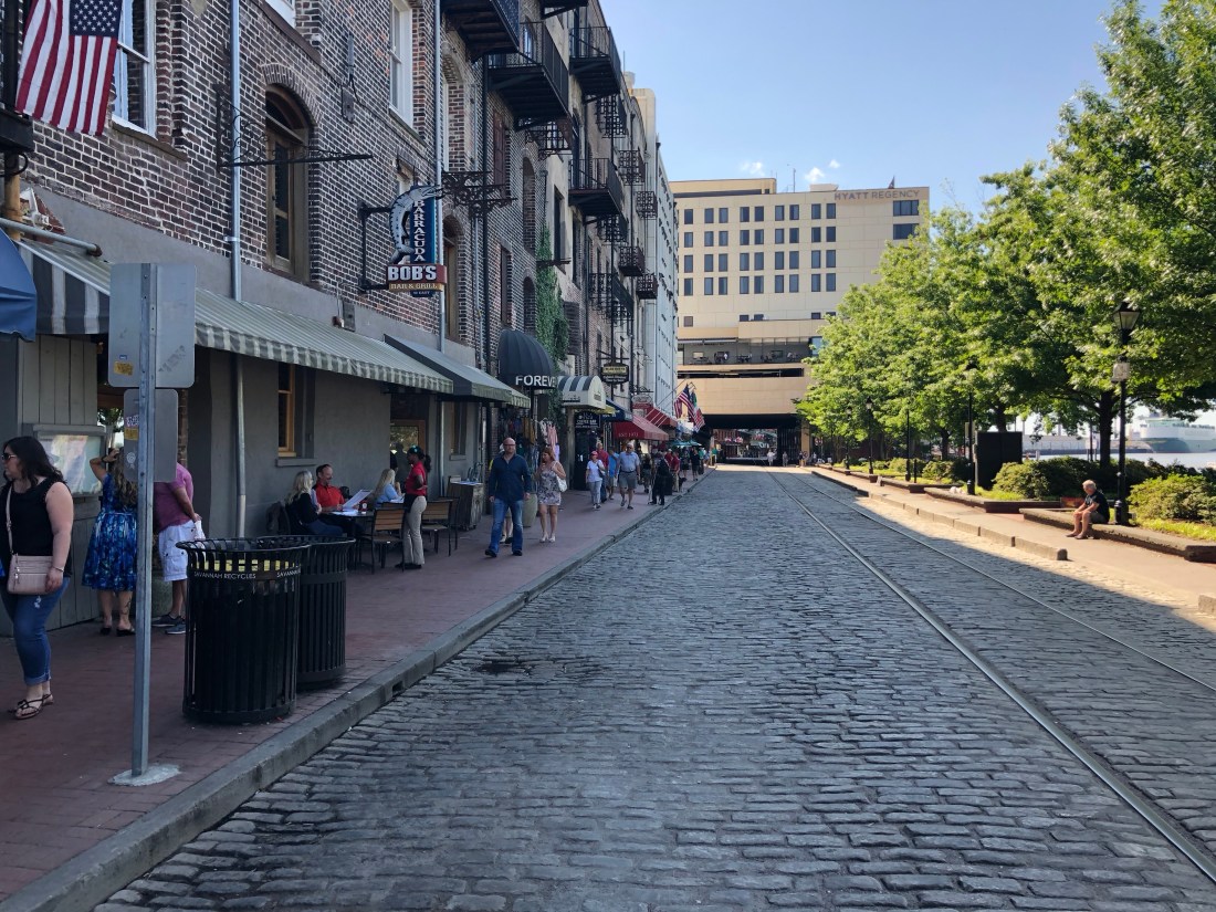
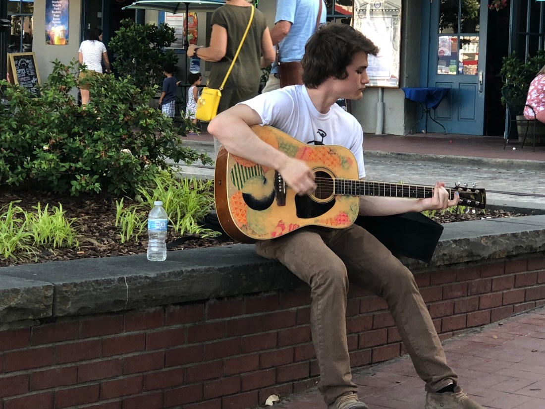
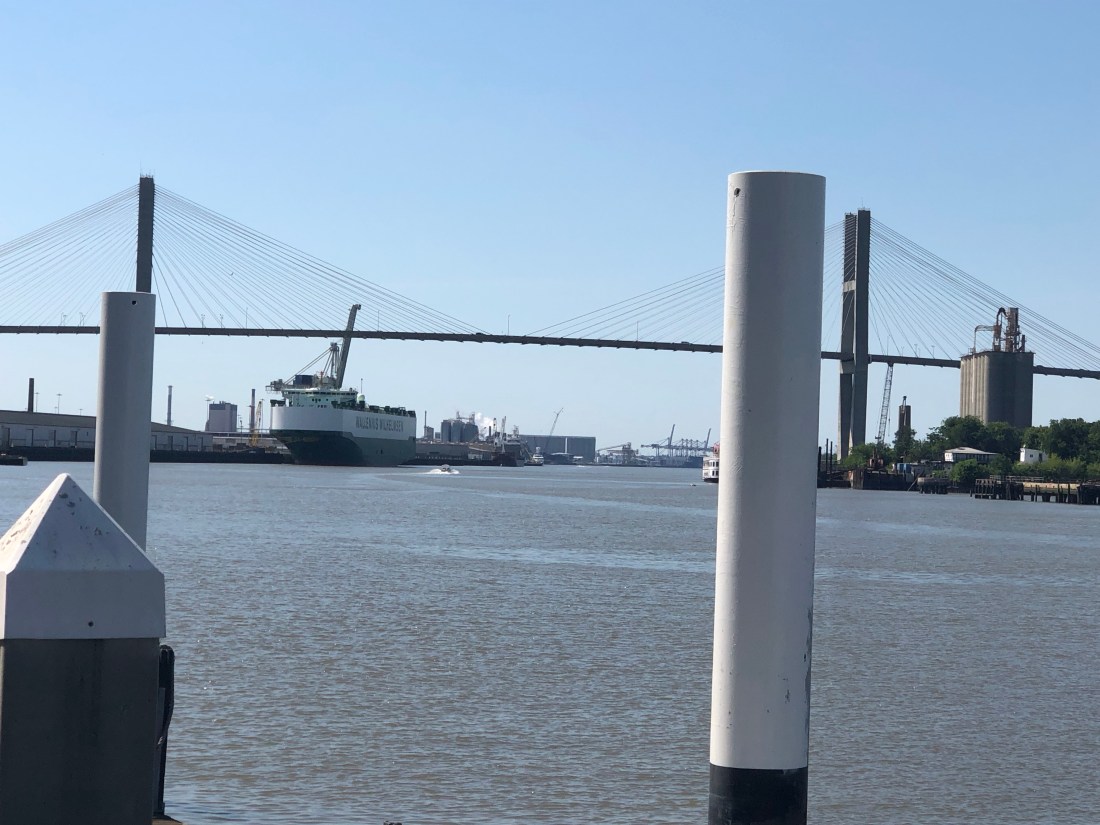
Leaving these beautiful parks, I discovered there is another side of Savannah, on River Street. River Street runs along the Savannah River and is full with boutiques, bars, and street performers to fill many hours.
River Street looking WestRiver Street looking East
The Sky Bridge to South Carolina. Savannah remains a huge port.
Loved Savannah and wish that I had more time to enjoy it. But, tomorrow I am off to an area called the Highlands in North Carolina where I will challenge the “Tail of the Dragon”, Moonshiners 28, Bridal Veil Falls. These are all part of this motorcycle shrine and I am looking forward to riding and hanging with my biker people.


")


 Having achieved the Bridal Veil Falls goal, I was off to Robbinsville, NC and the dreaded “Tail of the Dragon.” The 11-mile Dragon is said to have 318 curves. Some of the Dragon’s sharpest curves have names like Copperhead Corner, Wheelie Hell, Sunset Corner, Beginner’s End, and Brake or Bust Bend. The road earned its name from its curves being said to resemble a dragon’s tail.