My last post was titled “I can tell you where I’m going, I just can’t guarantee when I’ll get there.” As of today, I cannot even tell you where Wakely is going to be!
As I write this post, all the marinas in the Florida Keys are closed to all visiting boats. Period. And, many of the Florida marinas north of the keys are either closed or offering limited services. The same for many other marinas along the entire east coast.
Catherine and I remain in Naples as we were able to extend our rental lease for another month. However, at the end of April, we must vacate and head north. Catherine will be taking the train and I will be boarding Wakely for the cruise up the coast.
We lost our initial crew as Catherine and I could not ask our friends to travel. We are very disappointed. However, through exceptional luck, we found a gentleman named Stan Thurley who has offered to take the cruise with me. Stan winters in Naples and summers in Westport, CT, which is a neighboring town to us in Riverside, CT. Stan was planning on going home in May and elected to join me on this adventure. I am so happy that we found Stan as, without him, we did not know how Wakely would get home.
With Corona-19, the casual cruise of a lifetime, up the east coast, has turned into a delivery. The goal is now to move Wakely up the coast as fast as safely possible.
But, as with everything in life, and especially within the midst of the Pandemic, flexibility and patience are key.
So, as with every long journey, it begins with a small step. The first two days of the cruise will be dedicated to getting to Florida’s East Coast and as far north as we can.
As shown in the picture below, Stan and I have two options. One, cruise south to the keys and then turn northeast, and two, cruise north to Ft Myers and enter what is called the Lake Okeechobee Waterway.
The cruise starts in Marco Island, Florida and day one and two options are South to Marathon and up the coast of Florida or North to Fort Myers and through Lake Okeechobee
Lake Okeechobee is a very shallow, narrow channel consisting of rivers and canals. This increases the chance of running aground or worse. In addition, there are numerous locks along the way that slow you down and cost time. However, we hear that the marina’s along the waterway remain open and this makes Lake Okeechobee a major possibility.
The other option is to make a straight run to Marathon which would be much easier. However, as I said earlier, the Keys are not welcoming visiting boats at this time. We are hoping that this will change over time and that in the next two weeks things will open up in the keys.
Either way, Stan and I remain in planning mode and we are charting our course, making sure we have all the safety tools and spare parts we need.
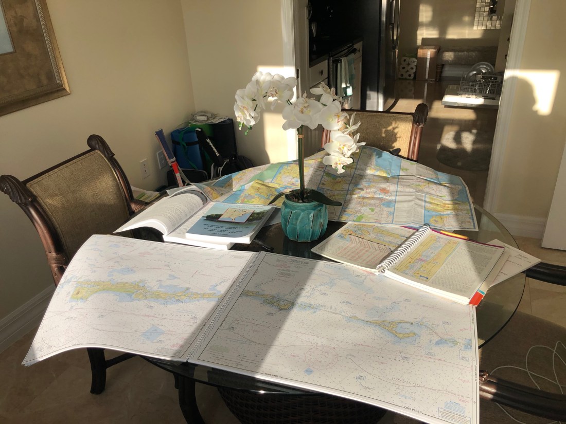
Does this look familiar? It is my “desk” filled with nautical charts, MapTech Embassy Cruising Guides, two books on cruising America’s “Great Loop” and a map of Florida.
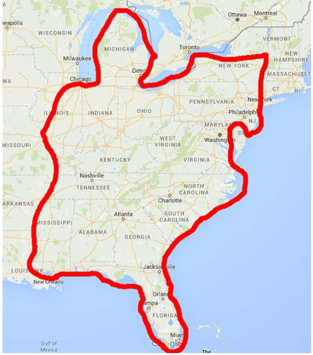
These are just some of the items I am using to plan my cruise from Naples, FL (Actually, Wakely is in Marco Island, Florida) to Riverside, CT. This cruise is the Atlantic leg of the Intercoastal Water Way (AICW). The AICW is just one leg of America’s Great Loop, a 6,000-mile route.
The entire Great Loop includes the Atlantic leg, that I am doing, and then continuing up the Hudson River, into the Erie Canal System, into the Great Lakes and then down the Mississippi River back into the Gulf of Mexico. Here is what the entire loop looks like:
Planning my cruise is much more complex than planning my past Motorcycle journeys. One factor is that a boat cruise is greatly affected by the weather. Rain and wind can keep you at the dock for days at a time. Hence, I can tell you where I plan on going, I just cannot guarantee when I’ll get there. Additional complexity is driven by the following:
• Maps versus Charts – Charting a cruise is not like planning a road trip. Planning a road trip calls for assuring that the road(s) you select gets you from point A to point B. You can tap into Waze or Mapquest to get the distance and time.
Charting a cruise is more complex as there are no roads. There is no Waze or Mapquest that I have found. There are Channels, Inlets, and Shipping Lanes to name a few that are designated on a chart. However, they are not as clear as a road map because the names are not familiar. We live on land and charts are based on navigating waterways.
• Roads versus Channels, Shipping Lanes and Inlets– A paved road, for the most part, is a paved road. Channels, Inlets, and Shipping Lanes can be greatly different based on their depth, width, location, and access to shelter. As I posted previously, the draft of Wakely is 3′ 9″. This means that as I chart the course from point A to B, I need to be sure that the depth along the entire route is a minimum of 5 feet. This gives me room for error as depths are constantly changing, especially in the Florida Keys.
Inlets, needed to traverse from say big water to inland waterways, can be quite treacherous as they can be narrow with very strong currents. These currents, along with wind can create large waves that can dash a boat against rocks or the shore. Selecting which inlets you choose to traverse is a careful decision
• Hotels versus Marinas – Marinas also present their own complexity versus Hotels. Hotels are either clean or not. They have a bed or not. With a Marina, you do consider the quality of the Marina, but you also look for floating docks versus fixed docks, can the marina accommodate Wakely’s 46′ length, does the dock offer diesel gas and, as a hotel, is it available. There are far fewer marinas than hotels. And, being left without a slip for even one evening can create its own problems.
Also, you can book a hotel month in advance and be confident you will arrive on time for your reservation. You cannot book a marina to far in advance as you can’t guarantee your arrival date.
• Diesel versus Gas Station – Along the road, there is always a gas station within reach, unless you are in very remote areas (I have been in these areas). On the water, Diesel marinas can be miles and miles apart. Therefore, I need to be aware of how much diesel I will use and whether I will have enough to get where I want to go and if there will be a pump when I arrive.
• Crew Versus No Crew – When I was planning my motorcycle ride, I knew that I was going to be riding alone. The planning process was simple as I needed to only take into account my needs.
Running Wakely needs a crew. A second or third set of eyes and help departing and arriving at marinas. I am lucky enough to have a great crew for the beginning of the cruise. My wife Catherine, and Bob and Maria Dwyer will be joining me for the cruise from Marco Island, Florida, to Key West and up the Florida Keys.
Catherine has been on the water her entire life and I have so much confidence and respect for her judgment on the water. And, Bob and Maria take it to an entirely new level. They are avid sailors and for years they have sailed in New England for the summer months and in the Carribean for the winter months. They know there way around the water. I am so lucky that Bob and Maria have elected to join Catherine and me.
I am in the middle of planning our route from Marco Island, down to Key West and up the Atlantic Coast. So far I have planned as far as the Florida/Georgia border. From Key West to Norfolk, VA is 1,243 miles and then I will have another ??? to go from Norfolk to Riverside, CT depending on the course I plot.
As we are planning to depart the week of Monday, April 13, I still have a little time. The rough schedule is to depart Marco Island on the Week of April 13 and arrive home the latter half of May.
Looking forward to continuing my posts and keeping you all in the “Loop”
I am sorry for the delay in getting out my first 2020 blog. But, this years marks a slight change of plans.
The past two years I have blogged about my Indian Roadmaster motorcycle adventures. First, in 2018, through the Southeast, and in 2019 through the Southwest. I have really loved my time on the open road – exploring new places and meeting new people from different walks of life. Please feel free to read past blogs.
In 2020, I am going to do something different. I am not going to explore America on two wheels. I am going to explore the Eastern Seaboard of the United States, from Key West to Riverside, CT, on a cabin cruiser. The good ship Wakely.
Wakely is a Back Cove 41. The 41 is the flagship of the Back Cove fleet and is fitted with an efficient single Cummins diesel engine. Catherine and I fell in love with the 41 last year. After a quick search, we found our Back Cove 41 in St. Petersburg, Florida.
Her name, Wakely, is a family name. It is the middle name of Catherine’s father, Peter Wakely Streich. Peter is a Navy veteran.
Right now, Wakely is located in St. Petersberg, Florida. Over the next few weeks, we are looking forward to moving her south closer to Naples where we are currently living. She will stay in Florida through March and sometime in April, we will begin our cruise up the Eastern Seaboard.
It will be a casual cruise up the Intercoastal Waterway allowing us to experience the seafaring tradition of the Eastern United States.
Oh, I have elected to keep the blog’s name “Wheeling with Kramer” as Wakely is driven by a single propeller that wheels (spins) to keep Wakely moving forward. So, “Wheeling with Kramer” is still pertinent.
I will keep you up to date on Wakely’s and our adventures starting in just a few weeks.
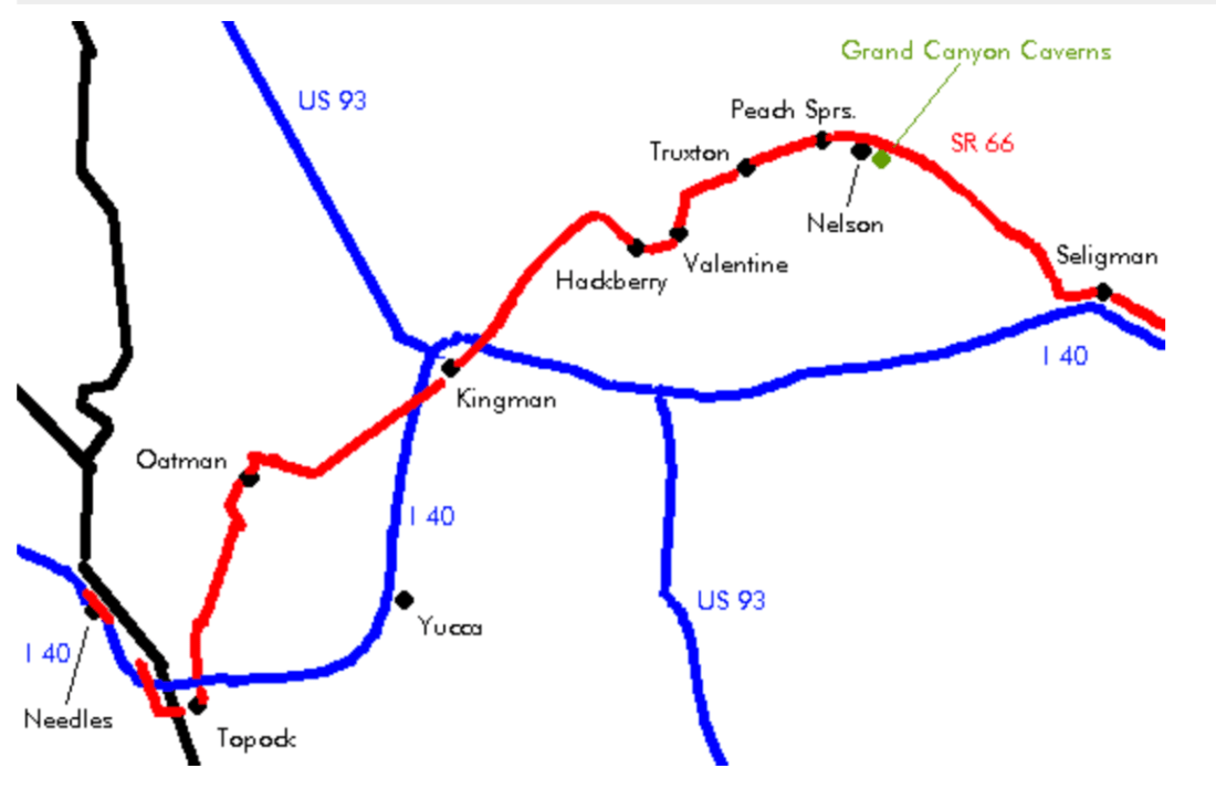
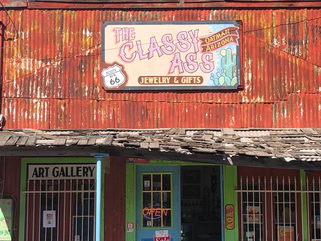
The last two days were enjoyed exploring the Arizona section of Route 66, the “Mother Road” as John Steinbeck named it in “Grapes of Wrath”. I entered US 66 from Needles, California and rode across the Topock Gorge, within the Havasu National Wildlife Refuge, and across the Black Mountains, through Oatman, Kingman, and Hackberry to Seligman, AZ.
As background, Route 66 was one of the original highways in the U.S. Highway System. The road came to be in 1926 connecting Chicago to Los Angeles through small-town midwestern and western America. At first just a dirt road.
The highway became the main thoroughfare for western migration. Dustbowl refugees raised the dust of the road on their way to California in their Model T Fords in the 30s. The road was fully paved in the late 50s and saw World War II veterans migrate to California looking for sunnier pastures and in the 60s and 70s families drove to California to visit Disneyland and other sites.
As the road became more frequently traveled, small towns along the route flourished and became communities offering all the services and amenities the travelers needed. The towns grew, businesses were started, buildings constructed and populations exploded.
Arizona benefited greatly from this river of mankind. People discovered this misunderstood state and many found their homes in the small towns Route 66 traveled through.
However, in 1978 it all came crashing down, as if a light switch was thrown, with the opening of the Interstate, I-40, through Arizona. For example, the small town of Seligman saw traffic go from 9,000 cars passing through a day to 50. The towns dried up, businesses were shuttered and people moved away. Things looked bleak.
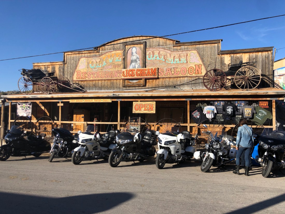
In the 1980s there was a small resurgence of this famous highway when Historic Route 66 Associations began to spring up from small towns such as Oatman, Kingman, and Seligman. These Associations petitioned state and the federal government to label the highway a “State Historic Route” and placed on the “National Register of Historic Places.”
These towns, to tough to die, now exist on tourism and holding events and gatherings.
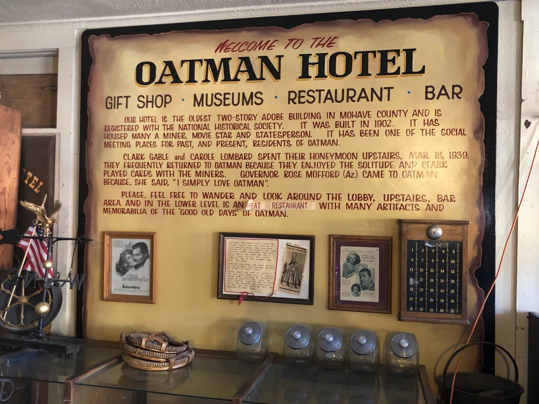
Oatman is a great example of a town too tough to die. Oatman has built a reputation for its raucous events, old west bars and wild burros who wander the town freely. The day I passed through, I was surprised to find an Oatman Motorcycle Rally.
Hundreds of Bikers descended on Oatman to take in the sites and toast the town and the Burros that freely walk the streets
Or hang in the shade when it gets too hotThe town of Oatman was named in honor of Olive Oatman – a young girl whose family was massacred by a Native American raiding party. She was kidnapped and lived with the tribe for 5 years.
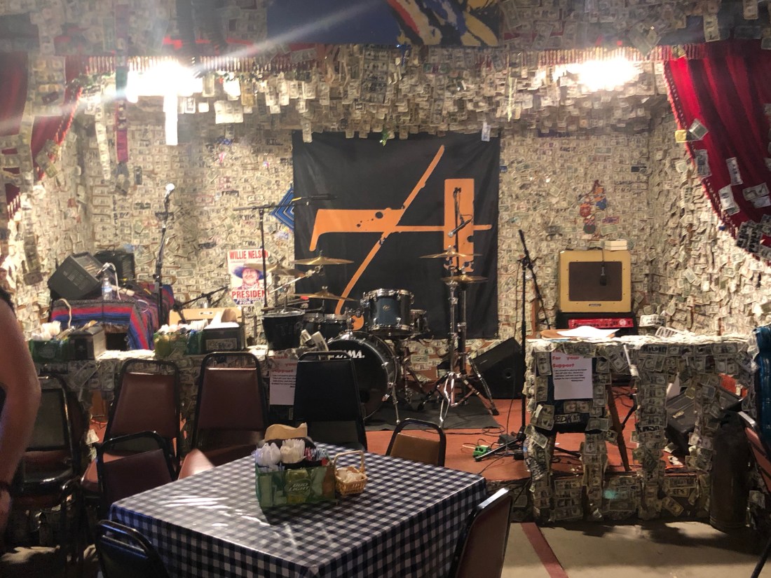
The Oatman Hotel Bar/Restaurant wall and ceiling are covered in autographed one dollar bills – I was told it could amount to $150,000
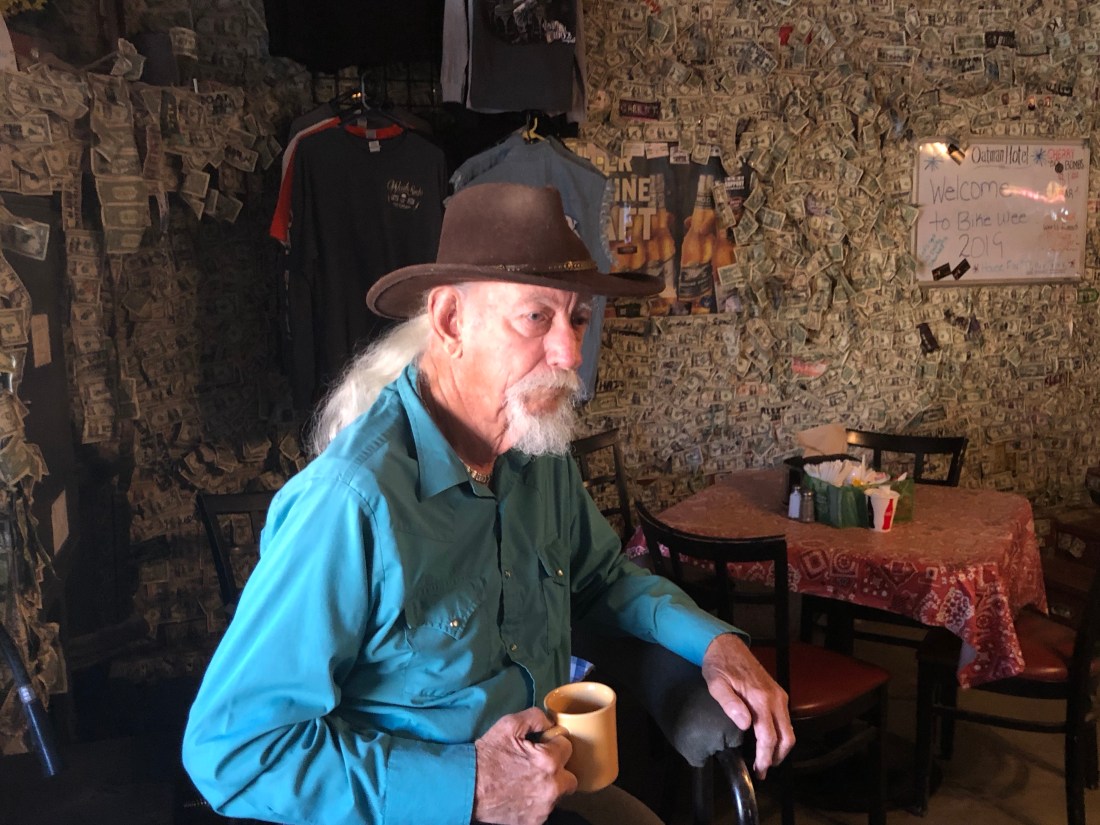
Oatman was full of characters. One gentleman I met was Fred. Fred was a miner. In the 60s and 70s, he mined gold and copper all over Arizona. Fred moved to Oatman in the 80s, to revitalize the gold mines that Oatman was known for. But, they had been played out. Fred never left and watched as Oatman made a comeback as a tourist town
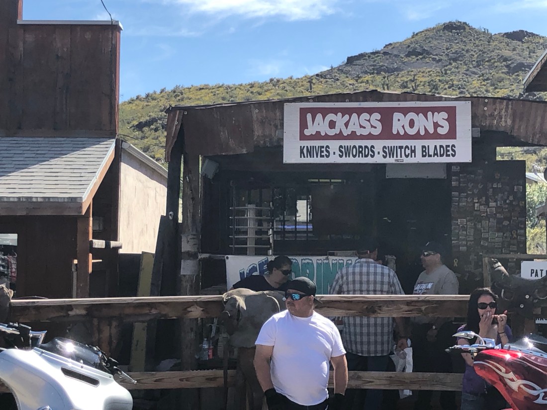
Fred, one of the many characters one finds in OatmanAnd the tourist shops are appropriately named
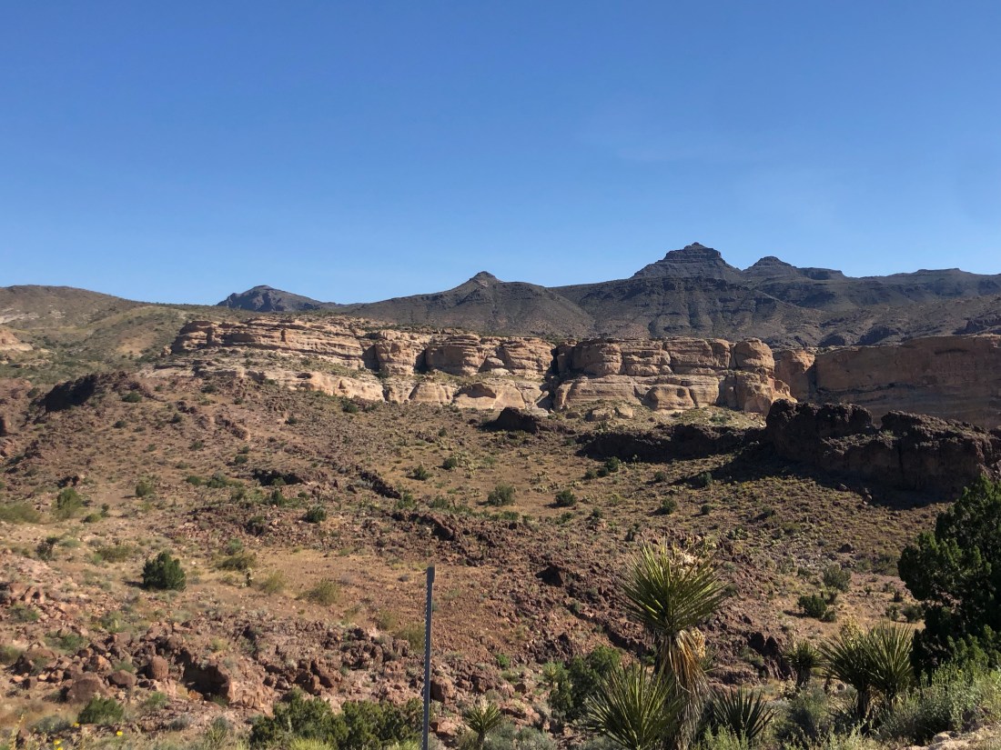
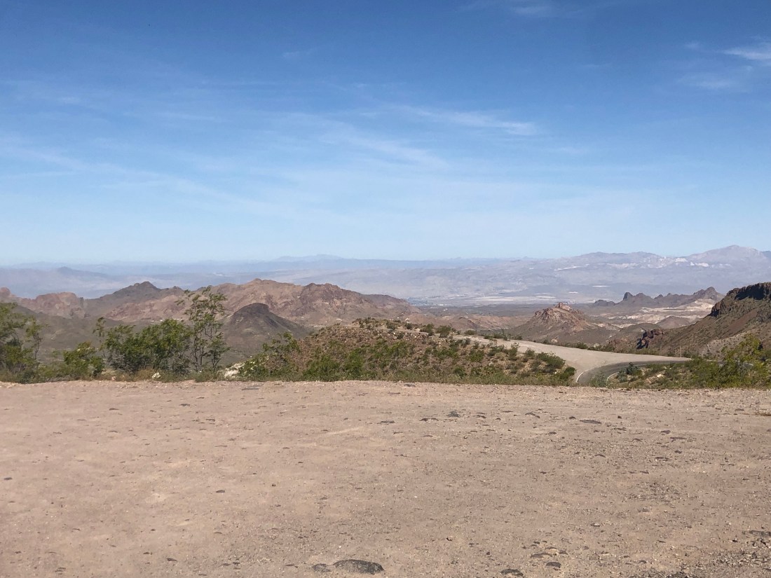
Oatman is located in the Black Mountains and the road leading out of town to the East offers great twisty roads with hairpin switchbacks and great viewsVistas that go on forever – Note the road down below and the tight, no guardrail, turn.An example of the sharp turns and switchbacks with no guardrail
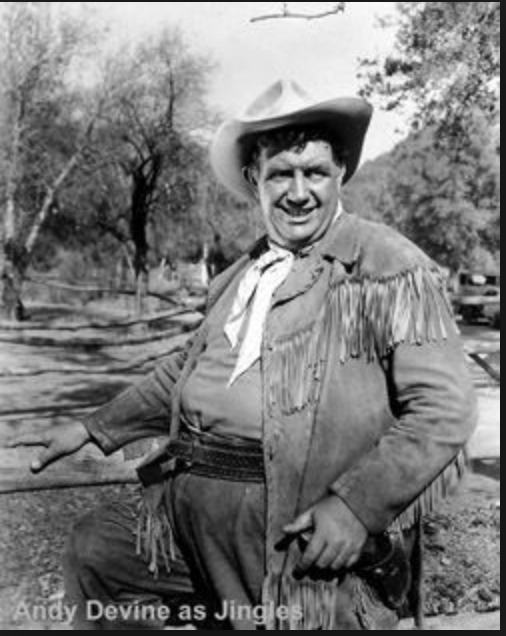
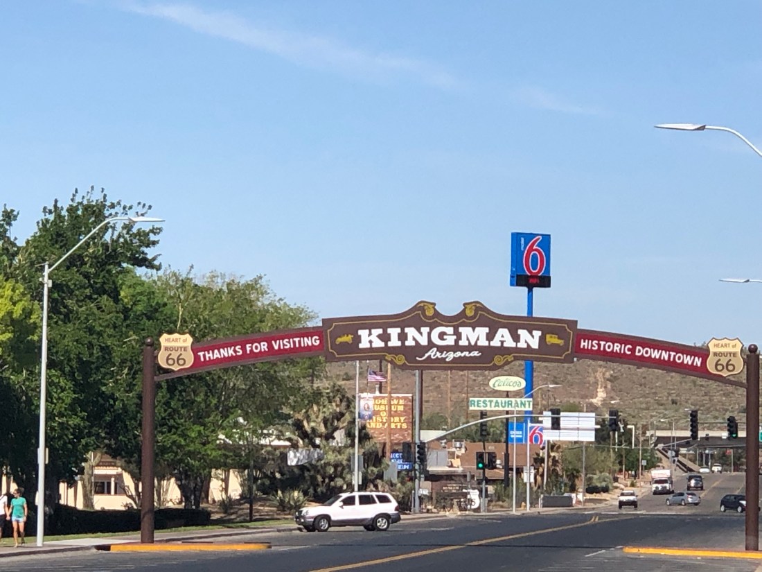
My next stop after Oatman was Kingman, Arizona. One of Kingman’s claim to fame is that it is the home of Andy Devine. Andy Devine was an American character actor known for his distinctive raspy, crackly voice and roles in Western films. He is probably best remembered for his role as Cookie, the sidekick of Roy Rogers. He also appeared alongside John Wayne in films like Stagecoach (1939), The Man Who Shot Liberty Valance and How the West Was Won (both 1962). The main street is named after him.
Today, Kingman largely exists as another US 66 tourist town
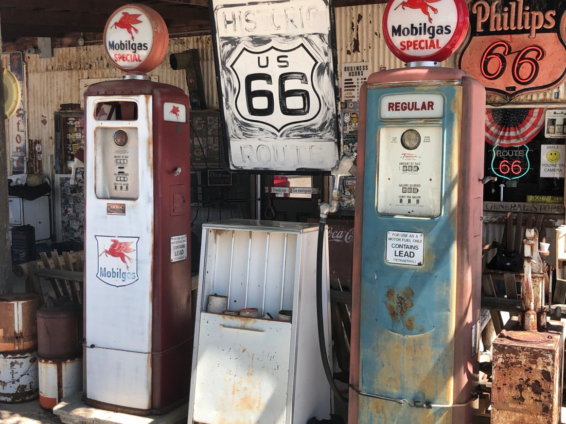
Moving on from Kingman, I stopped at the Hackberry General Store. The Hackberry General Store, located in Hackberry, AZ was a crucial gas station and store on the old Route 66 as it sat between Seligman and Kingman. Travelers needed to gas up in between the two larger towns. Today, the general store which is privately owned stands alone in the middle of nowhere. It only exists because it sits today on historic Route 66. But, it is offering one family a living and hiring people to man the store
The Hackberry General Store does not look like much. But, captures the flavor of what was America’s Main StreetGas pumps circa 1940s 1950sThe Hackberry soda fountain with a tribute to Elvis and Maralyn Monroe – I guess people are big on autographed one dollar bill.
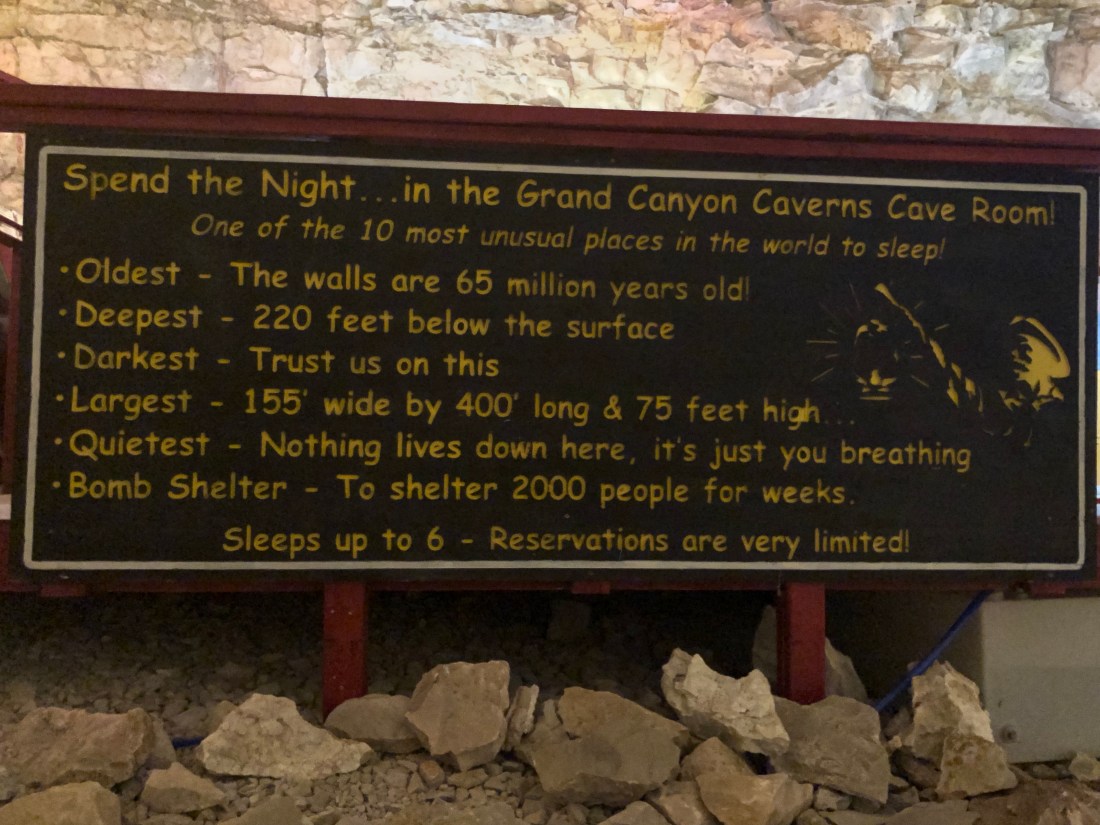
My next stop was the Grand Canyon Caverns, the largest dry cavern in the United States. This is a wild story and an example of how to turn lemons into lemonade.
The Cavern was discovered by a Walter Peek in 1927 when he nearly fell down a hole leading into the cavern. The next day, he and friends returned and they lowered Walter into the cavern to explore.
Walter thought he had found the mother load of gold. He immediately purchased the property and began plans to mine the mineral. After the purchase and getting everything ready to bring the gold home, he found that his gold was iron oxide, or more commonly known as “rust.”
Peek, being an entrepreneur, then began to charge 25¢ to lower people into the cavern and allow them to explore the cave on their own. Unfortunately, Walter forgot that Uncle Sam likes a piece of the action in income tax. Walter failed to pay and the caverns were taken away and sold to a consortium of three owners. An elevator was added to allow easy access to the cavern.
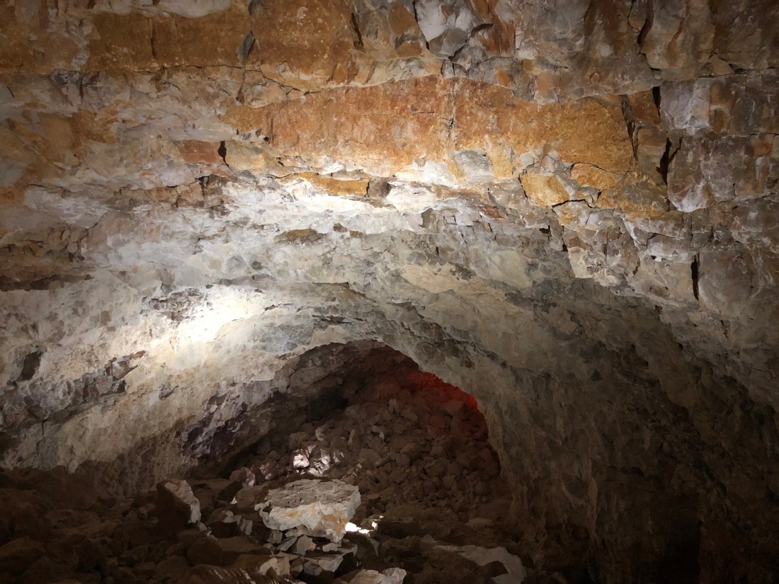
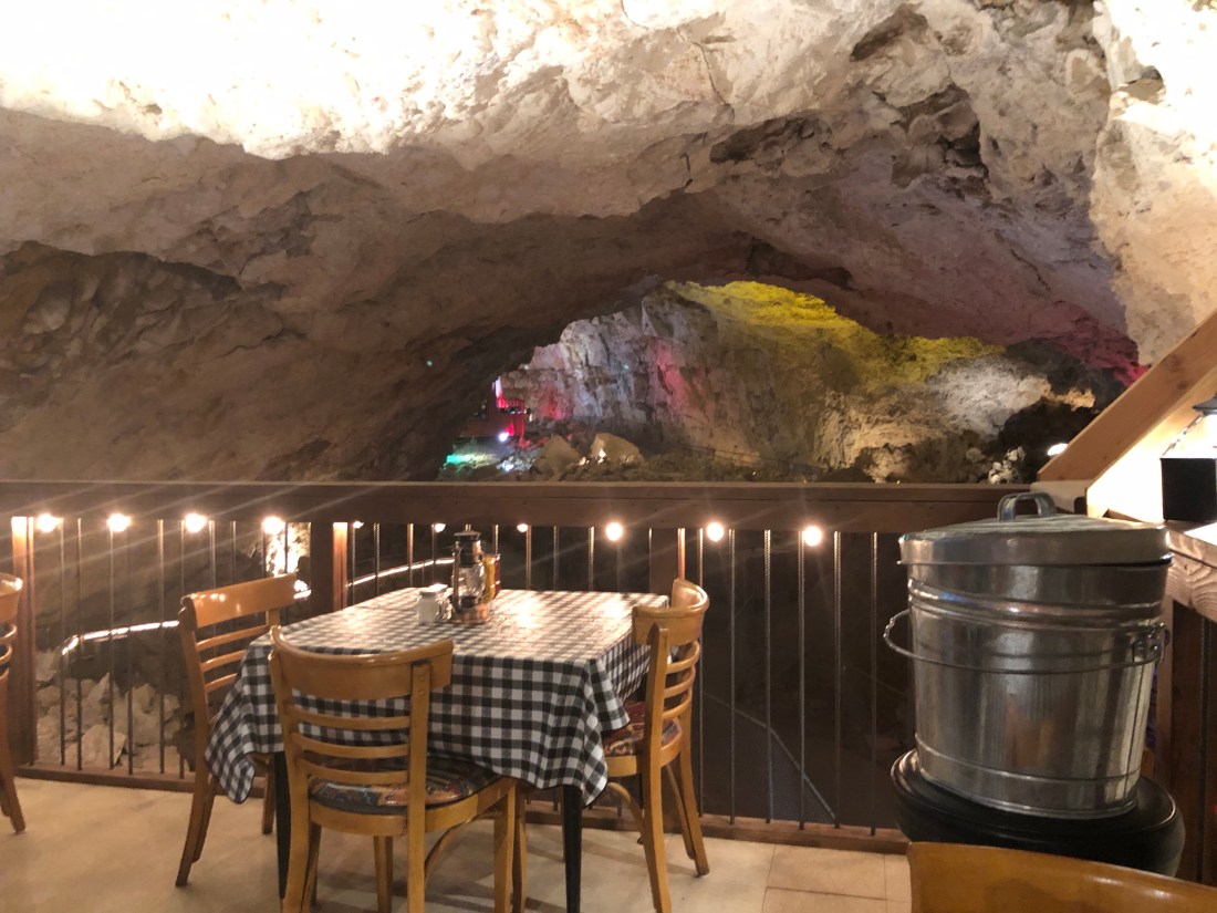
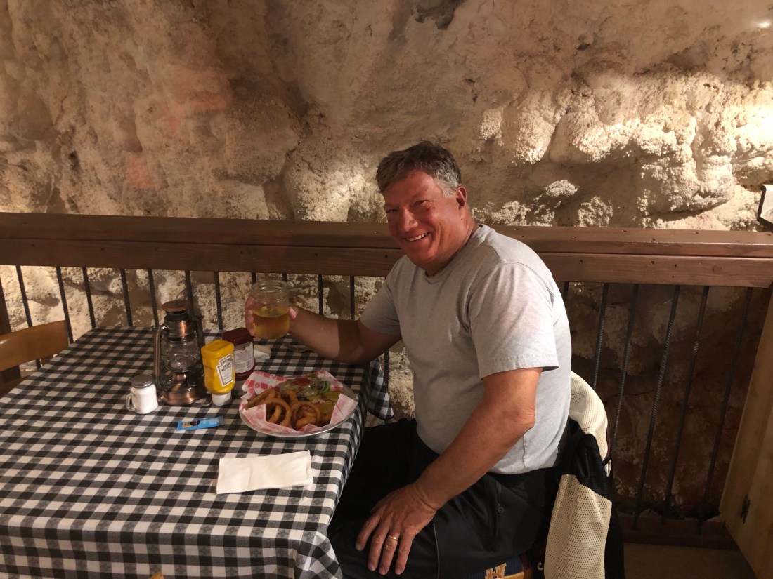
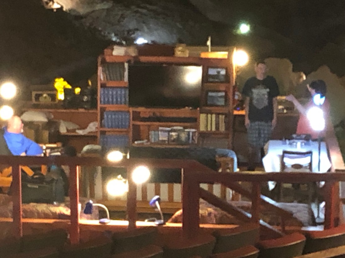
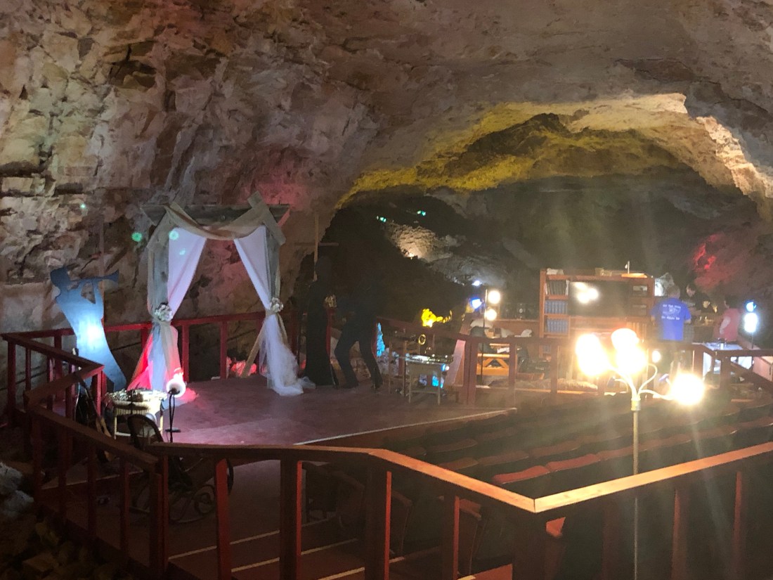
Today the cavern continues to be excavated and offers the opportunity to eat 210′ (approximately 21 floors) below the earth’s surface at the Cavern Grotto, to sleep in the cavern and even to get married. At a constant 57 °F (14 °C) with only 2 percent humidity year round, the caverns are an ideal preservation area.
The Cavern lies 210 feet below ground level. It is among the largest dry caverns in the United States. Because of the lack of water, stalagmites and stalactites are rare in the caverns. Notice the iron oxide on the top – this is what Walter thought was gold.345 million years ago, the southwestern United States was covered by ocean. Skeletons of sea life settling to the depths created these fan “rocks”
While not many fossils have been found, they did find the remains of a giant and extinct ground sloth that lived around 11,000 years ago, when the woolly mammoth and saber-tooth cat roamed North America. Having fallen into the cavern, it was impossible for the animal to get out.
A replica of the Ground Sloth – The University of Arizona has the bones. The claw marks where the animal tried to scale the wall are still visible
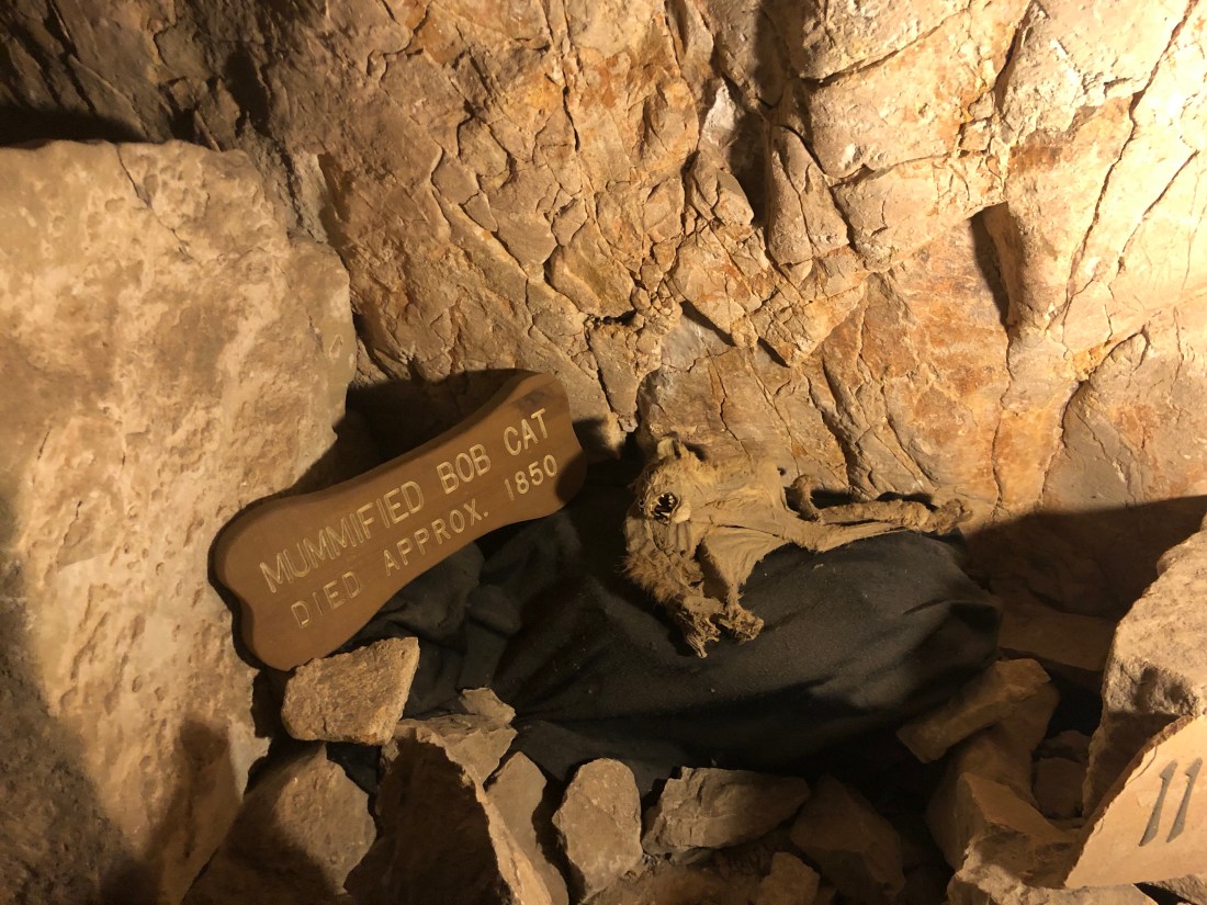
They also found a mummified Bob Cat – they did say that this was the real thing
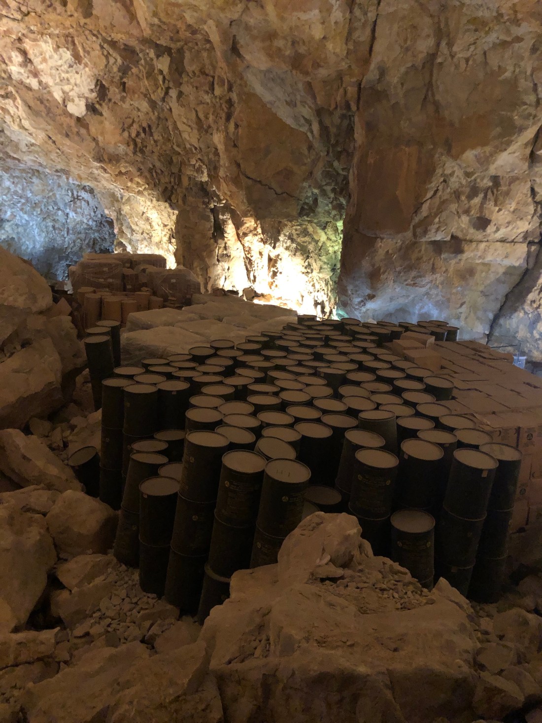
The Canyon Grotto Restaurant – 210′ below the surfaceFood is ordered on the surface and lowered in the metal tin by dumbwaiter.Enjoying a Burger 210′ below the surfaceFor $900.00 a night, you can sleep in the Grand Canyon CavernNice sitting room with Cable TV, Queen Bed and dining areaThe wedding area – with seating for approximately 50 people. The last wedding held in the cavern was in 2017 and the couple is still married.During the Cold War, the Cavern was designated as a fallout shelter. It was filled with water and foodstuff. Enough to shelter 2,000 people for weeks. The foodstuff is still in the cavern and the cavern’s temperature and humidity makes it a perfect preservation area
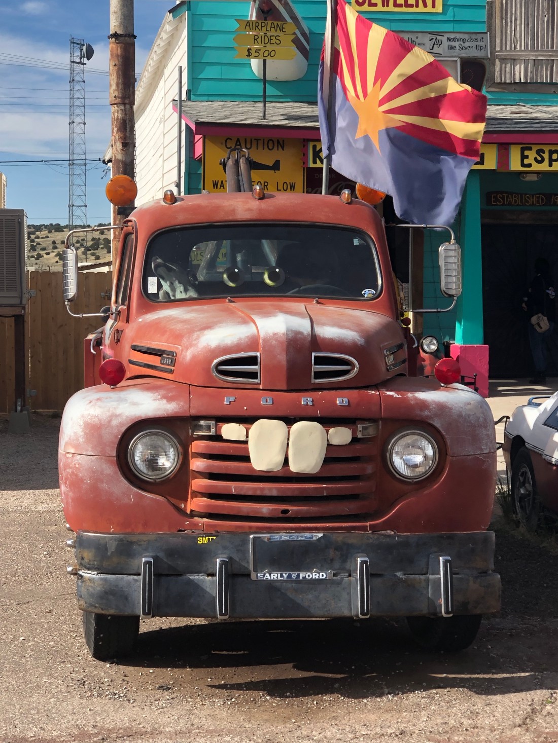
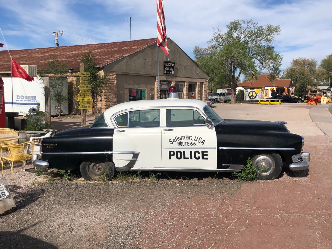
My last stop on Route 66 was the sleepy little town of Seligman, AZ. Seligman is another tourist town along Route 66, but with a twist.
In 2000, Writer and Director of Pixar’s “Cars”, John Lasseter, hatched the Cars idea while taking a cross-country trip on Route 66 with his wife and five sons. Upon returning to work, he contacted Michael Wallis, a famous Route 66 historian. Wallis then took eleven Pixar animators on two different road trips across Route 66 to research the film.
The movie’s fictional town of Radiator Springs was inspired by several real-life locations along historic Route 66, most notably Seligman. To take advantage of the opportunity they have dressed a number of cars up like the characters. And the town remains a sleepy little town on Route 66
Sleepy Seligman
Sleepy Seligman
Dressed as the character Mater in Cars (Voice of Larry the Cable Guy)A 1950s Pontiac Chief Police Car“You can trust your car to the man who wears the star”Elvis, as the Icon of the 50s and 60s, is closely linked to Route 66
Having been born in the late 50s, I can appreciate some of the nostalgia offered by Route 66. But, I think my biggest take away is the perseverance of these towns and the people who live in places like Oatman and Seligman.
These tough Americans fight for their right to exist and look for opportunity in every detail. They ask for nothing and count on one another and themselves to keep the spirit of Route 66 and their towns alive.
Seligman brought me to the end of my Route 66 adventure and pretty much the end of my ride. It has been another incredible experience. Discovering the beauty of America’s national parks. Meeting proud, spiritual, Navajos who keep the sacred lands such as Monument Valley and Canyon de Chelly. Meeting other bikers and having my faith in the kindness of people reignited.
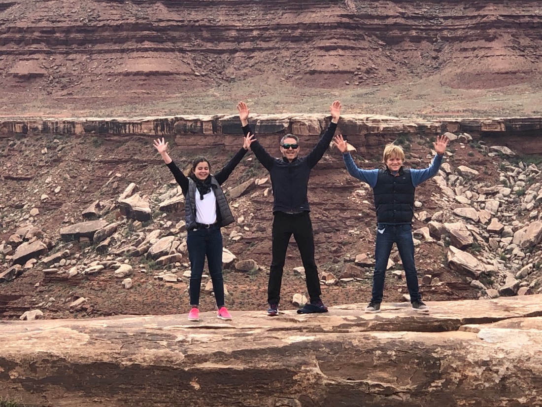
I also found time on the trails of Bryce and Zion, back roads of Canyonlands and other areas to stop and reflect on how fortunate and blessed I am. I am blessed with a wonderful family, my wife Catherine and my two daughters Emma and Sarah. I am blessed that all my girls are happy and healthy and pursuing their lives and dreams. I am blessed with my health and the love and support I receive to pursue my adventures, such as this ride.
I am off to Tucson to catch up with some dear Cowboy and Cowgirl friends of mine. Then, back up to Phoenix to drop off my bike so that it can be trucked back to Connecticut. I fly home at the end of this week.
I have greatly enjoyed writing these blogs and I graciously thank you for sticking with me. I hope that you have enjoyed reading my blogs and at some level, you have had a visceral thrill with the pictures and stories of our great land and her people.
Thank you again, Keep Wheeling! – Until next time.
It was over 100º as I visited Lake Mead and Hoover Dam. Hoover Dam was hot as well – as in “incredibly” impressive.
The Geen Dot was where I started. “B” is the Marina at Lake Mead I visited and the Checkered Flag is Hoover DamThat was the temperature gauge on my Indian Roadmaster in the shade.
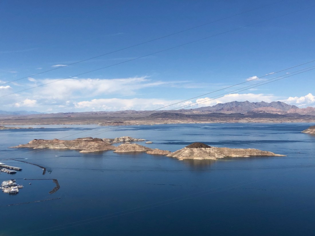
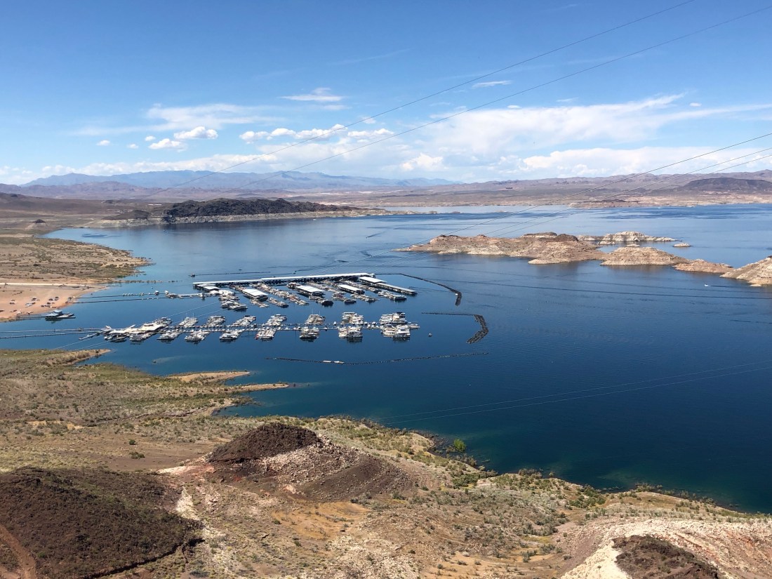
Lake Mead is a man-made lake that lies on the Colorado River, about 24 mi (39 km) from Las Vegas, in the states of Nevada and Arizona. Formed by the Hoover Dam on September 30, 1935, the reservoir serves water to the states of Arizona, California, and Nevada, as well as some of Mexico, providing sustenance (water and electricity) to nearly 20 million people and large areas of farmland.
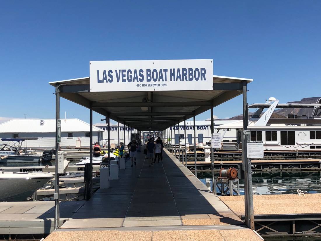
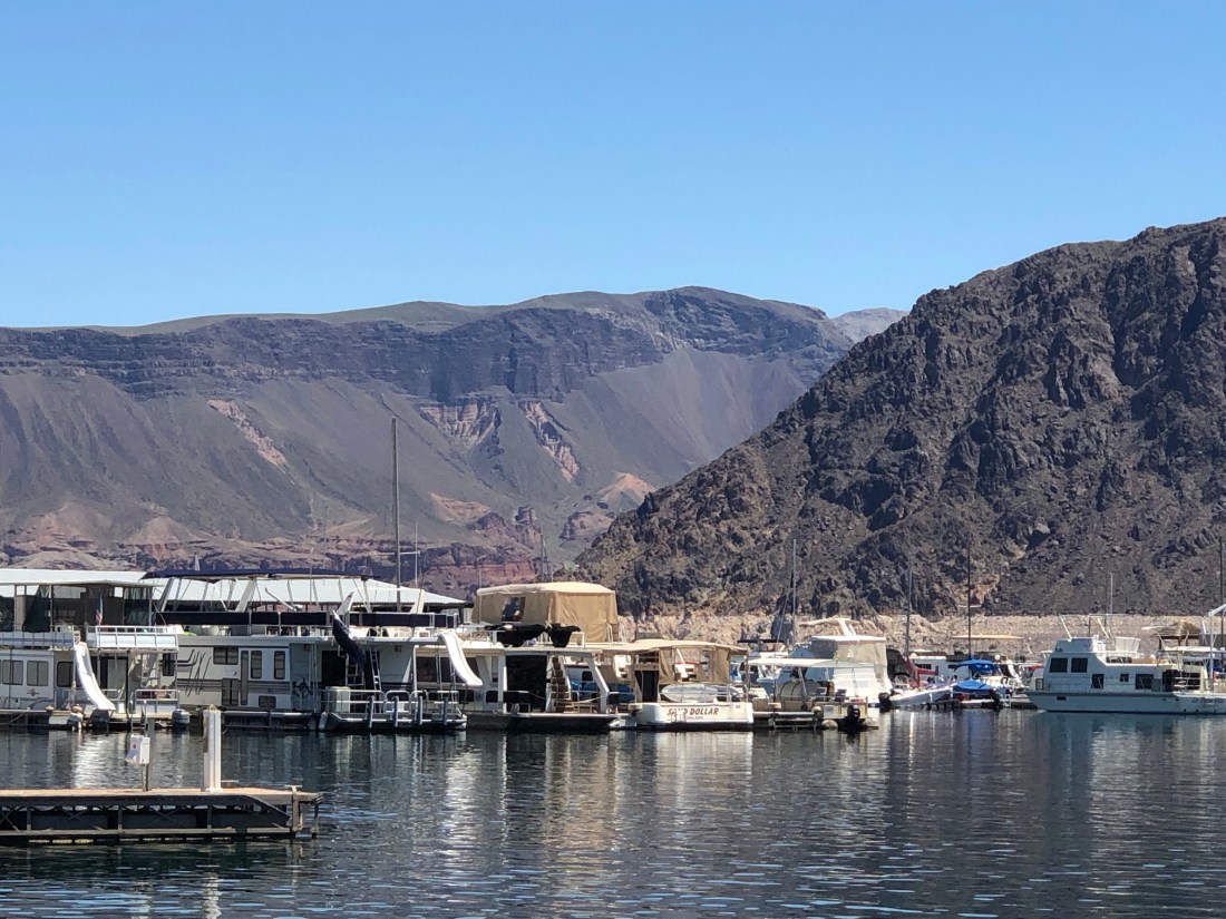
Lake Mead from an overlook. The water level is at 40% of capacityI visited this Lake Mead marina looking for ideas for Riverside Yacht ClubFirst, so many people feed the fish at the Harbor, that the fish follow people down the dock looking for food. The fish include catfish, carp, bass, bluegill, etc.
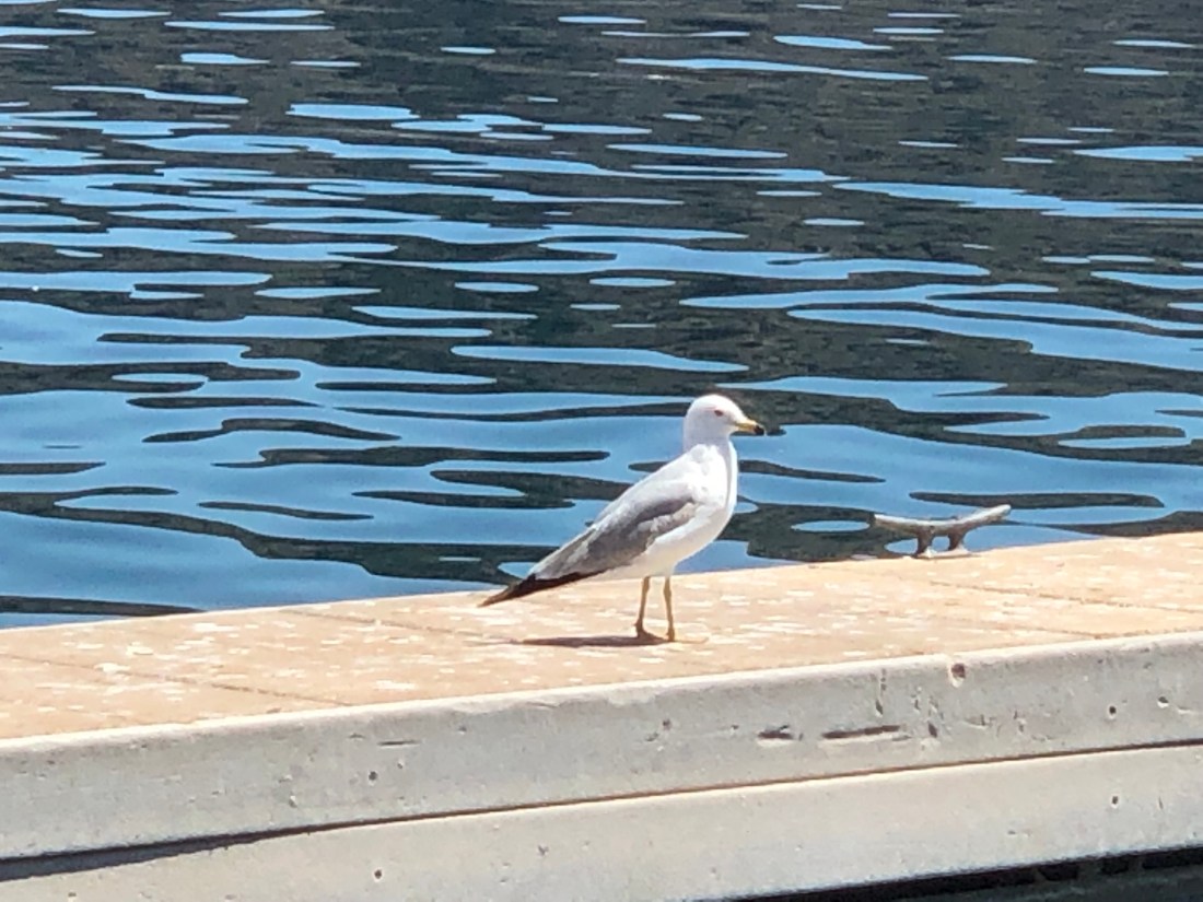
Lake Mead does have birds that look a lot like Seagulls – A little skinnier than East Coast.
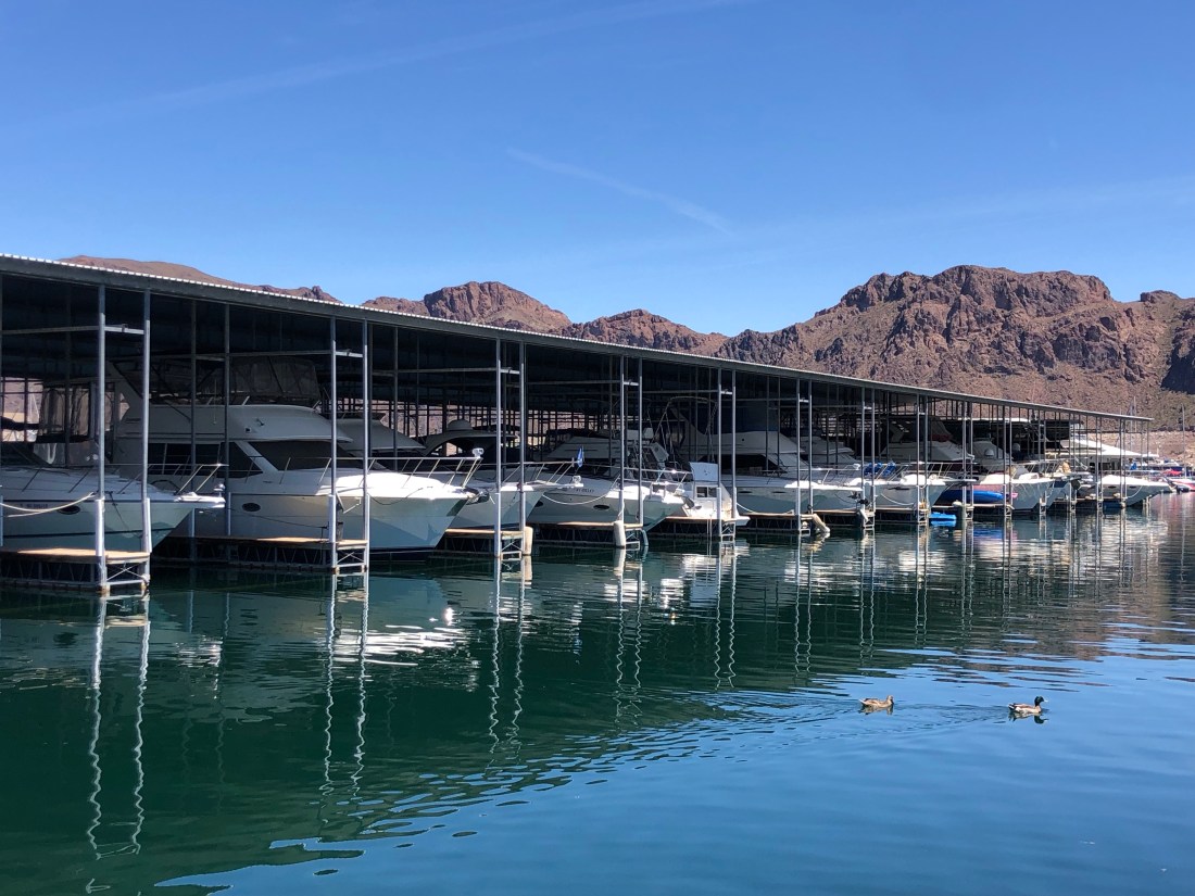
The average high temperature at Lake Mead in July is 106º. Therefore, many of the boats are undercover.You also find a lot of houseboats on the lake – Good for getting out of the heat
And the Desert Princess Paddle Boat that gives 90-minute tours of the lake.An overlook view of the Marina
There is a great deal of concern regarding Lake Mead’s water level and its ability to continue to serve the over 20 Million people who count on it for water and electricity. Changing rainfall patterns, climate variability, high levels of evaporation, reduced snowmelt runoff, and current water use patterns are putting pressure on water management resources at Lake Mead as the population relying on it for water, and the Hoover Dam for electricity, continues to increase.
As a nation, this will become a major focus over the next few years as the lake is so critical to the western states and the country as a whole.
One of the world’s Engineering Wonders.
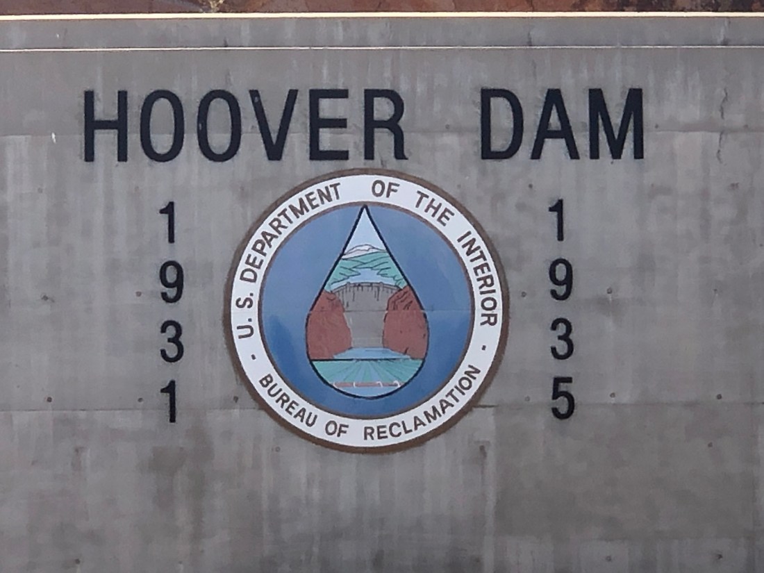
Hoover Dam was constructed in just five years, between 1931 and 1936, during the Great Depression and was dedicated on September 30, 1935, by President Franklin D. Roosevelt.
Its construction was the result of a massive effort involving thousands of workers and cost over one hundred lives. Originally known as Boulder Dam from 1933, it was officially renamed Hoover Dam, for President Herbert Hoover, by a joint resolution of Congress in 1947.
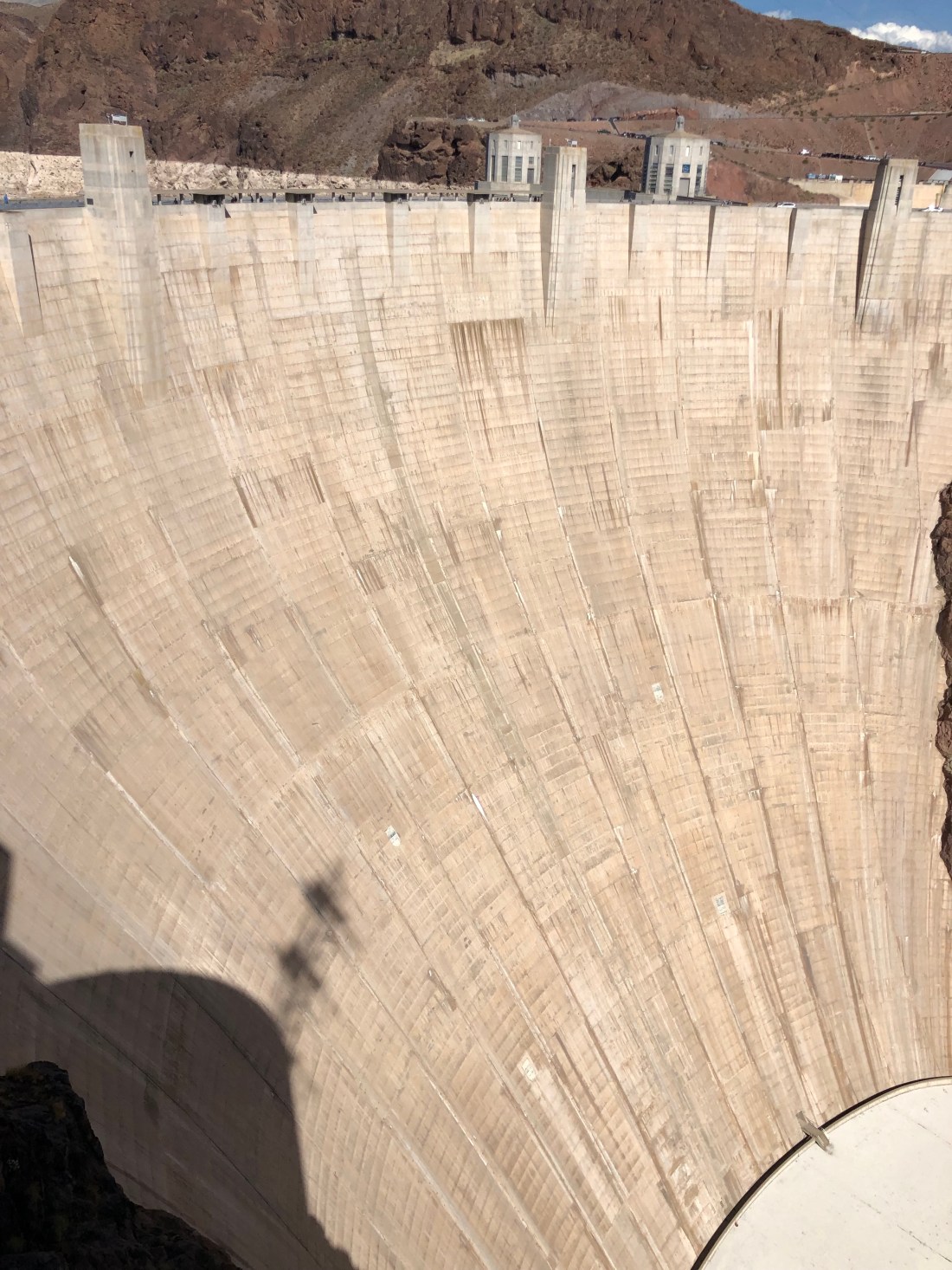
A total of 3,250,000 cubic yards (2,480,000 cubic meters) of concrete was used in the dam before concrete pouring ceased on May 29, 1935. Overall, there is enough concrete in the dam to pave a two-lane highway from San Francisco to New York. Hoover Dam is 726 ft. tall. That is 171 ft. taller than the Washington Monument in Washington D.C. At its base, Hoover Dam is as thick (660 ft.) as two football fields measured end-to-end.
The Dam is so large that it is a challenge to capture it in a photo.A view of Lake Mead from the Dam. The “Tub Ring” is minerals deposited on the rock walls when the lake’s water level was higher. The Desert Princess in the background.On the other side of the Dam, fromLake Mead is the Colorado River.
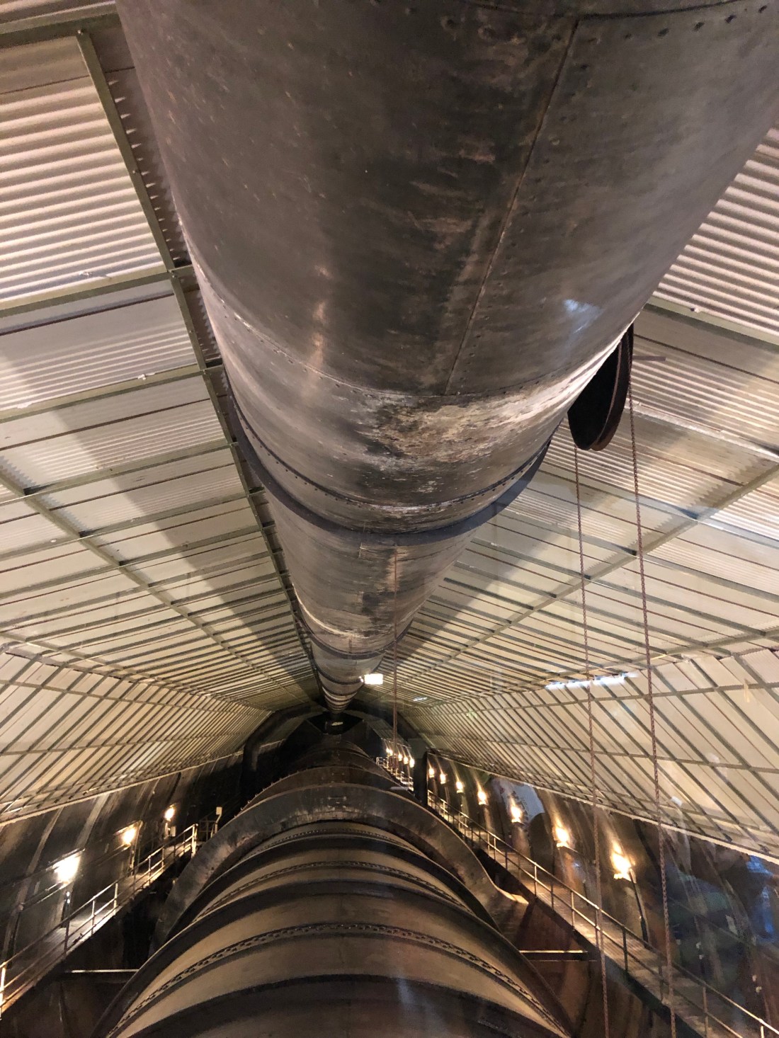
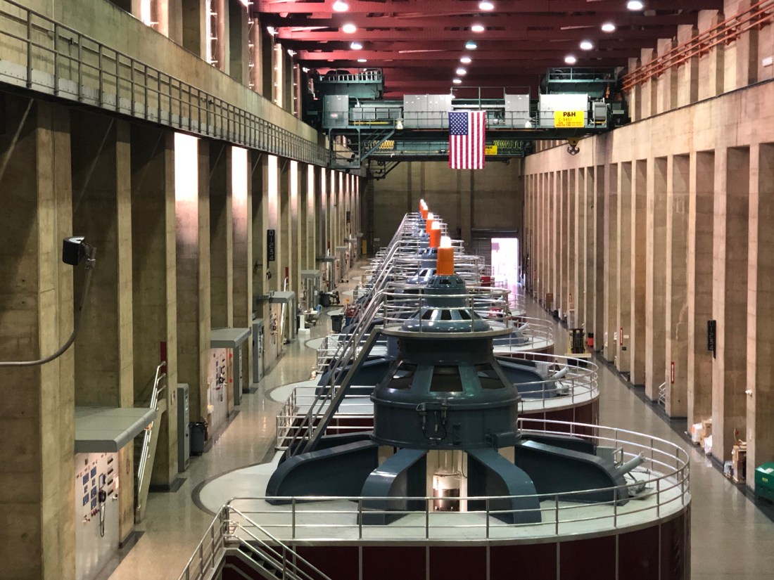
I took a tour of the Dam with focus on her power plant and tunnels. Before the dam could be built, the Colorado River needed to be diverted away from the construction site. To accomplish this, four diversion tunnels were driven through the canyon walls, two on the Nevada side and two on the Arizona side
You can see the diversion tunnels above. The outer tunnels have been closed while the inner Diversion Tunnels now carry water to the electricity power plants.We stood over one of the inner diversion tunnels and you could feel the vibration of the water under your feet.And, these are the power plants with turbines that create the electricity – A little too technical for me.
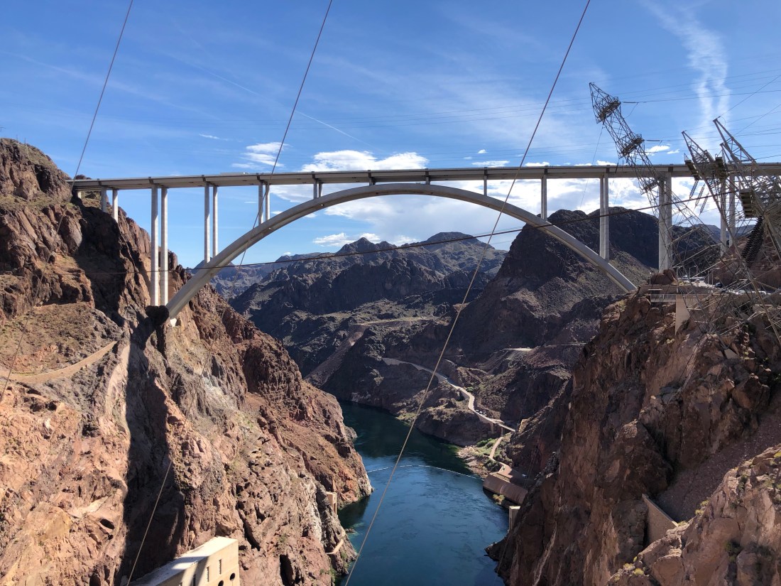
The traffic crossing the Hoover Dam had become so intense that another bridge needed to be built to ease the congestion. The newly-completed Mike O’Callaghan-Pat Tillman Memorial Bridge is the world’s tallest concrete arch bridge, it is the first concrete-steel arch composite bridge in the United States and towers 880 feet over the Hoover Dam.
The 1,905-foot-long bridge connects both Nevada and Arizona roadways, so it’s fitting that it’s named the Mike O’Callaghan-Pat Tillman Memorial Bridge, as it honors a hero from each state. With 30,000 cubic yards of concrete and 16 million pounds of steel, the massive engineered wonder is the widest of its kind in the Western Hemisphere. The bridge was opened, October 16, 2010 (to pedestrians); October 19, 2010 (regular traffic).
A view of the Mike O’Callaghan-Pat Tillman Memorial Bridge from Hoover Dam
The Hoover Dam was a great engineering accomplishment…..a tribute to America’s ability to design and execute a monumental project during the Great Depression. The construction of the Dam was in the 1930s what reaching the moon was in the 1960s. It was a project that united the country and brought tremendous pride in America’s ability to tame the wild Colorado River.
It will take another great American effort to save Lake Mead and the Hoover Dam. Because without American ingenuity, Lake Mead and the Hoover Dam will not be able to supply our Western states with the water and electricity necessary to not only survive but to thrive.
I’m betting on us. Tomorrow I am off to explore what is known as the Mother Road, The Main Street of America or The Will Rogers Highway. Route 66 from Needles, CA to Seligman, AZ.
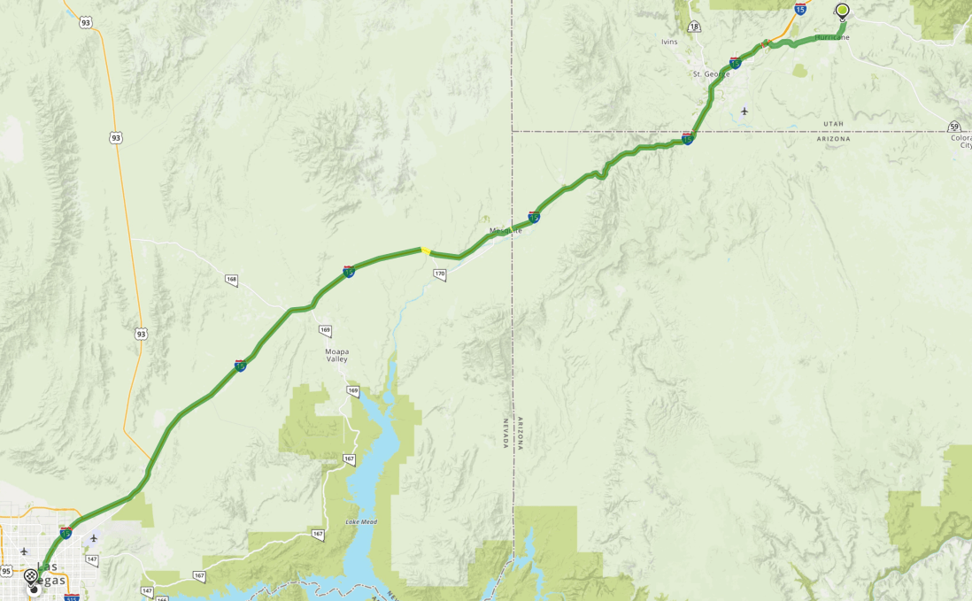
I had few expectations regarding yesterdays’ ride from Zion National Park to Las Vegas. There was nothing on any social media that I saw referencing interesting roads.
The conventional route, as seen below, is to get on I-15 and ride 80 MPH for 141 miles.
Look closely and you will see Moapa Valley, Nevada Route 169, converting to Nevada Route 167 and connecting with Nevada Route 147. Finding this detour, I immediately saw hope for an interesting ride.
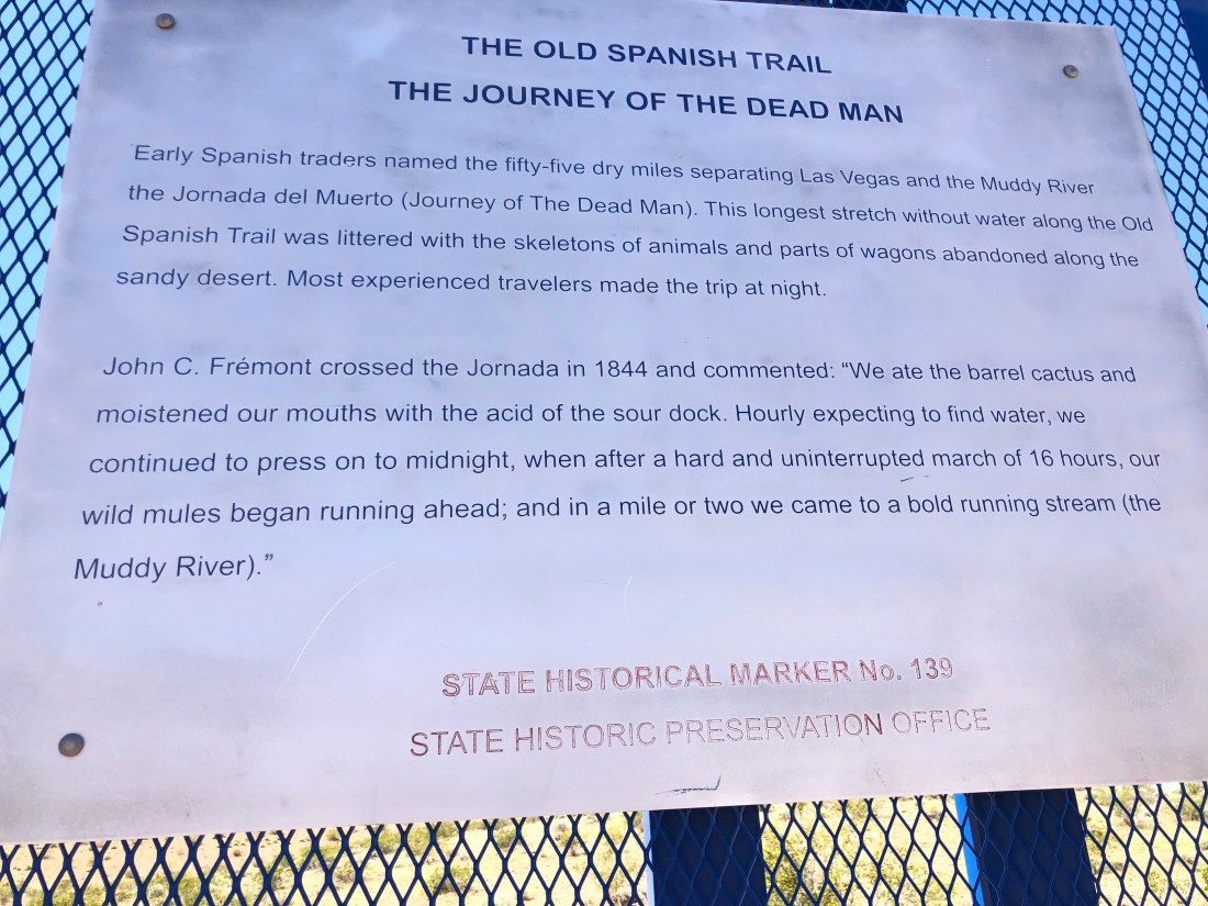
The minute I left I-15 I knew I was in for fun. The sign below was at the intersection of I-15 and Rt 169 just as I started down the road.
Even on a motorcycle, reading this gives you pause.
I looked at my surroundings and saw the exact same sight those early Spanish traders saw. Untouched dry land for miles and miles. Unchanged in hundreds of years.
Dry Desert for as far as the eye can see – not much use even today – But beautifulAgain, very few cars on this unconventional route.
I drove south approximately an hour and was surprised to find this sign encouraging me to continue.
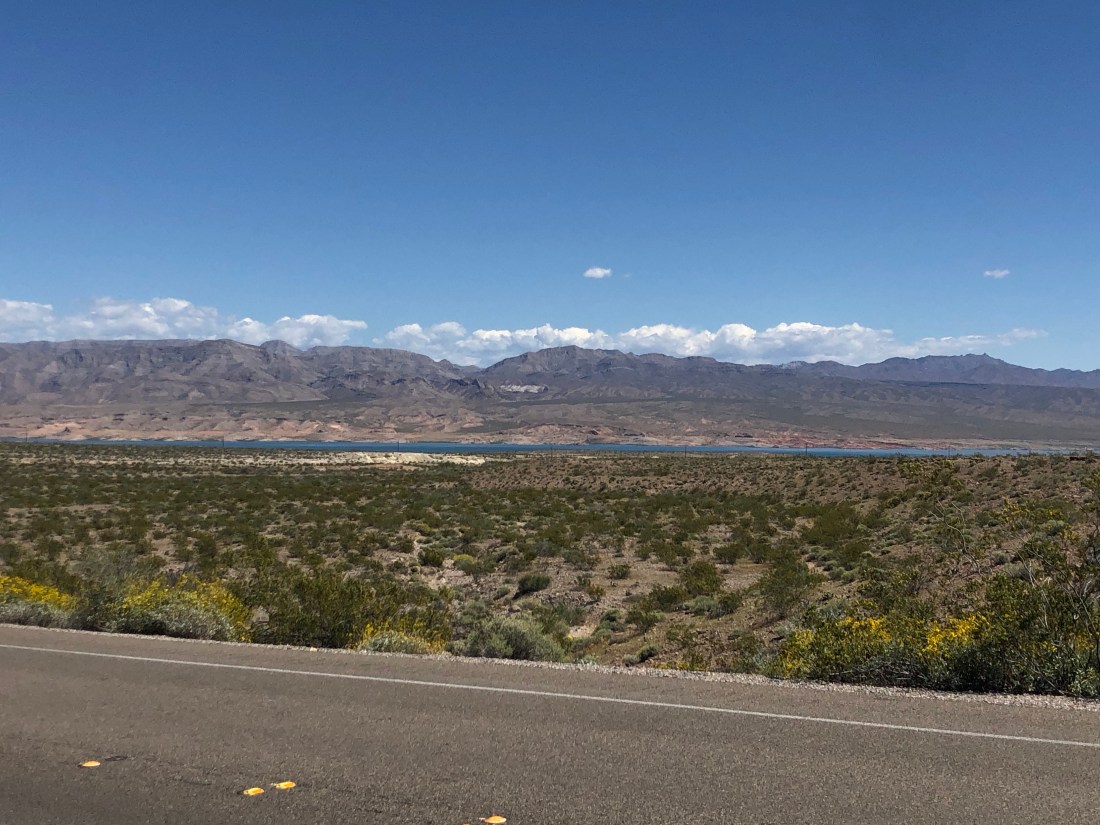
My first view of Lake MeadI was informed that the white rim around the lake is the level the water used to be just a few years ago.
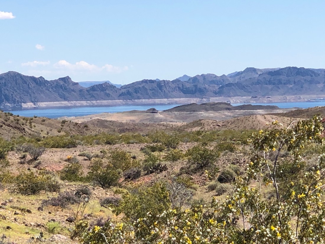
After spotting Lake Mead, I continued on and found a Red Rock Wonderland – an area with rocks so red that they glowed. I apologize as again the pictures do not do justice to the deep red they featured. This area is near the Valley of Fire State Park, but I do not believe that I entered the Park.
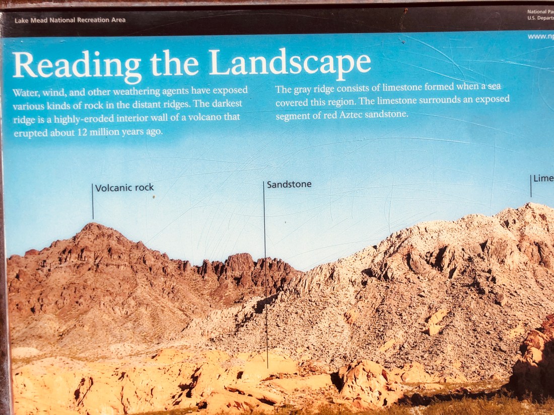
There was a sign that called out the vista I was seeing in front of me. Read below how the farthest out and darkest ridge is a highly eroded interior wall of a volcano that erupted about 12 MILLION years ago. Which means that I was standing inside the volcano as I read the sign.
It also calls out limestone coloration and what the sign calls my red stone as red Aztec sandstone. Look at the following two pictures, I have attempted to duplicate the sign so that you can see clearly what the sign refers to.
Line up the tallest peak just left of center with the picture above.
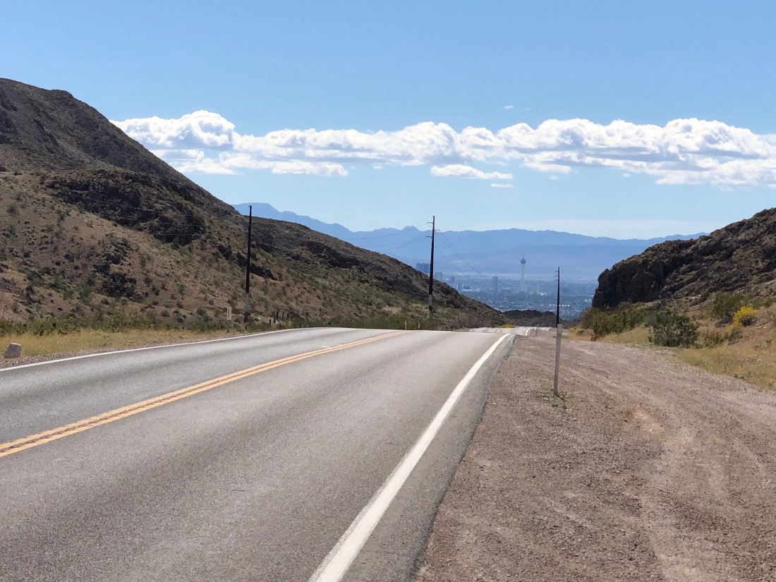
Returning to the road, I continued to pass red rocks, Limestone, and desert until I crested a hill and there was Las Vegas. When you hear that Las Vegas was built in the middle of the desert, they are telling the truth.
Look closely and you can see the Stratosphere – 1,149′ tall observation tower
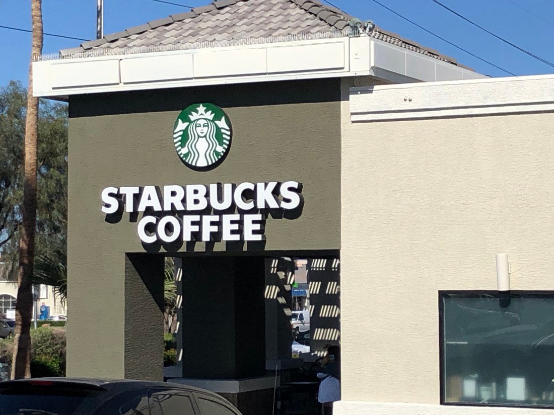
Just a few minutes later I found the first Starbucks I had seen in over two weeks, since I left Phoenix on April 7th. I did not miss Starbucks and I was 100% happy without them, but I did immediately run in and had an iced coffee.
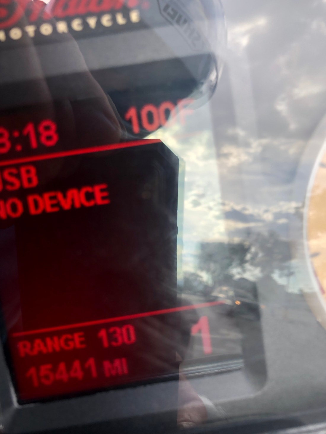
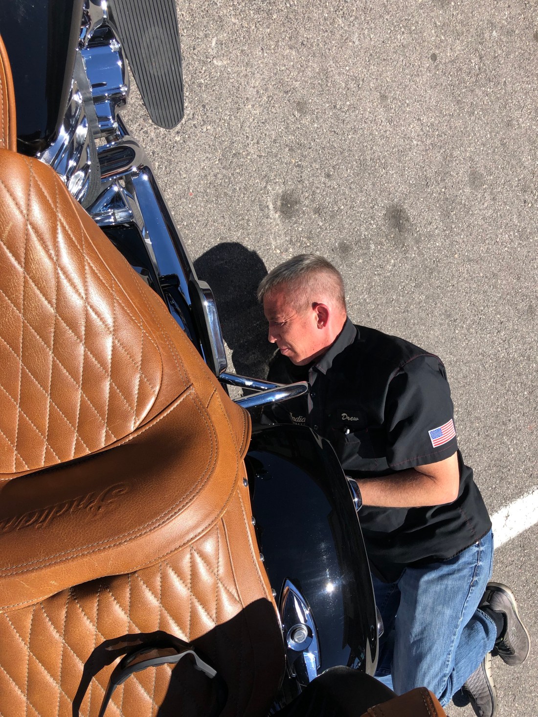
As a quick reminder and an update on my Indian. I came to Las Vegas to first and foremost have my Indian Motorcycle checked out. She has been through a lot over the last few weeks, “ridden hard and put up wet.” She had developed a whine in her drive belt, the kickstand was slightly loose, her power was down and some other minor issues.
Sin City Indian is a great Indian dealership and their manager Drew was really attentive. Knowing that they may never see me again, they still gave me, what I consider to be, 100% attention. Below is Drew, the manager, helping me clean the drive belt and checking my shock pressure.
I am happy to report that the whine in the drive belt has been fixed, the belt needed aligning. The kickstand, something I use many times a day, is tightened, the air filter has been changed and the power is back up. Over the past weeks, I have ridden through so much dust the air intake was clogged. I am happy to report that the Indian is now happy.
OK, I am also in Las Vegas to lay down a few bets – $30 on the Yankees to beat the Angels tonight – Straight money bet. Go Yankees and…
After seeing the Petrified Forest I thought I had seen the “best”, and the same after Canyon de Chelly, Monument Valley, Canyonlands and Arches, and Bryce. However, I have found each of our Southwest national parks is unique and equally beautiful. Zion National Park is no different. Zion is a Hebrew word for Sanctuary and Refuge.
Two quick side-notes before I describe the wonder that is Zion National Park. The first is that the drive from Bryce to Zion was nice. But due to mother nature, I was unable to ride the Zion Park Scenic Byway. This 54-mile road is the spine of the park and is an engineering feat. Unfortunately, 4″ of rain in March, which is usually what the area gets in a year, washed the road out. It will reopen in May.
The second quick side note is an acknowledgment to the National Park Rangers. I have spoken to many over the past few weeks and their pleasant, happy demeanor can be accountable to the fact that they love their job. Working in God’s creation is a special opportunity and as one Ranger informed me, “Going to work is like going to church every day.” These are special people who do so much more than give directions. They inspect and keep trails open, they provide search and rescue support to lost travelers, they monitor the ecosystems to provide up to date reports on environmental change, etc. They are people that I have a new perspective and deeper respect for.
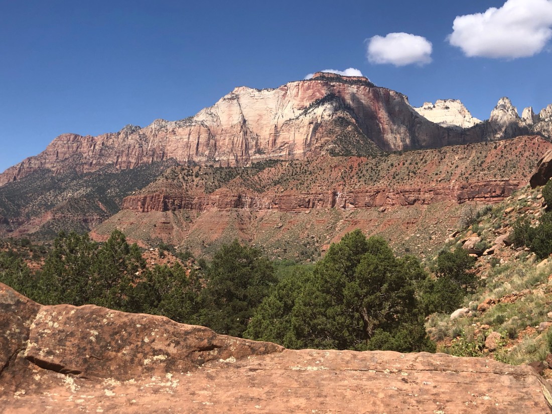
As I have mentioned, each park is unique. From the petrified tree trunks in the Petrified Forest to the Mesas, Spires and Buttes of Monument Valley and the Hoodoos of Bryce. Zion’s unique geology is soaring rock cliffs hundreds and hundreds of feet above the canyon floor. Zion, unlike Bryce, is a true canyon having been created by the flow of the Virgin River.
Soaring Peaks as seen from Watchman Trail.
Again, I was moved to hike the park which is new for me versus my past horses and motorcycles. But, to find sanctuary and quiet and get away from the crowd, hiking is one way to find solitude. My first day I did an easier hike on Watchman Trail and an even easier hike to Lower Emerald Pool. The morning Watchman Trail hike, a three-mile round trip, 500′ elevation, provided views across the canyon.
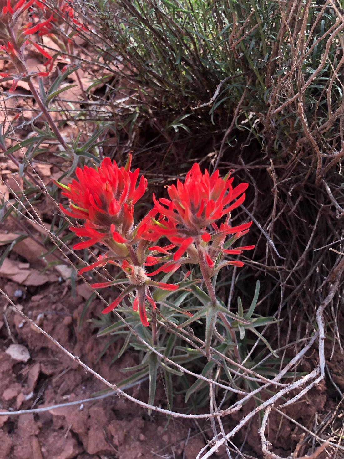
Yes, I climbed thatCactus was thrivin’ in Zion and seen much less in BryceAnd beautiful Mountain Flowers was abundantA portion of the trail showing layered rocksAt the top of Watchman, you see clear across the canyon.
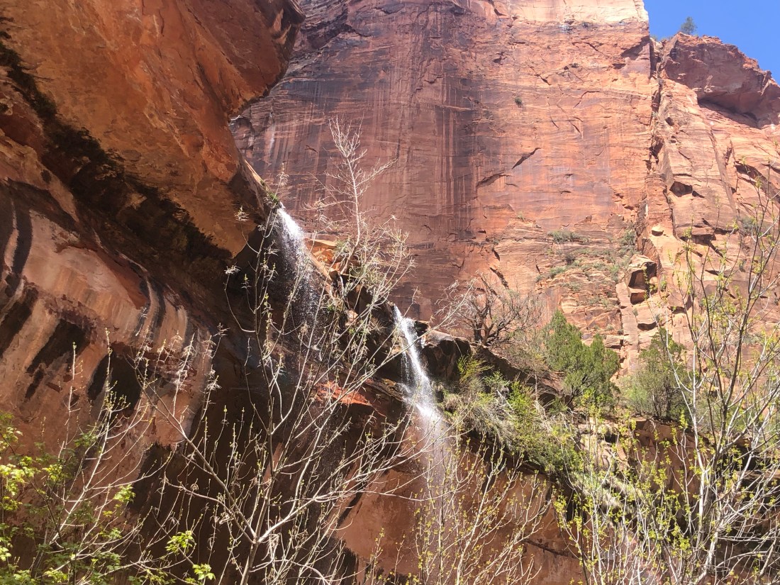
The afternoon, I took a much easier hike, really a stroll, to Lower Emerald Pool as the Upper Pool trail was closed due to rock slides. While an easy stroll, it did take me to an impressive waterfall that I could walk under – I guess I am big into walking and riding under waterfalls.
Waterfalls at Zion Lower Emerald Pool.
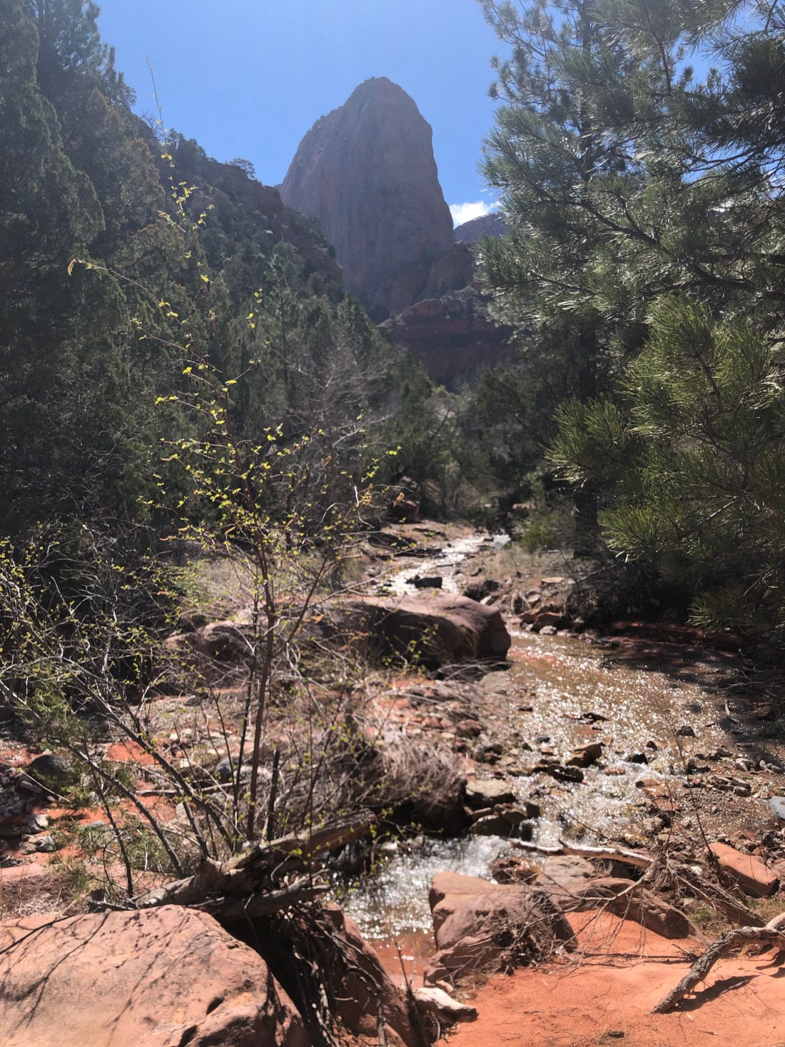
In search of smaller crowds, the second day I traveled to the north end of Zion to hike Taylor Creek Trail. This 5 mile, 715′ trail is called moderate and it was not a challenge. However, you do need to recapture muscle memory to enjoy the trail. Let me explain.
Taylor Creek Trail, as its name suggests, runs alongside Taylor Creek. The trail crosses the creek dozens of times. I must admit, the first time I had to cross the creek, not knowing that this would be the first of many, embarrassingly, I took off my shoes and socks and waded across. You had to learn to look for the stones to jump across the creek and keep your feet dry. By the end of the hike, I was jumping the creek like a Mountain Goat (if they jump creeks – I would think that they would be good).
The beginning of Taylor Creek – it looks less wide than I remember it.I ran across very few hikers – but, reassuring to see others on the trail
As I walked the trail, the canyon narrowed.
The canyon narrows to almost a slot canyon
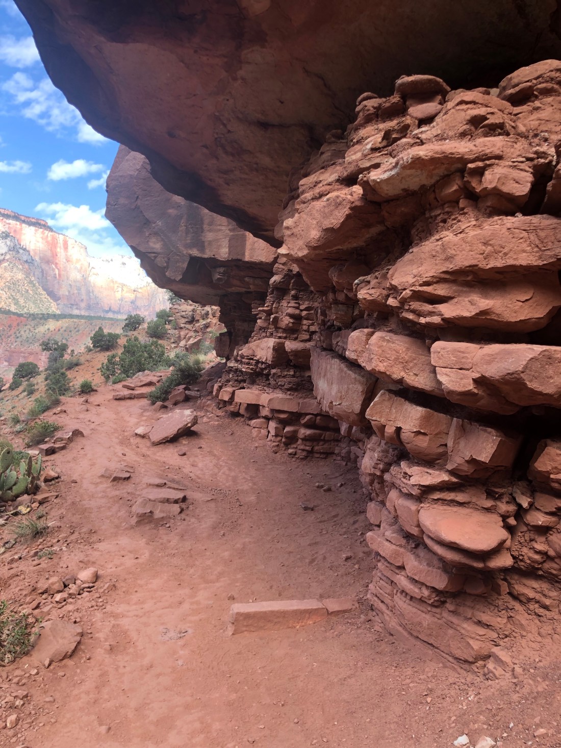
Twice along the trail, I rounded a corner and came across a settler’s cabin built around the 1930s. I could not imagine why these two families would build a cabin this far off the beaten path with little area for farming. They must have existed by hunting and they had an abundance of water – I am sure at times too much.
The Mountain Flowers were in full bloomAnd frequent little waterfalls added to the beauty of the creek.
At the far end of the trail is Double Arch Alcove – Indents in the canyon wall created by Taylor Creek when running wild.OK? – How would you cross – all the stones in the middle are slippery and wet
Zion National Park was founded in 1919 and is truly a national treasure. Zion concludes my tour of the “Grand Circle” of the Colorado Plateau National Parks. This expedition was a bucket list adventure. It surpassed my wildest expectations and the beauty and grandeur of our Parks are breathtaking. I encourage you to find time to visit this amazing part of our country and hike or ride horses as deep into this beautiful land as you can.
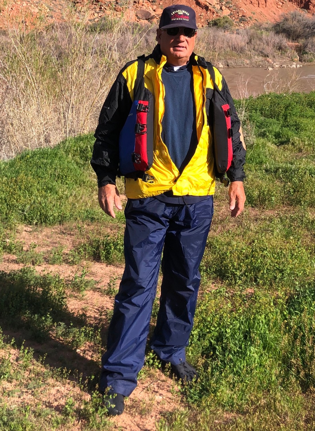
Now for something different. Today, I am off to Las Vegas. My trusty Indian is in need of some attention. She has developed a wheeze in her drive belt and I need to have it looked at by “Sin City Indian Motorcycle” ( did not make that up). One quick note about my Indian. You become attached to your motorcycle at a different level than your truck or car. Especially when you are in the desert, with nobody within miles, and you need to count on the machine running smoothly. She has been a trooper.
I am coming to the end of my odyssey with only Route 66 and Sedona left to explore. I then have a quick trip to Tucson to catch up with some great friends and then back to Phoenix and home on May 3rd.
This trip has been amazing – the wonder, sites, and experiences have surpassed my expectations. Thanks for joining me.
This Blog is two stories of two incredible days as I continue my search for wonderful roads, sights, and adventures.
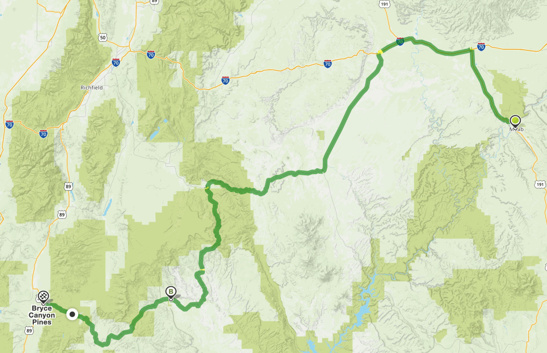
Ride from Moab to Bryce Canyon UT
Story One – The ride from Moab, Utah to Bryce Canyon, Utah and Bryce Canyon Pines Motel. I started north on 191 out of Moab to Interstate 70 West.
Interstates, with a speed limit of 80 MPH, is not fun on a motorcycle. You need to stay vigilant as people are doing 85 to 100 MPH and things can happen fast. From I 70 I connected with US 24 and then to US 12 and into Bryce Canyon.
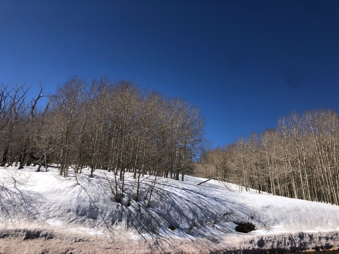
The ride took me from summer to spring to winter and back to spring in a matter of 5-6 hours. It demonstrates the impact of elevation and the diversity of this amazing country.
The intersection of I 70 and Route 24
This was the view at the beginning of my ride on Route 24. I had just exited I 70 and the temperature was 70º+ and as you see, the terrain was dusty and flat with no other vehicles in sight.
Along Route 24 desert changed to rock and cliffs
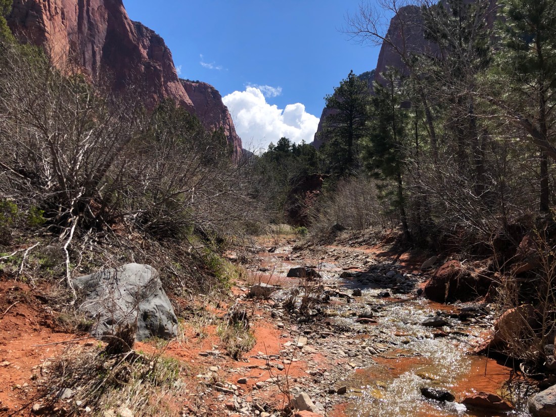
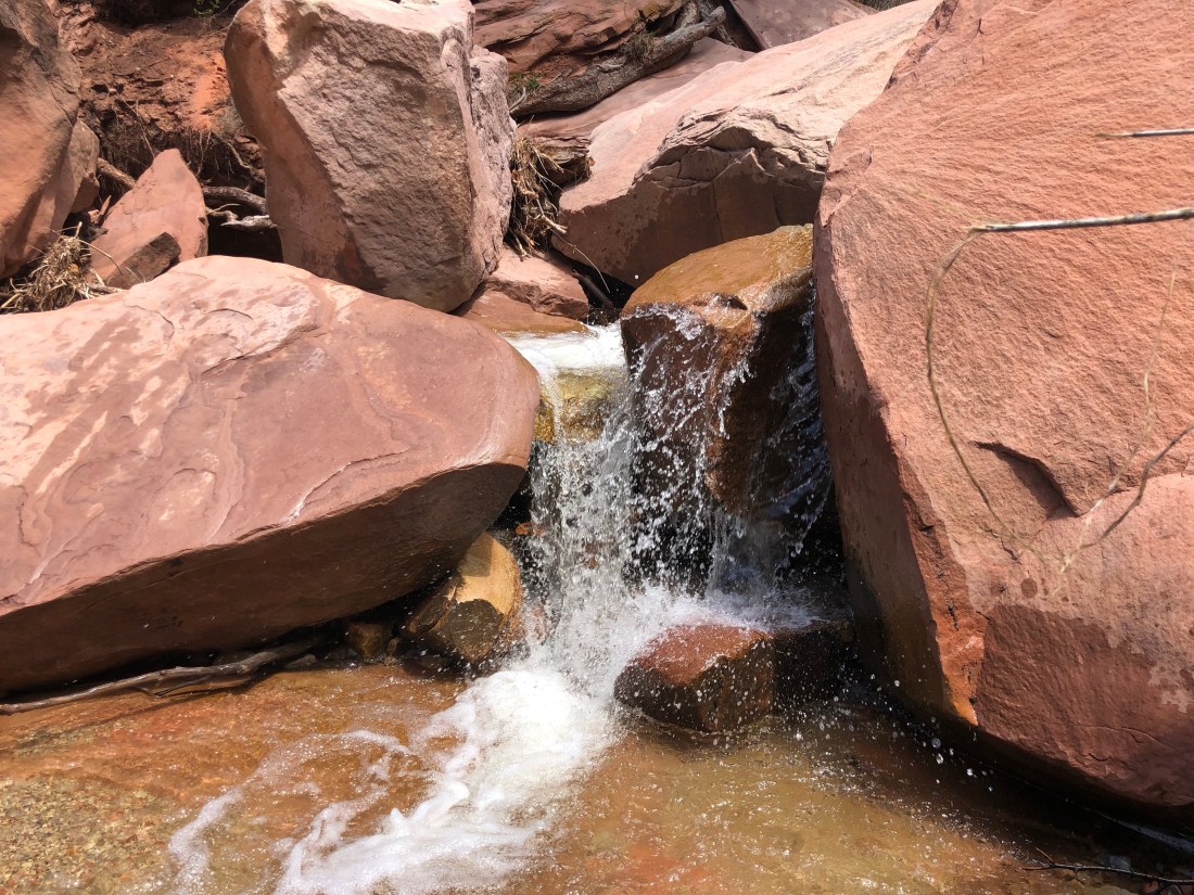
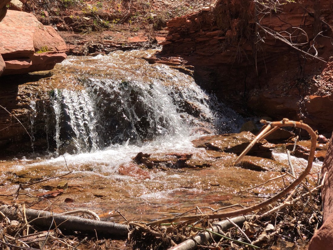
Within just a couple of hours, I had moved out of the desert and into rocky terrain with beautiful streams running alongside the road. The temperature had dropped to the mid-60ºs.
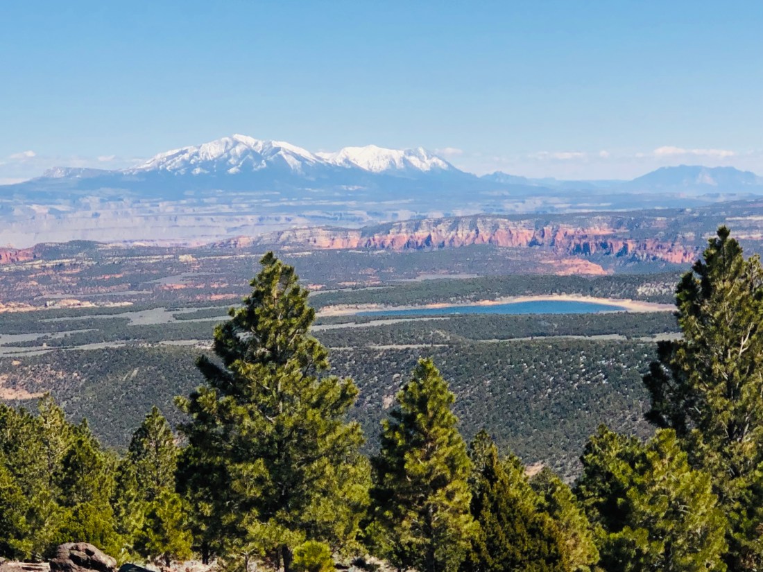
The View from Torrey, UT looking East into the Henry Mountains
When I reached the intersection of 24 and 12, I could see the large Henry Mountains that I would need to cross to get to Bryce on Route 12. They were large, high and snow covered. They also lay in the Grand Staircase-Escalante National Monument.
The Henry Mountains in Utah
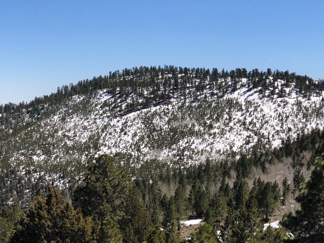
As I climbed in elevation, the snow-capped mountains came closer and closer and the temperature was dropping into the 50ºs. The roads were clear, but the mountain meadows still lay under feet of snow.
Winter still hangs on high in the Henry Mountains of Utah
As I reached the peak, the temperature had dropped into the 40ºs. The sides of the road were completely snow covered and winter still lived high in the mountains.
The view from the peak of the Henry Mountains
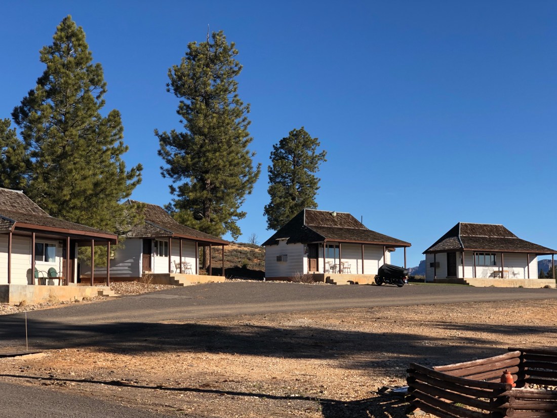
The ride was completely worthwhile as I was treated to breathtaking vistas of the “world”. Having crossed the mountains, I arrived at my cabin at Bryce Canyon Pines.
My cabin at Bryce Canyon Pines – Can you guess which is mine?The view from my front porch!
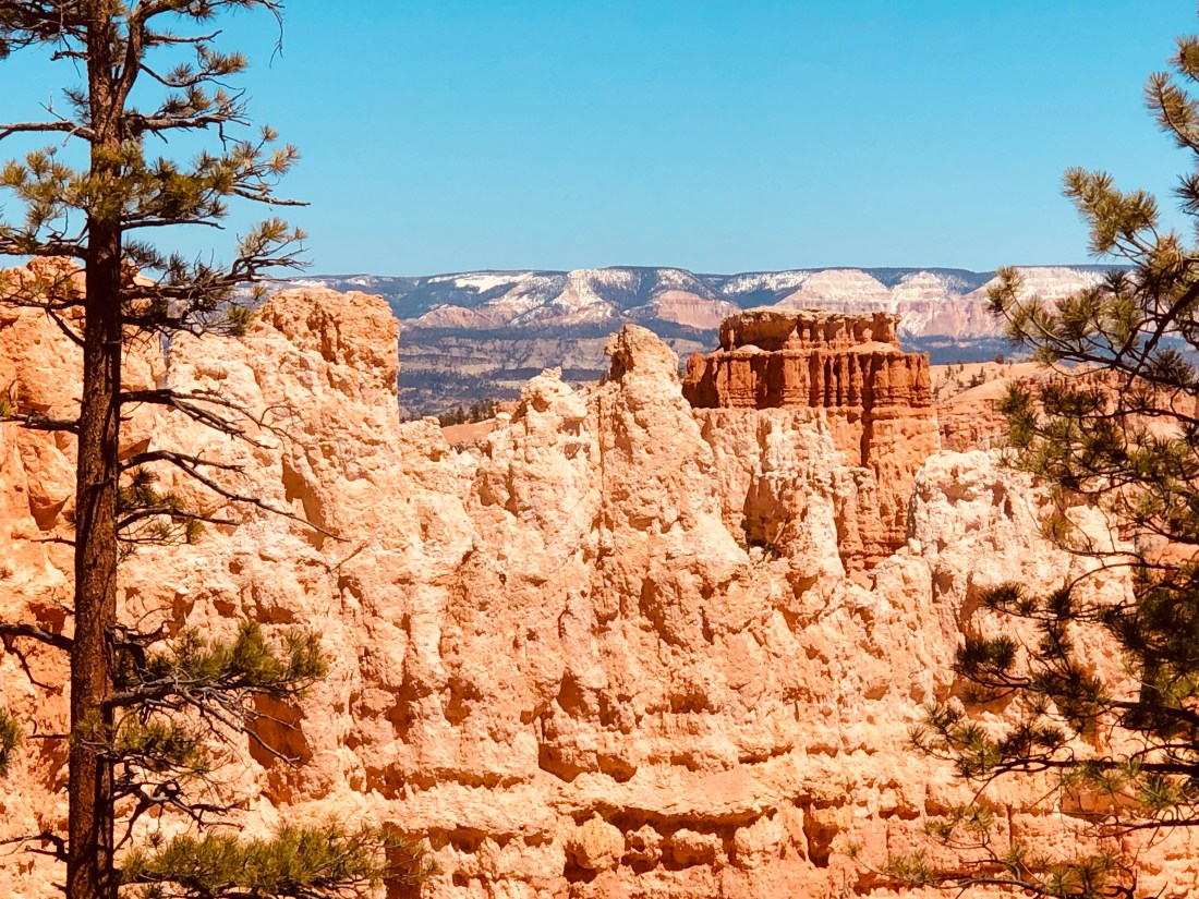
Bryce Canyon, UT
The second story is my discovery of Bryce Canyon. The Bryce Canyon area was settled by Mormon pioneers in the 1850s and was named after Ebenezer Bryce, who homesteaded in the area in 1874. The area around Bryce Canyon was originally designated as a national monument by President Warren G. Harding in 1923 and was redesignated as a national park by Congress in 1928.
Bryce Canyon is technically not a canyon as it was not formed from erosion from a naturally flowing stream. Instead, time and weather have created a collection of Amphitheater shaped features.
Bryce Canyon is a place where intricately carved towers, called Hoodoos, and archways of stone shimmer in a dazzling array of color under the bright sun. It is a maze of rocks that intertwine with vast vistas of the country that surrounds it. Interestingly, as I looked at the Hoodoos, I was not surprised that the Paiute Indians thought the hoodoos were people who’d been frozen into a rock by the evil coyote spirit.
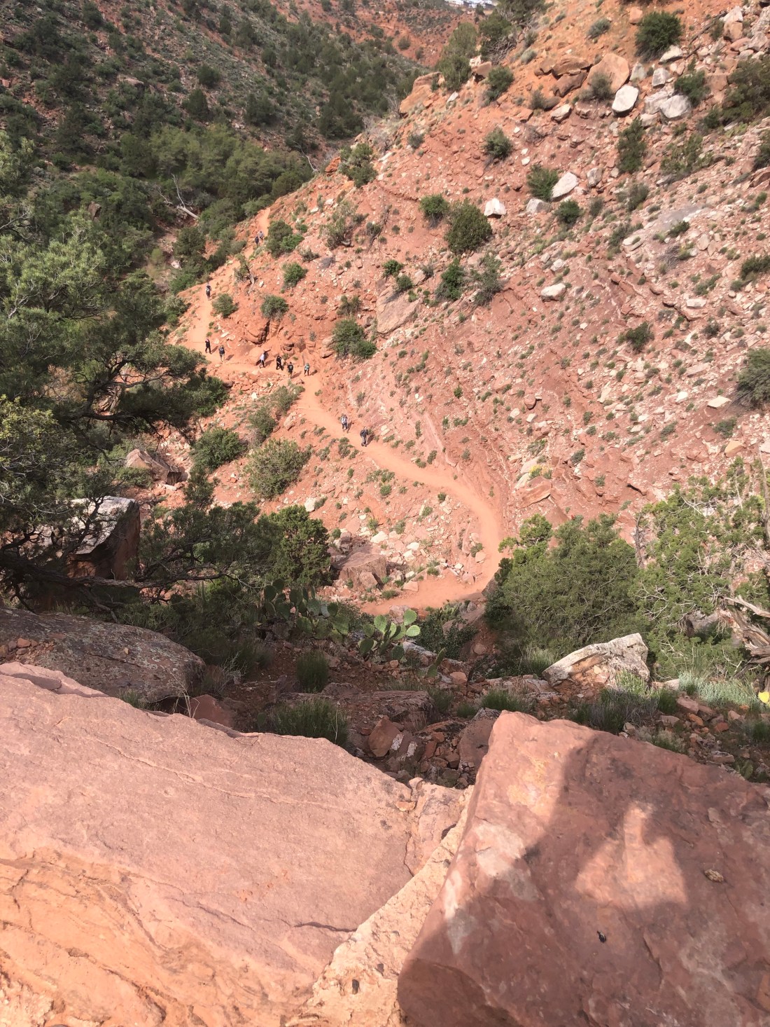
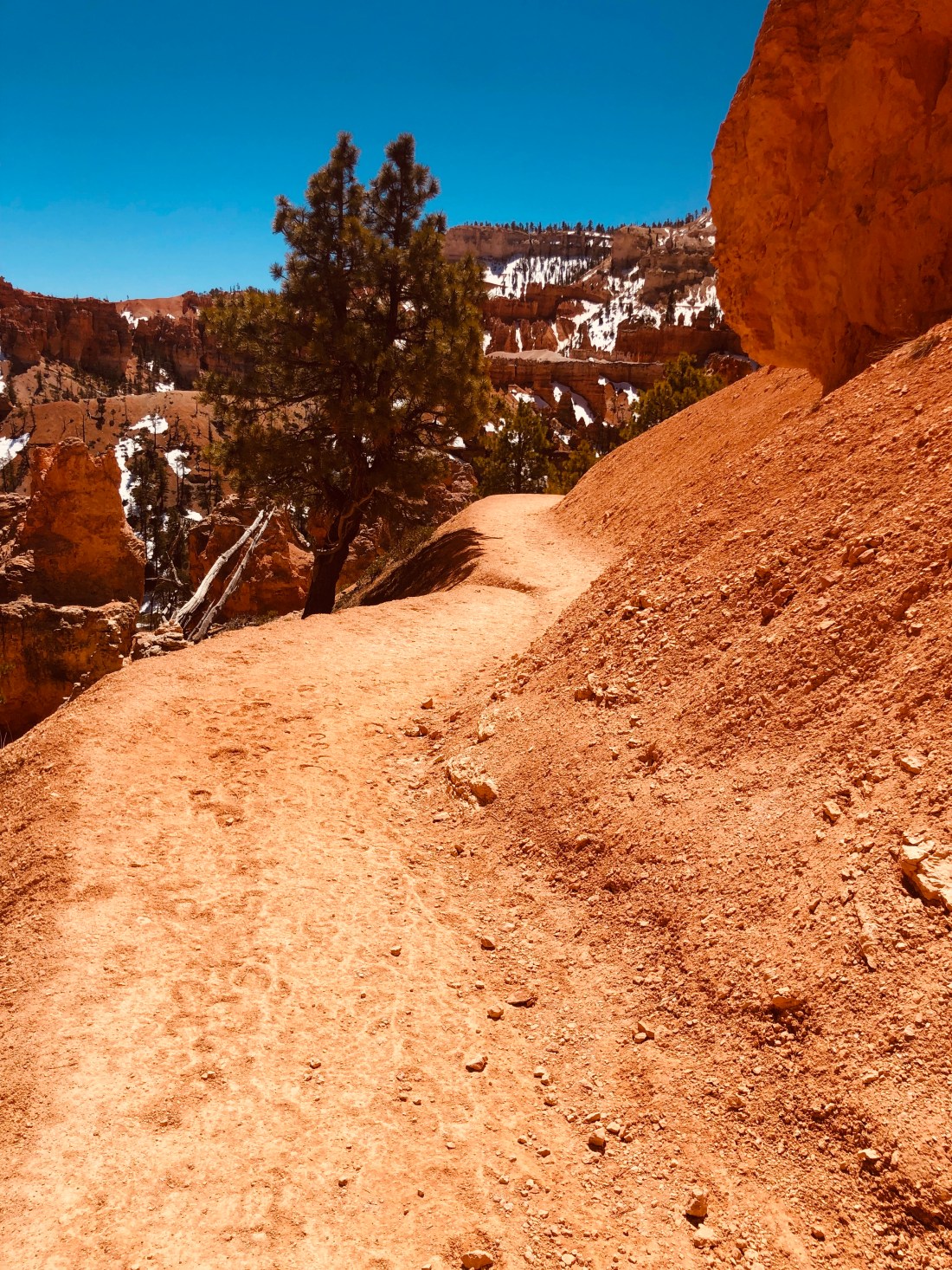
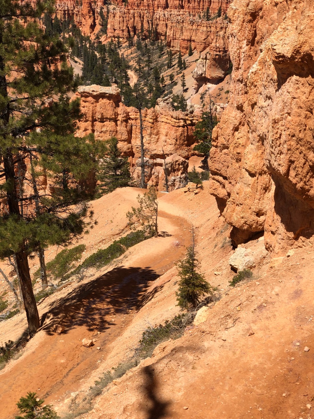
To fully discover this wonder, I took a seven-mile hike into the amphitheaters, giving up my motorcycle and Jeep vehicles for my bipeds.
These took me 7 miles up and down and through the snow – WOW!Looking into Bryce Canyon from Sunrise Point
I started at the rim from Sunrise Point and looked down into the canyon and out at the broad vistas. Little did I know that looking down from the rim hides the true wonder of Bryce. To see her beauty, you have to immerse yourself into her amphitheaters and arches.
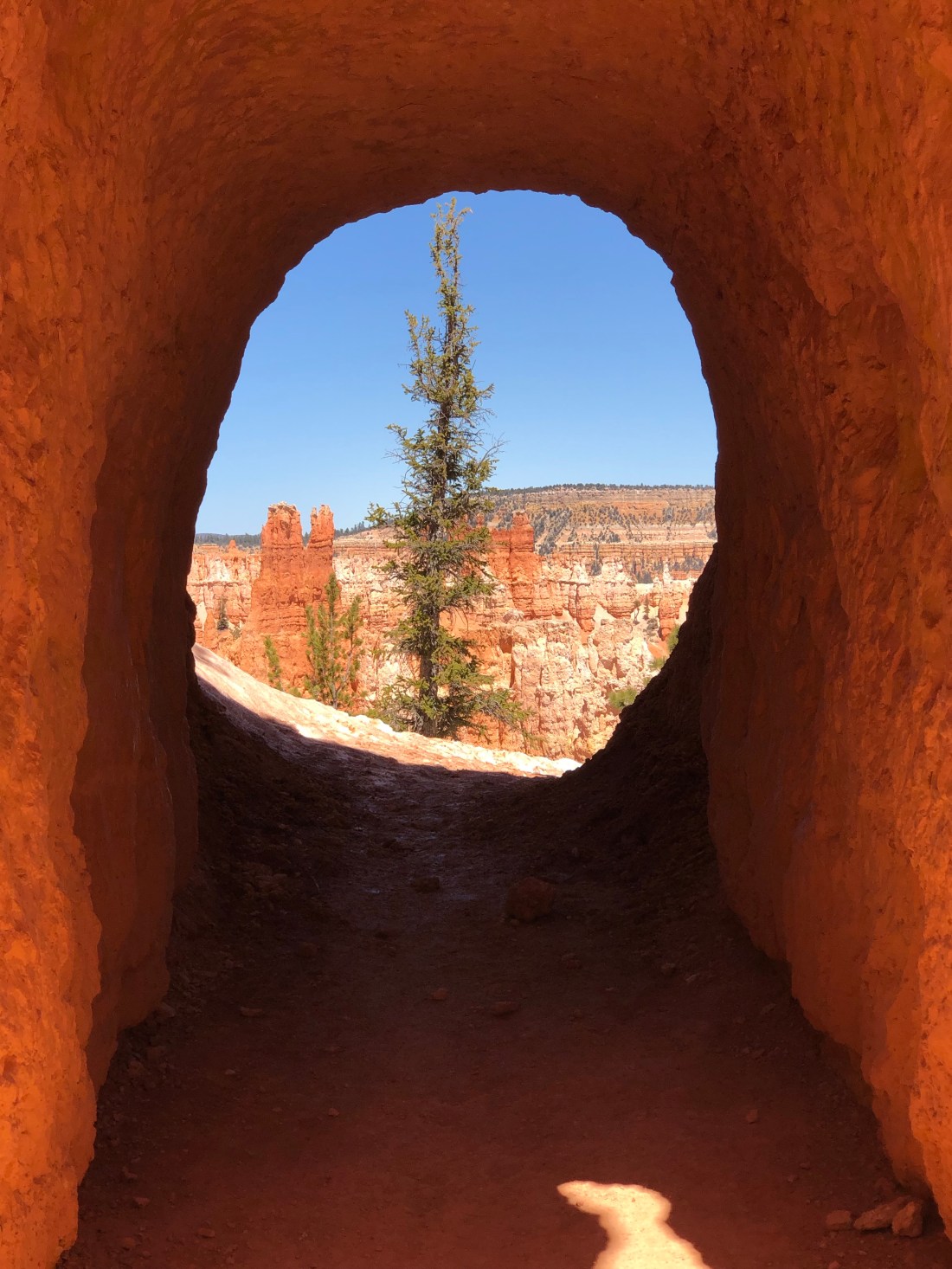
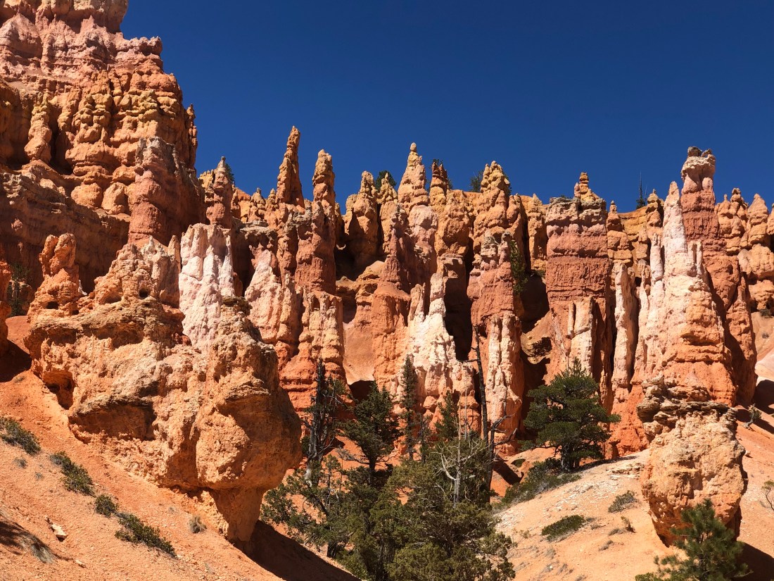
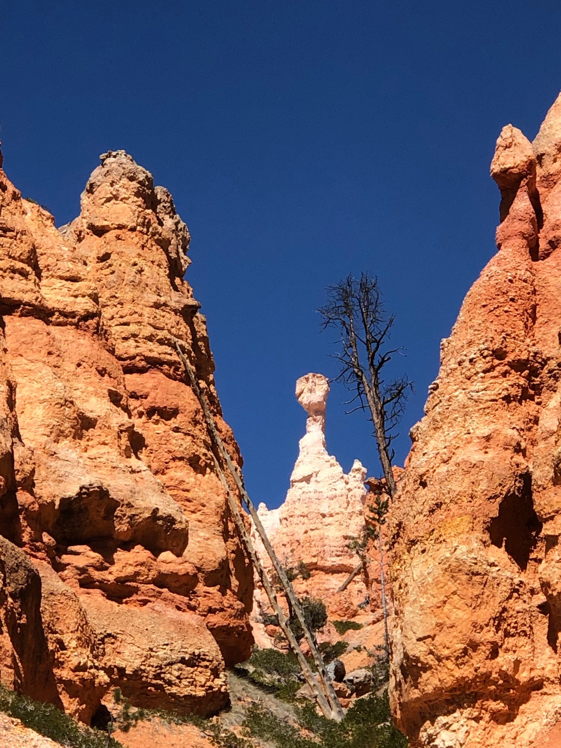
As I starter down Queens Garden Trail, I came eye level with the magnificence of the spires, hoodoos, and colors.
Hoodoos rising from the floor
After a steep, 1.8 mile downhill hike on the Queen’s Garden Trail, I came to a fork in the road. To take on Peek-A-Boo loop or to turn back. This time I forged ahead.
I do not know why they call it Peek-A-Boo loop, but I can guess that it is because around every corner is a site that says “Peek-A-Boo”, like this arch into the next amphitheater.
An arch that leads from one wonderous amphitheater to the next.Looking up at the Hoodoos that create the amphitheaters.
The colors and shapes of the hoodoos are caused by different rocks in the area that weather at a different rate. Iron oxide in the rock gives it a vivid red, orange or yellows tint.
The many amphitheaters I visited were each unique and wonderous while the trail, at times, was still snow-covered and treacherous.
A snow covered trail on the Peek-A-Boo loopAnd, at times, steep drop-offs down hundreds of feet.I had to watch where I was going despite the views.
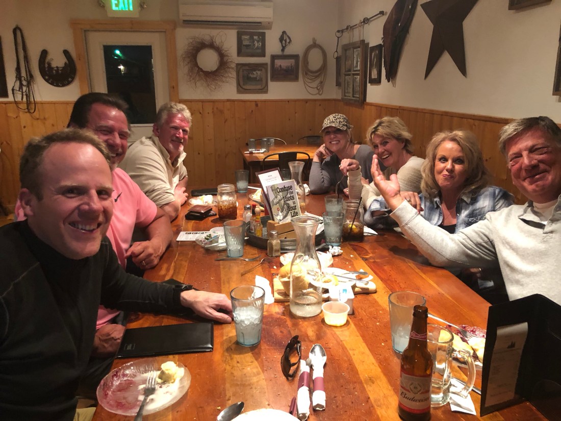
But, to cap off a great day, when I returned to Bryce Canyon Pines, I met these three couples who were riding Victory Visions out of Salt Lake City. Clockwise from left, Mark, John, Kelly, Shelly, Che (?) and Jan. As fellow riders, there is an immediate bond and I was invited to join them for dinner. It was a great evening and I am so grateful for the invitation. I hope to see them on the road again – great folks.
That is the end of my Bryce Canyon story, because, after yesterday’s hike, I am so sore I cannot move. My plan for today is to issue this blog and at 1 PM take a 0.5-mile hike along the rim with a park ranger who will share the history and geography of the park. I hope they have wheelchairs 🙂
The premise of this blog and the last two days is either “Discretion is the better part of valor” or, “I am a scaredy-cat” – your call.
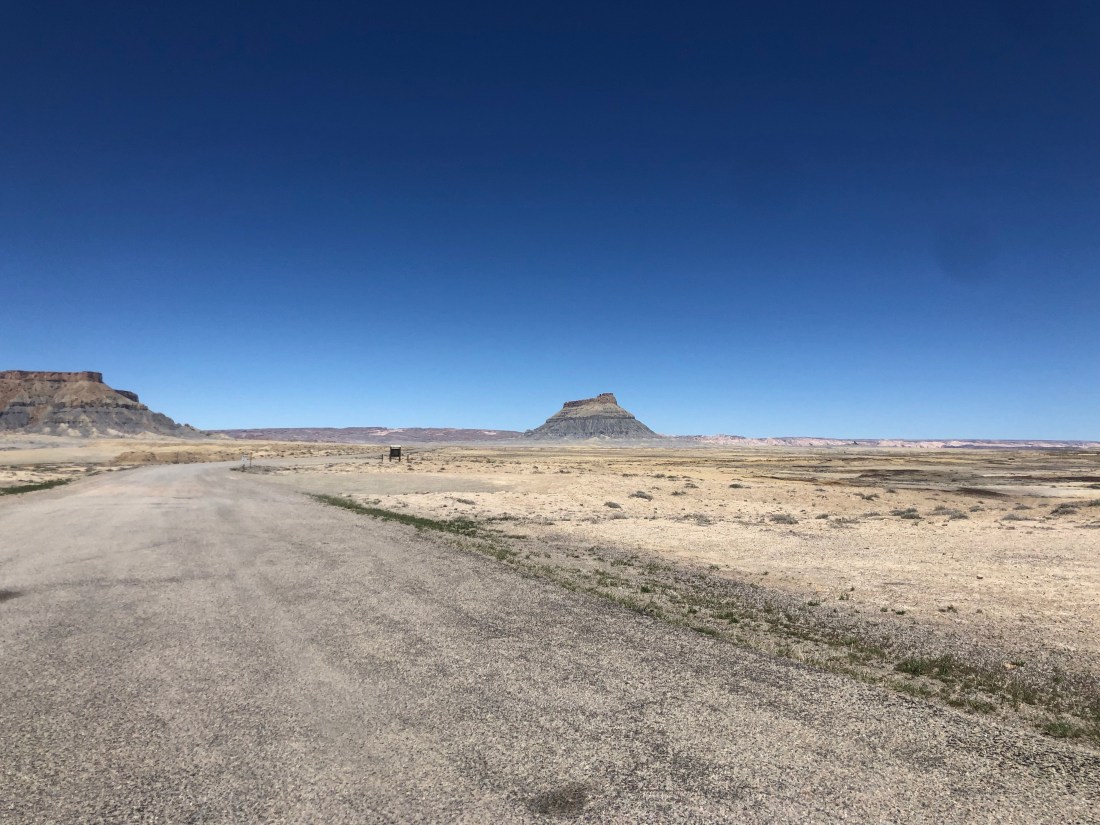
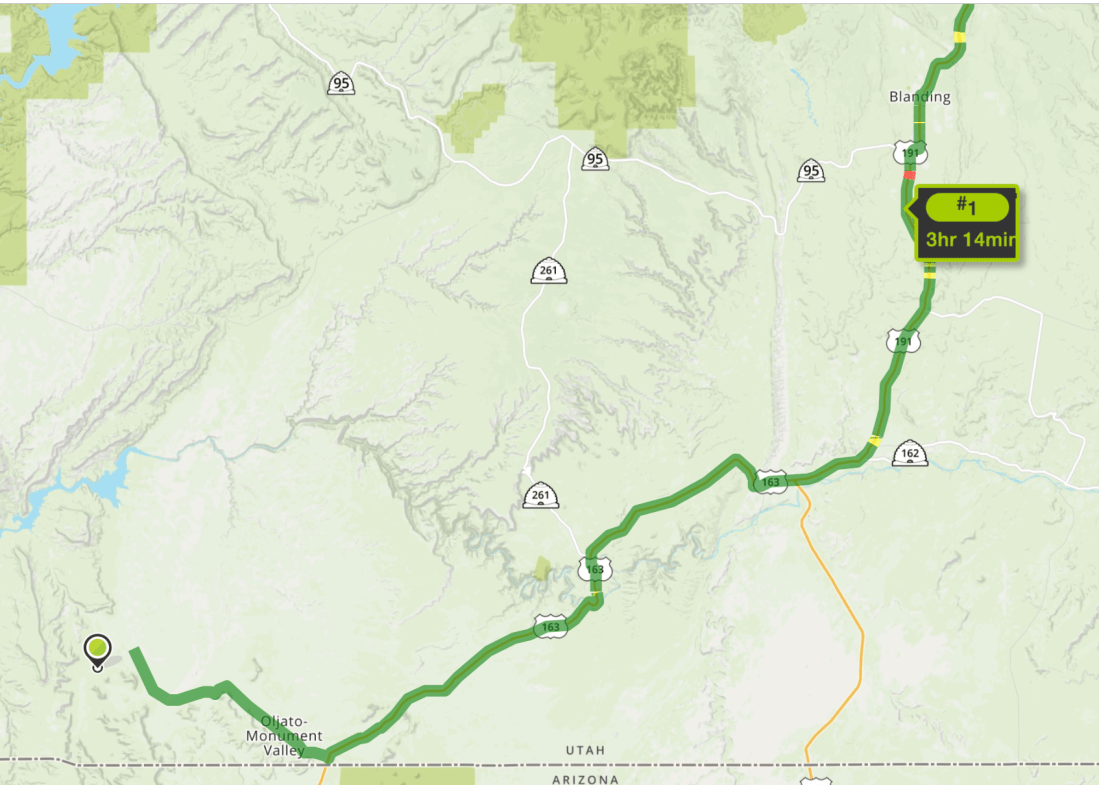
Sunday, April 14th I left Monument Valley and headed north approximately 160 miles to Moab, Utah. Moab was my destination as it is the home to both Arches and Canyonland National Parks.
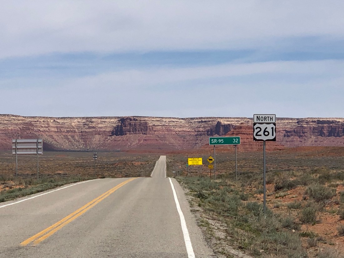
As I considered my motorcycle route, I had choices. The more direct route (163 East to 191 North – shown) or the indirect route (163 East to 261 North to 95 East to 191 North). Always looking for adventure and adding challenging roads to my drive, I selected the indirect route.
As I left 163 and entered 261, I began to see warnings such as “primitive road” ahead. “Trucks and autos pulling trailers prohibited”. I then saw this monster Mesa looming up out of the desert and I wondered how this road circumvented this Mesa.
261 Ran into the Huge Mesa – No Idea how it would work its way around
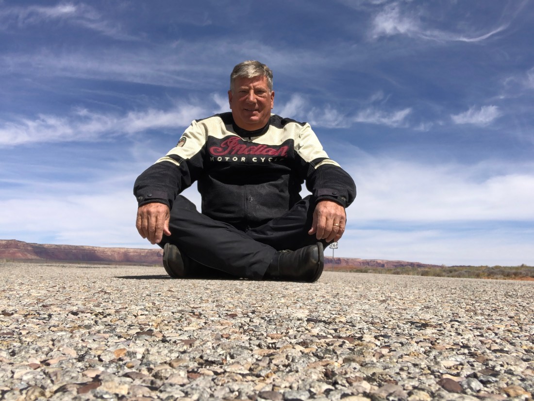
I entered the Mesa and found that the road was not going to circumvent the Mesa but was going to go directly over it. And, 261 was going to go over it with sharp hairpin turns, extremely steep uphill climbs, no guardrails and as I soon found out an unpaved gravel and dirt road. I started up the Mesa and at the first hairpin turn, I said: “not for me”.
I sat down and said I am not going – I will not go (my apology Gary, always liked this shot of you)
So, I turned around and went the direct, simpler way. Of course, needing the means to rationalize this decision, I told my trusty Indian Motorcycle that I actually did it for him. All that dirt and gravel would not be good for my fine-tuned machine. “Yeah, that’s the ticket, not me, my Indian, I did it for my Indian”. “Discretion is the better part of valor” or, “I am a scaredy-cat” – your call.
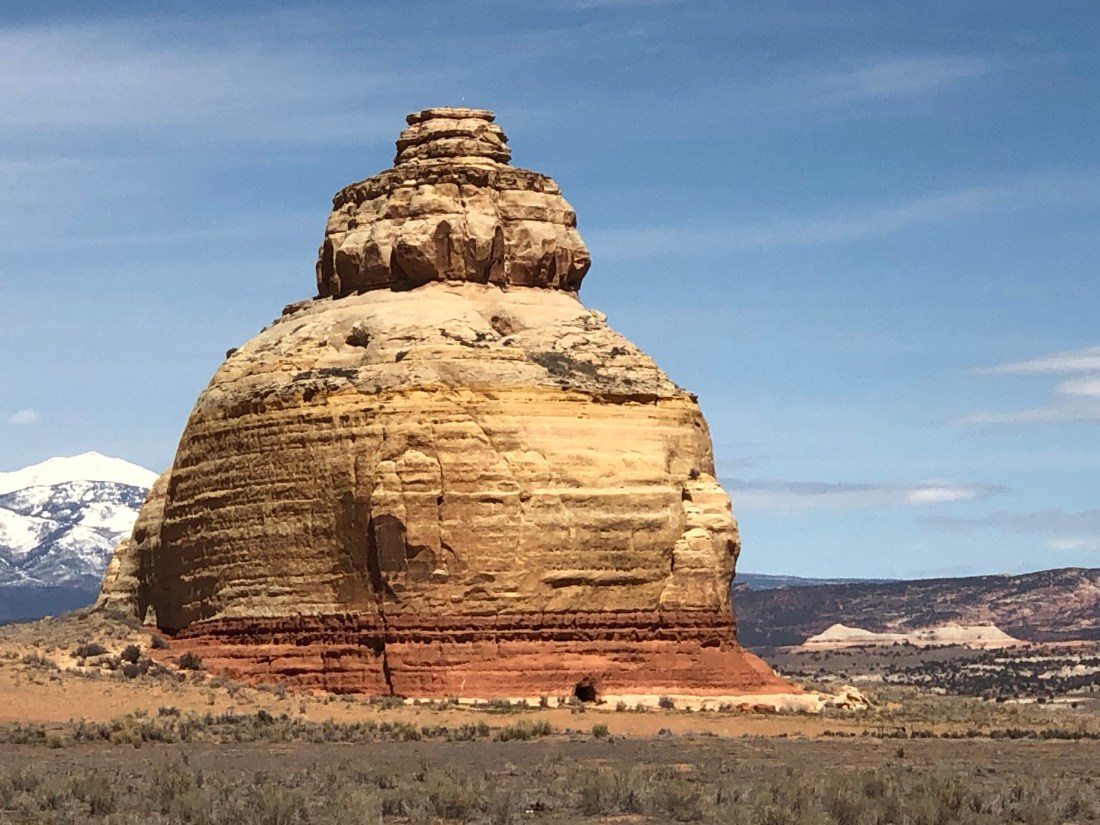
Turning loss into fortune and under the heading of you never know what you may see, because I took 191 the entire way, I had the opportunity to view this rock formation that looks like a beehive.
Beehive Rock
I arrived in Moab late Sunday afternoon and immediately prepared for a busy two days.
Day one, Monday, was a day-long rafting trip on the Colorado and day two was planned as a Canyonlands and Arches exploring day. So, that did not go so smoothly.
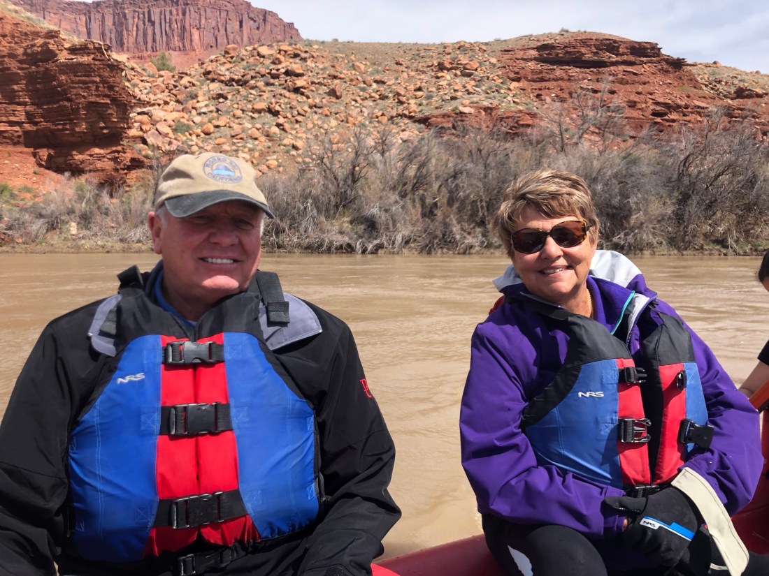
On Monday, I arrived at the shore of the Colorado River all suited up with my water shoes, motorcycle rain gear and everything else you can think of to protect yourself from getting wet.
All geared up for a day on the Colorado RiverTwo of my raft-mates, Bob, and Linda Lynn (Linda was not thrilled).And, an Israeli family of five, all outstanding oarsman (not) and Doug, our guide.
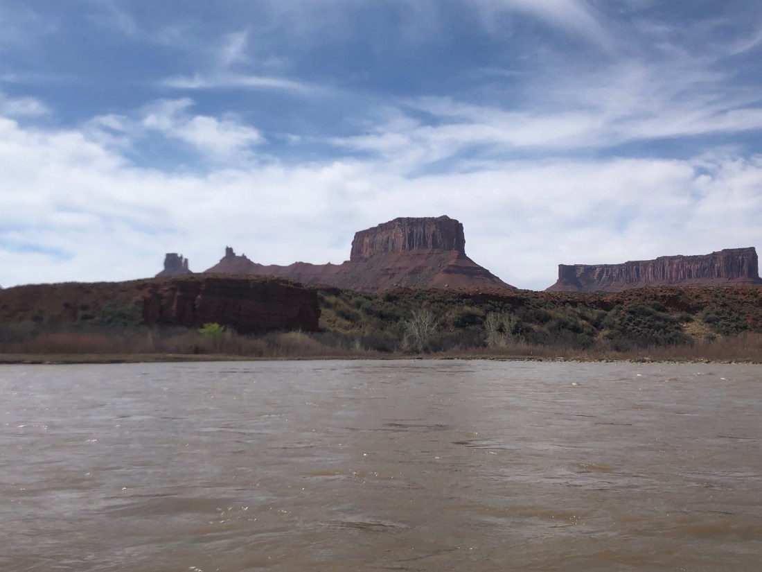
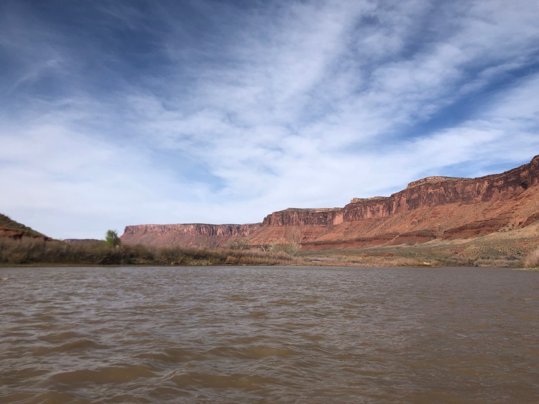
The morning was wonderful. Warm weather, sun, great sites, and relatively easy rapids.
A mesa off the Colorado RiverSoft bends in the river
Click on the visual below for a taste of the “rapids” we faced. No challenging, but fun.
As is common in the Southwest, the weather changed drastically for the afternoon. The wind picked up to a “breezy” 25 Kts to 30 Kts right on the bow. It clouded up and the temperature dropped. To get home against the wind, we would “all” need to row constantly and hard. The Israeli Father, Bob and I were left with Doug to get us home within a reasonable time frame. Hours late, we pulled in sore and tired. Have I sold you on a Colorado Rafting Trip yet?
After the Colorado Rafting trip ordeal on Monday, I decided to explore the National Parks the way the locals do it, in a Jeep.
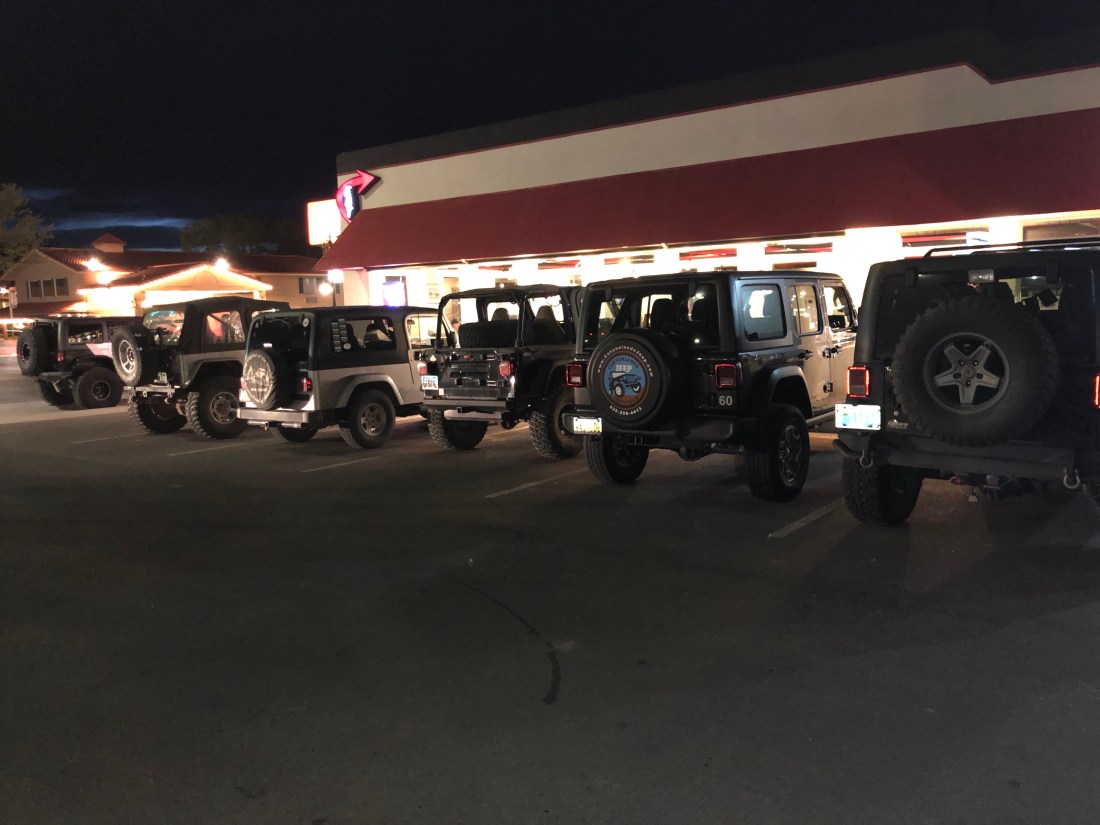
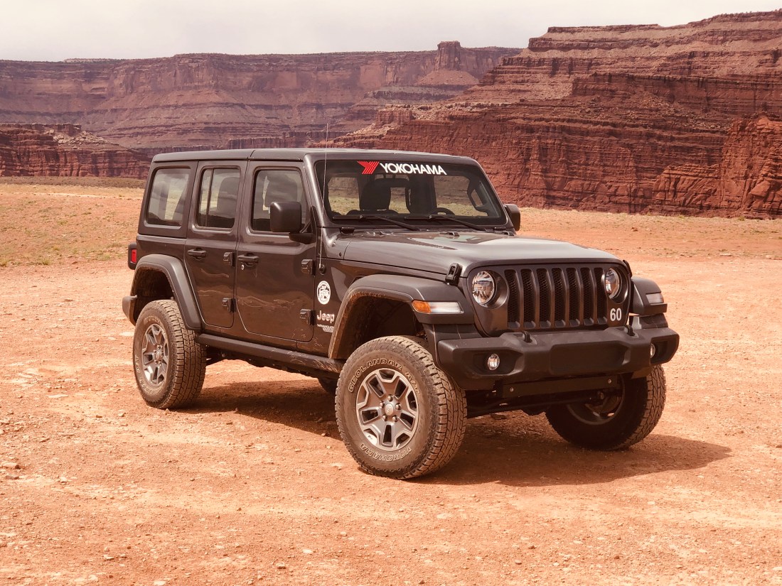
How strange are this – 6 Jeeps parked side by side at the Moad DinerIf you can’t beat them, join them – My Jeep for a day
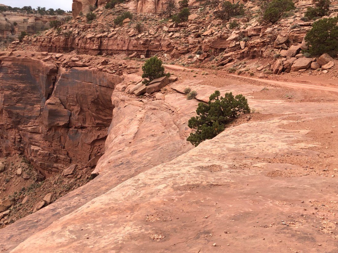
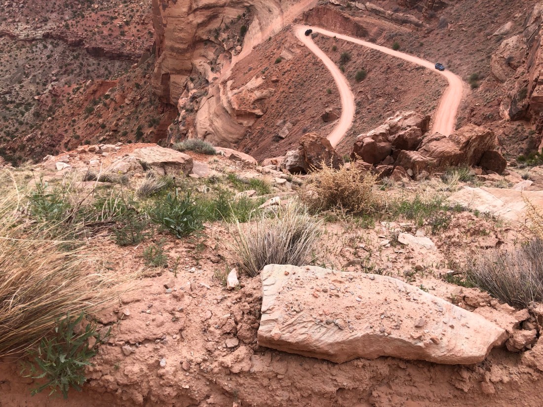
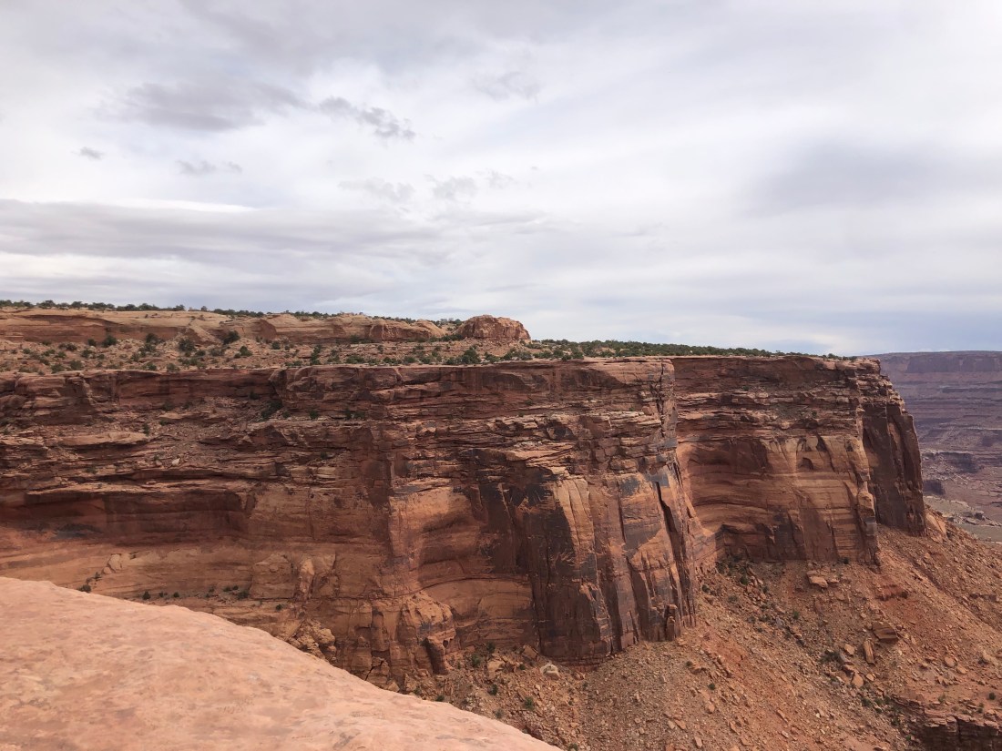
I started the day at Canyonlands and took the Schaefer Trail to explore deep into the canyons. As this was a “primitive road” and only 4-Wheel Drive Vehicles were allowed, it greatly reduced the crowd size,
The Shaefer Trail is only 18.2 miles long. But, the trail makes a 1,500-foot descent on a series of switchbacks in just over its first mile. The descent road was single lane, again with no guardrail and a drop off of hundreds and hundreds of feet.
The drop off on the Shaefer Trail RoadA view of where I was and where I had to go (Notice the left side of the picture)The sharp hairpin turns with a single lane roadThe views were dramatic.
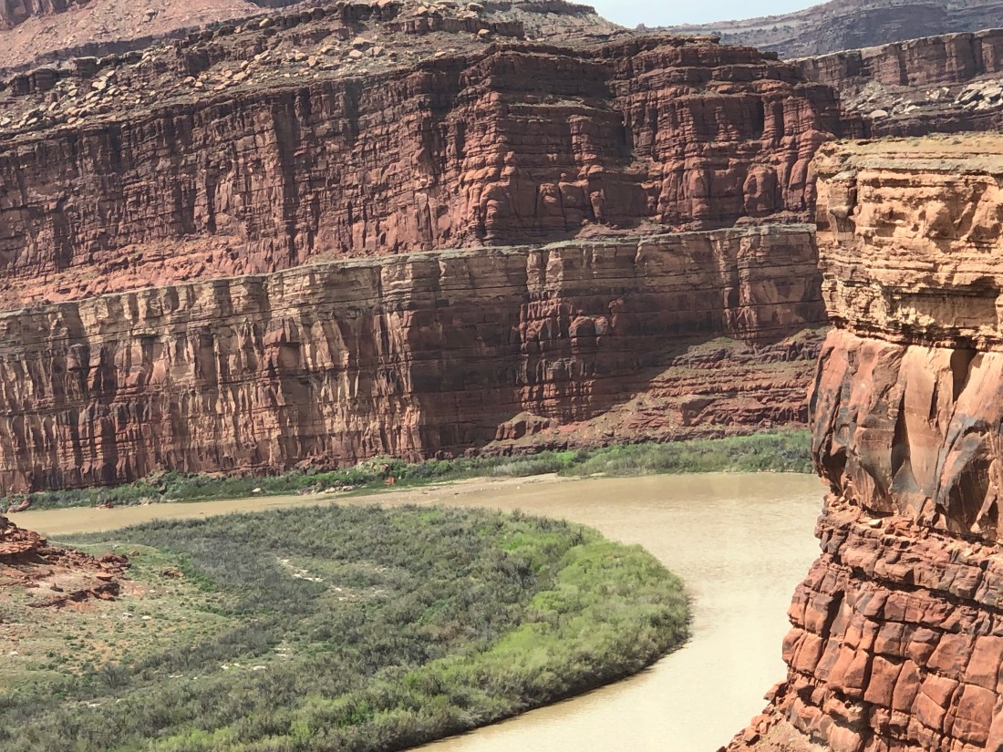
Once on the canyon floor, I found that I was just down one flight and that there were many more canyons to view.
A view from the “Canyon Floor” down to the Colorado River
Click on the video below to see my lunch stop.
And, to top it all off, the trail went right through the location of “Thelma and Louise” famous over the cliff scene. Click on the video below as I attempt to recreate the iconic scene.
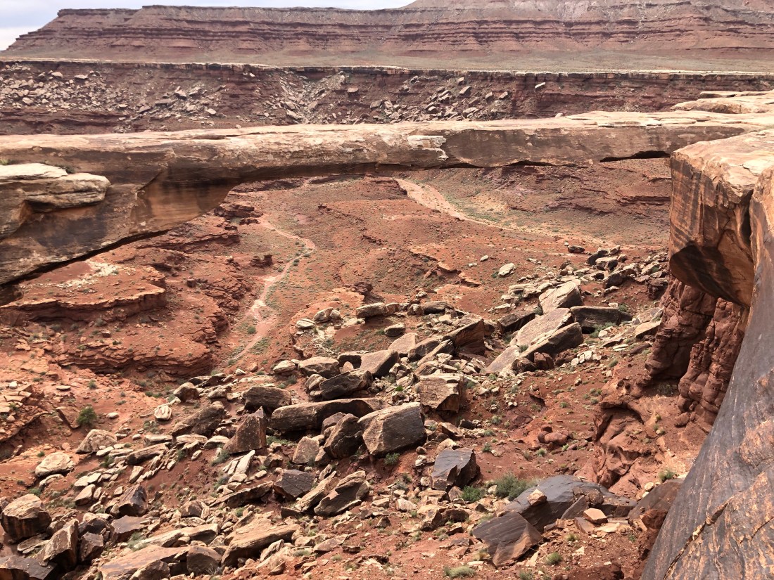
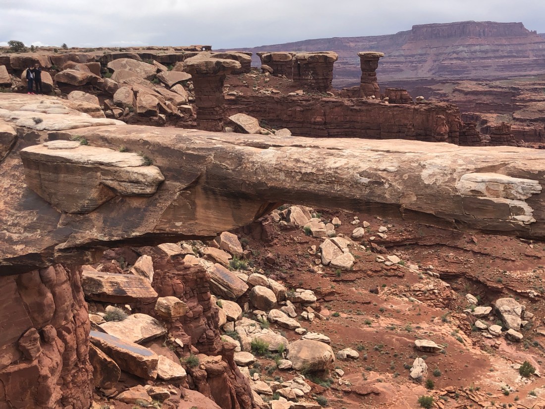
Notice I did not get too near the edge as those who know me, know I am afraid of heights. And, talking of heights, the trail also brought me to Musselman’s Arch. A stone bridge suspended, again, hundreds and hundreds of feet above the canyon.
Just looking at this narrow bridge had me hyperventilating.Clearly wide enough for someone else to walk across, but not me.But, no problem for this family of crazy people!
“Discretion is the better part of valor” or, “I am a scaredy-cat” – your call.
Canyonlands is a wonderful place that lived up to its name with many levels of canyons to see and dramatic views of the Colorado River.
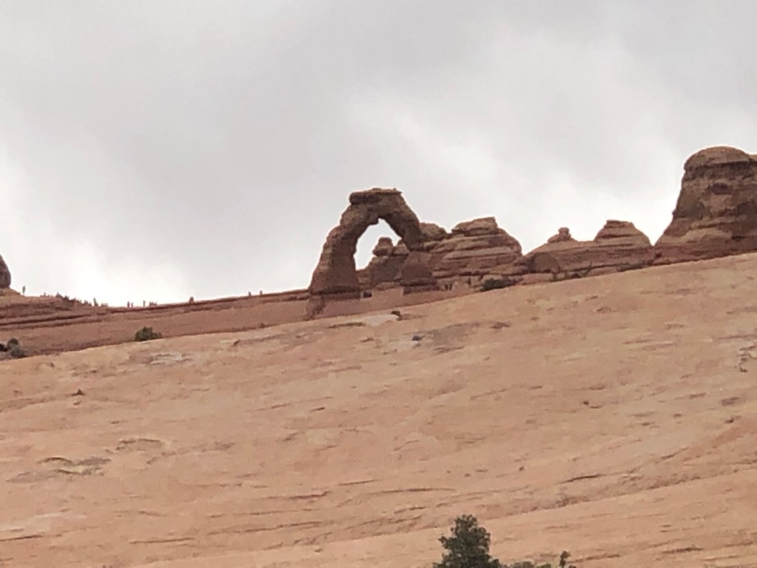
After, exploring Canyonlands, I really only had time to run through Arches to see the Iconic “Delicate Arc” which is depicted on Utah License Plates. But I was also treated to fantastic views of the snow-covered La Sal Mountain Range.
Delicate Arch – Depicted on Utah License Plates.The La Sal Mountains (“The Salt”) named by the Spanish who believed the snow was salt.
It was a very busy and tiring two days in Moab. Moab is a vibrant and alive city that attracts tourists of all kinds. Motorcycle riders, bicyclists, mountain climbers, river rafters, kayakers and people who come to experience the grandeur of two wonderful National Parks, Canyonland and Arches.
Tomorrow my adventure continues as I am off to Bryce National Park, looking for wonder.
Yesterday, Friday, April 12, I motorcycled out of Canyon De Chelly and the adventure continued with a stop at the Four Corners where Arizona, Utah, New Mexico, and Colorado meet. The only place in the United States where four states intersect in one place. I then backtracked to Monument Valley. The entire trip was approximately 200 miles.
Green Dot – Canyon de Chelly, “B” – The Four Corners, “Checkered Flag” – Monument Valley
The Four Corners was a bucket list stop and a place where I could be in four states at the same time. It was a check off the list, but I must say, a little underwhelming. However, if you want to be in four states at the same time, it is the only place to do it.
The Four State Spot
In all four at once
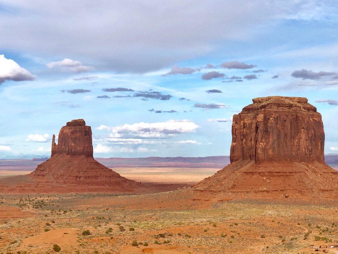
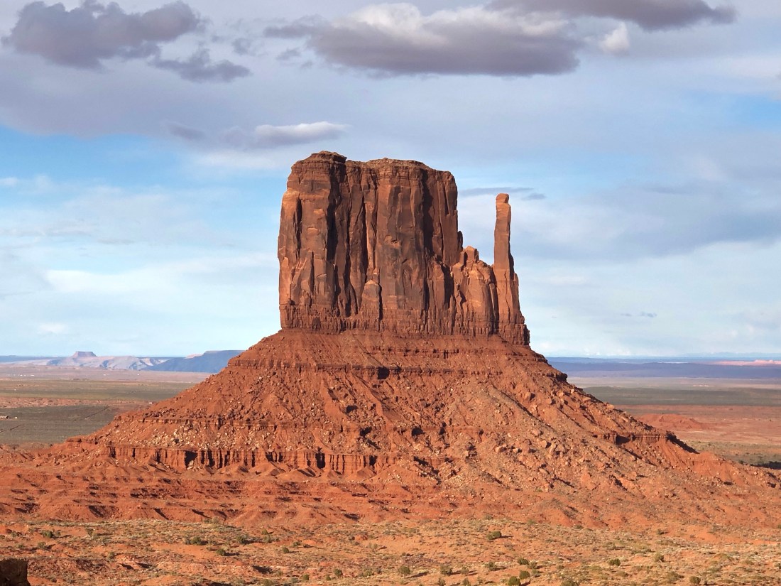
After my stop at the Four Corners yesterday, I moved onto one of the most magical and mystical spots I can imagine. I mentioned that Canyon de Chelly was special, and it is. Monument Valley is Canyon de Chelly and more. Its grandeur took my breath away and I could not stop looking in awe at the sites that surrounded me or the tales I was told.
Monument Valley is host to towering sandstone rock formations that have been sculpted over time and soar 400 to 1,000 feet above the valley floor. Combined with the surrounding mesas, buttes, spires and desert environment, it truly must be one of the natural wonders of the world.
I lucked out when I booked an all-day tour and found out that, as the only person, I had a private tour of the Valley. My tour guide for the entire day was Reever (not his Navajo name – I could neither spell or pronounce his name when he told me anyway) a 35-year-old Navajo who grew up in the Valley, like his parents, grandparents, great grandparents, and great-great grandparents.
Reever told me that he had met his Great-Great-Grandmother who lived well over 110, maybe as much as 120, and his Great-Grandmother who passed away at approximately 110. Reever’s grandmother, 97 years-old is a Shaman. One who is in touch with the spirits.
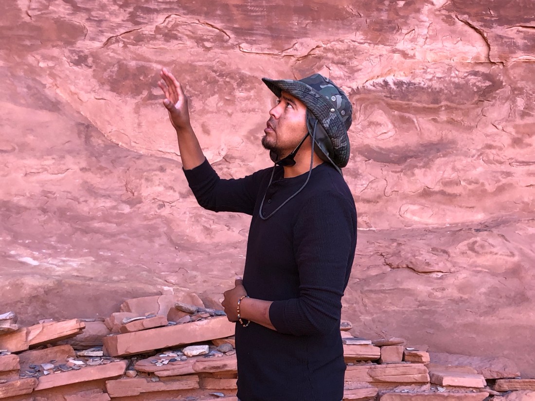
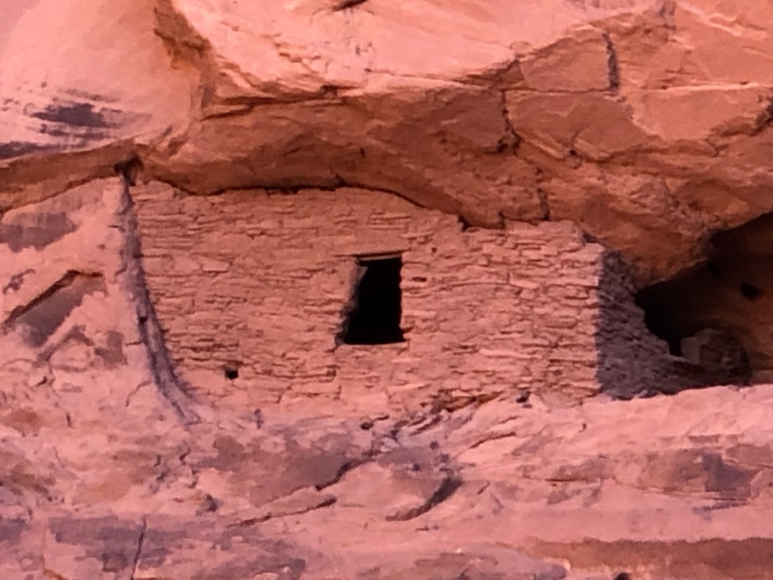
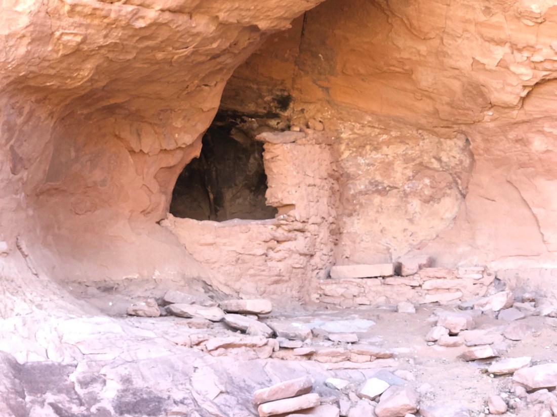
As a Shaman, she had instilled in Reever a very spiritual connection with the Valley. For instance, when I wanted to enter and photograph a cliff dwelling that we had reached in the backcountry, he adamantly told me not to. Not because of tribal law, but because it was a bad omen to disturb the ancient ones. Reever was very spiritual, sincere, and an incredible guide that I spent 8 hours with and enjoyed every minute.
Because I was the only person, and I can still hobble up the side of a rock, we explored beyond the reach of average tours. For most of the day, we were well off the beaten path as we explored places that Reever had heard about but never seen. For most the day, we never saw another person. The quiet and solitude was, was, well, spiritual…
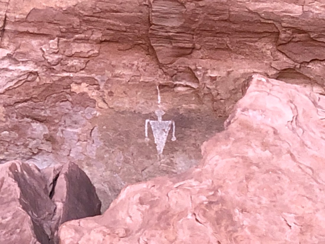
We got close enough to Cliff Dwellings to look inside if not enter, we climbed up rocks to look in caves and explore arches that one could not see from the ground. We were close to Petroglyphs to study them in detail. It was an incredible experience from the moment I rode my Indian Motorcycle into the Valley.
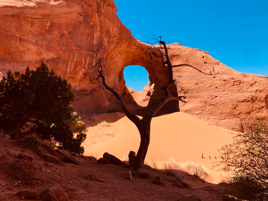
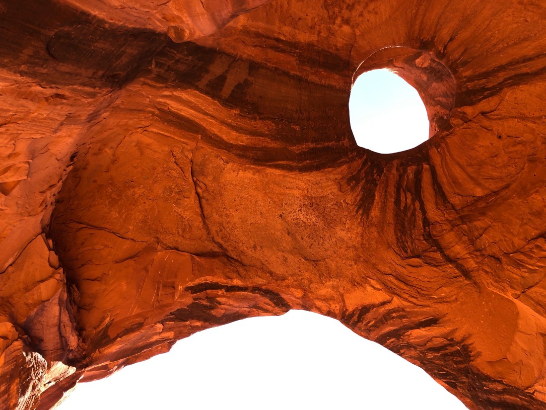
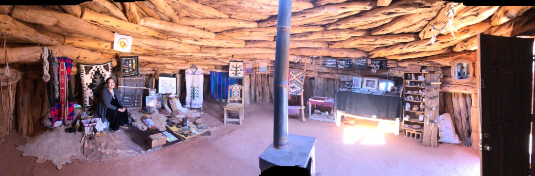
One of my first views of Monument ValleyOne of my first views of Monument ValleyReever, my tour guide getting ready to explore a caveReever, pointing out petroglyphs high on the rock wallOne of the dwellings that we could reach – But, the spirits did not want us to enterAnother dwelling that we could reach but that the spirits did not want us to disturbBroken chards of Pottery from the Anasazi? Hopi? or Navajo? Either way, hundreds of years old and still colorfulClose enough to touch this petroglyph of a KokopelliAnother petroglyph depicting a Spanish Conquistador and his wide shoulder armor – Anytime from the 1500s to 1600sAn arch in Monument ValleyThe Eagle Arch – Look very closely and you will see an Eagle. The hole is the eye and his beak is the larger curved ridge to the left – see it?The moon rising over the face of an Indian Chief – see it?The outside of a traditional Navajo Hogan – A dwelling still used by Valley Navajo peopleThe inside of the hogan – made from trunks of Juniper trees and filled in with Mud. The wood burning stove is new
The following is a video that you will very much enjoy listening to. It is Reever playing his flute. He did this a number of times during the day in very quiet places. He plays here and the echo reverberates off the walls of the small canyon we are in. What can I say other than “spiritual”
I do not know if I will be able to top the Valley, but tomorrow, bright and early I bid farewell to Monument Valley and I head north to Moab, UT and Arches, and Canyonland National Parks.


 Wakely is a Back Cove 41. The 41 is the flagship of the Back Cove fleet and is fitted with an efficient single Cummins diesel engine. Catherine and I fell in love with the 41 last year. After a quick search, we found our Back Cove 41 in St. Petersburg, Florida.
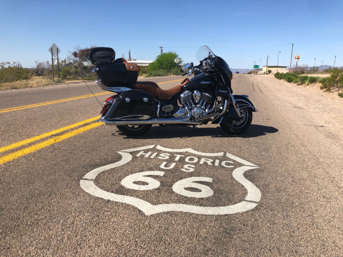


 The Cavern was discovered by a Walter Peek in 1927 when he nearly fell down a hole leading into the cavern. The next day, he and friends returned and they lowered Walter into the cavern to explore.