It has been over three weeks since Stan’s and my safe return to Riverside, CT. A lot is going on and I have fallen behind in concluding this year’s blog.
Last we spoke, Stan and I were in Southport, NC. It was May 8th and we still had approximately 700 miles to go in our 1,400 miles journey.
We left Southport and had a smooth cruise to Beaufort, NC (pronounced BO-FURT). The weather was beautiful and perfect for cruising. From Beaufort, NC, we were told by Mission Control, Jeff Neubirth, to stop in a little ICW town called Coinjock, NC. And, the reason for our stopping in Coinjock was for one reason only — the Prime Rib.
Now, let me share that while traveling north on the Intercoastal Waterway, we would mention to people that we would be stopping in Coinjock and universally, they would scream, get the Prime Rib! This Prime Rib is deservedly famous and known up and down the ICW. Jeff was wise enough to direct us to immediately put in our order the minute we hit the dock because they sell out. I did and later found out that they did sell out. But, we had our Prime Rib. While we failed to get a picture of the biggest Prime Rib I have ever seen, it did make three full meals.
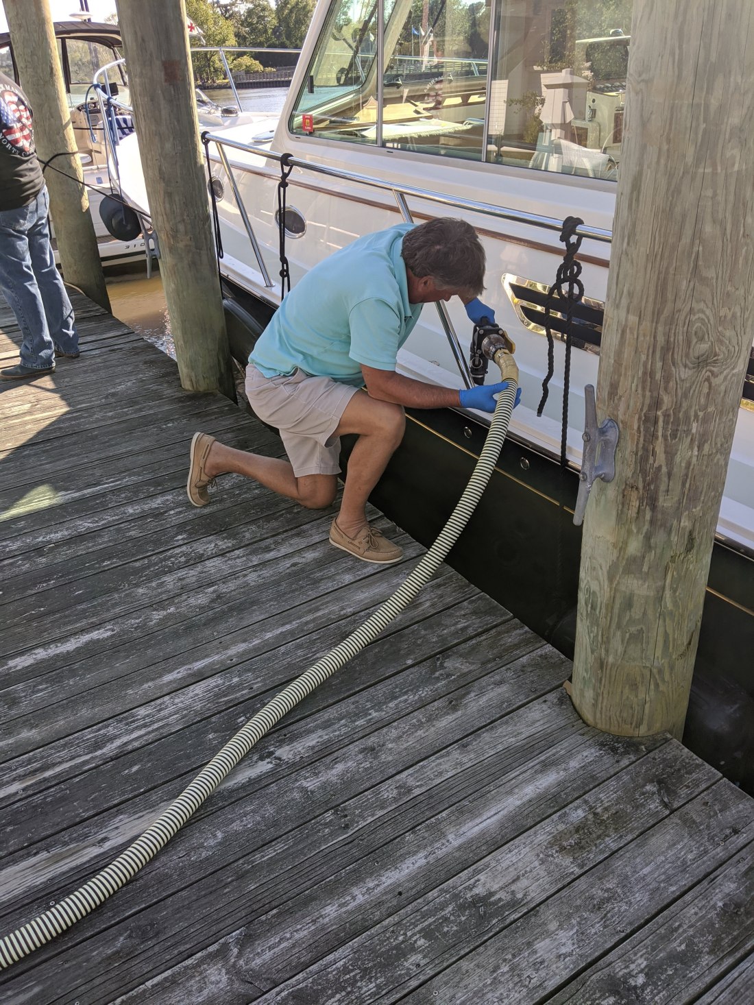
While The Prime Rib in Coinjock was delicious, it was not all glamour. Here I am pumping out the “holding” tank. You do not want to get it on your hands.
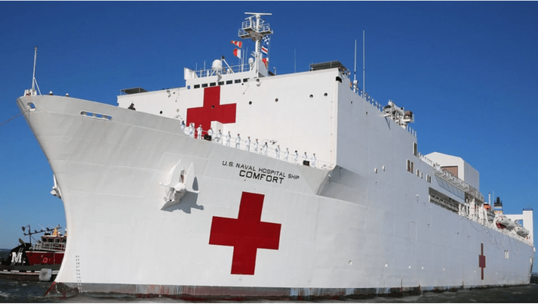
From Coinjock, our next stop was Norfolk, VA. Norfolk is a large Navy town and home to numerous naval vessels. The one that caught my eye, as the timing was right, was the USS Comfort, who had just returned from NYC where it was fighting Covid 19.
After almost two weeks of perfect weather, the weather was finally becoming a factor. Our original itinerary called for us to travel from Norfolk, VA to Annapolis MD (120 NM north on the Chesapeake Bay) on May 12th. Annapolis to Cape May, NJ (130 NM) on May 13th and from Cape May, NJ to Riverside, CT (154 NM) on May 14th. Over 400 miles in three days.
One driving weather issue was that the last clear weather forecast window, to cruise up the New Jersey shore out in the Atlantic Ocean, was May 14th. After the 14th, there was a stretch of bad weather that would have delayed us for days.
On the morning of May 12th, the weather on the Chesapeake Bay was a small craft advisory. A Small Craft Advisory means that wind speeds of 21 to 33 knots are expected to produce hazardous wave conditions to small craft.
As we departed Norfolk, VA, and entered the Chesapeake, we knew it was going to be dicey.
After four hours of banging through the waves and the water coming over the bow, we had only traveled only 40 miles of the planned 120. It became clear that we were not going to make it to Annapolis that day.
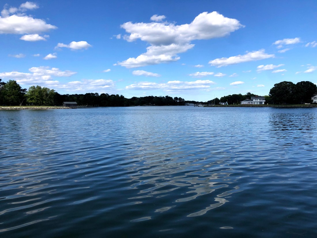
So, we pulled into the York River and stayed at the York River Marina. What a difference a few miles can make in weather conditions.
The view from York River Marina
The delay, while putting the chance of getting home on the 14th in jeopardy, did provide a moment to catch our breath.
Stan catching up on emails.
The next day, May 13th, to keep on schedule, we needed to leave at first light and travel 231 NM to Cape May, NJ. We left at 6 AM with perfect weather and made our way north up the Chesapeake to what is called the C&D (Chesapeake and Delaware Bay) Canal. This Canal connects the two Bays and is built for both commercial and private vessels.
Passing the Global Sentinel in the Chesapeake and Delaware Canal
At 7 PM, after 13 hours on the water, we arrived at Cape May, NJ exhausted. But, happy that we had beat the weather and Thursday, May 14th was looking like a great cruising day.
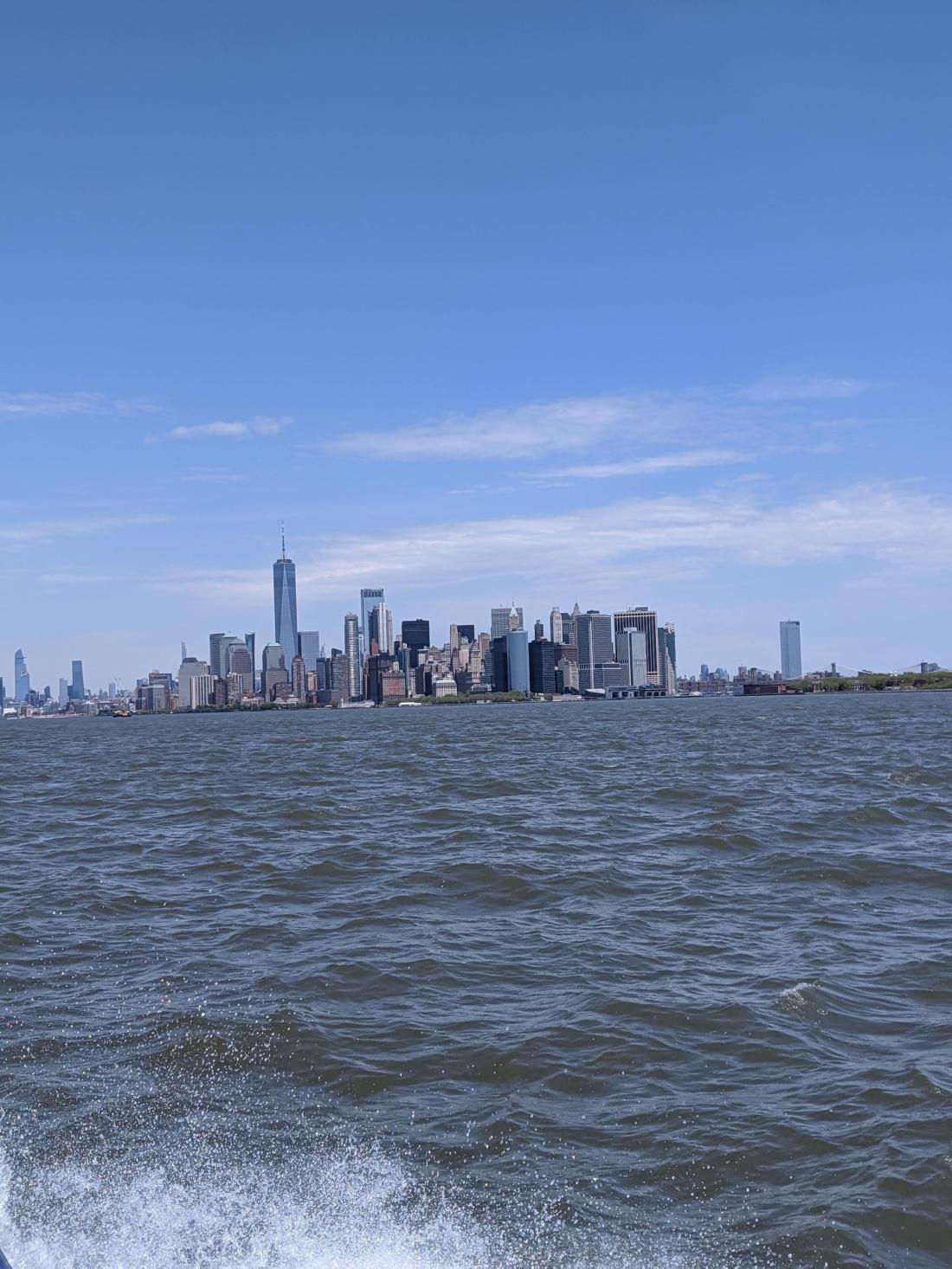
At 6:45 AM on May 14th, we left Cape May and cruised up the Jersey shore. The weather could not have been more perfect. The ocean was calm and the wind to our back. It could not have been nicer. Around 12 noon, NYC came into view.
Lower Manhattan with the Freedom Tower standing strong
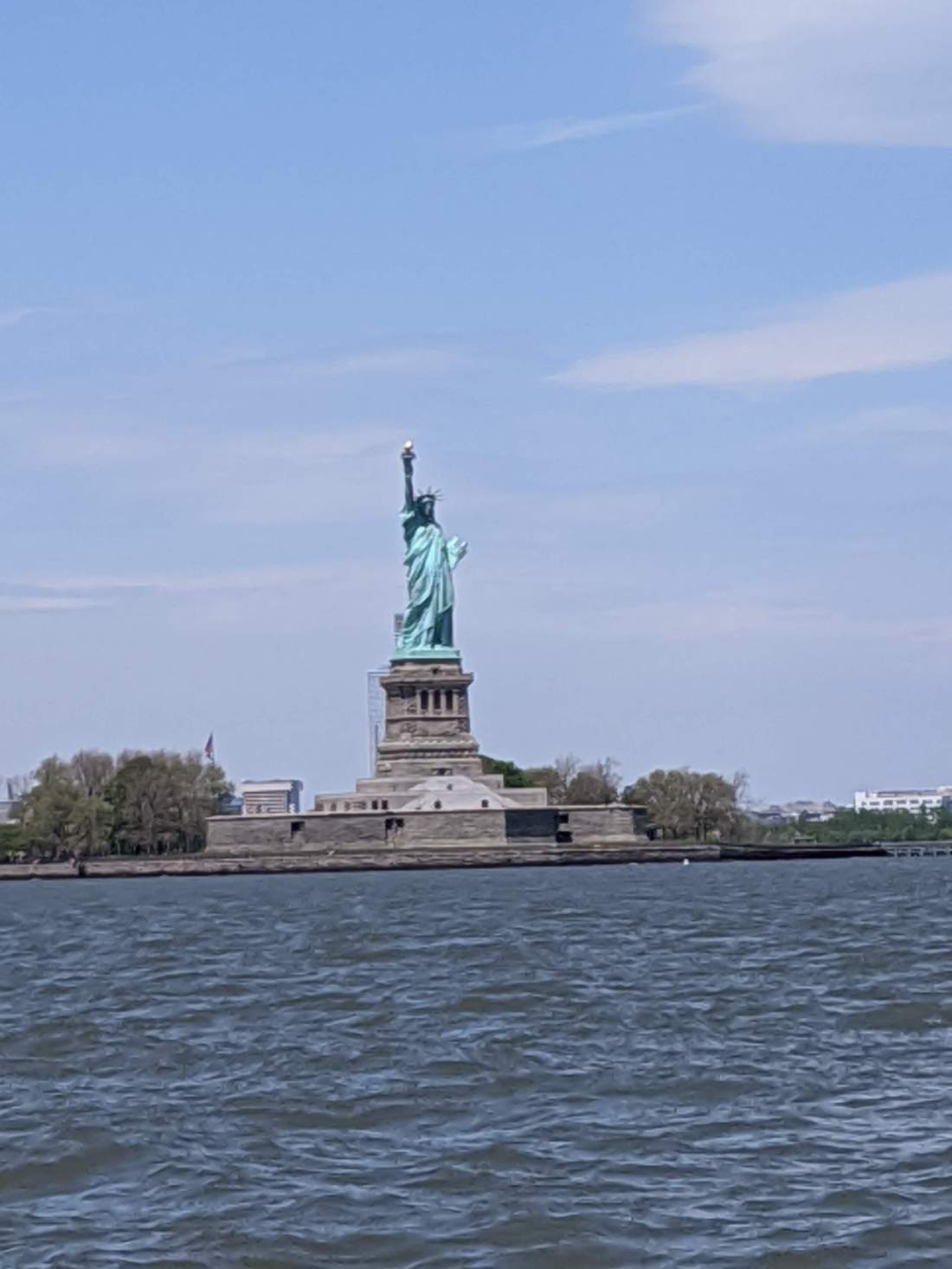
We cruised past the Statue of Liberty.
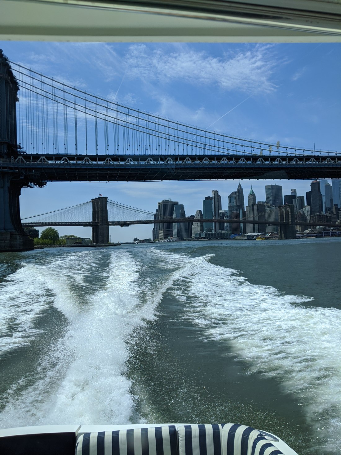
We turned North East and went under the Brooklyn and Manhattan Bridge as we headed to Long Island Sound.
At 14:45 (2:45 PM) we arrived at our final destination, Riverside Yacht Club in Riverside, CT.
Wakely had performed flawlessly. Stan was an incredible first mate and Jeff Neubirth played a critical role as “Mission Control”.
It was a great experience and one that I hope I have the chance to do again when the world is fully open and we can take advantage of all the great wonders that are the East Coast of the United States.
Until then, keep cruising. All the best,
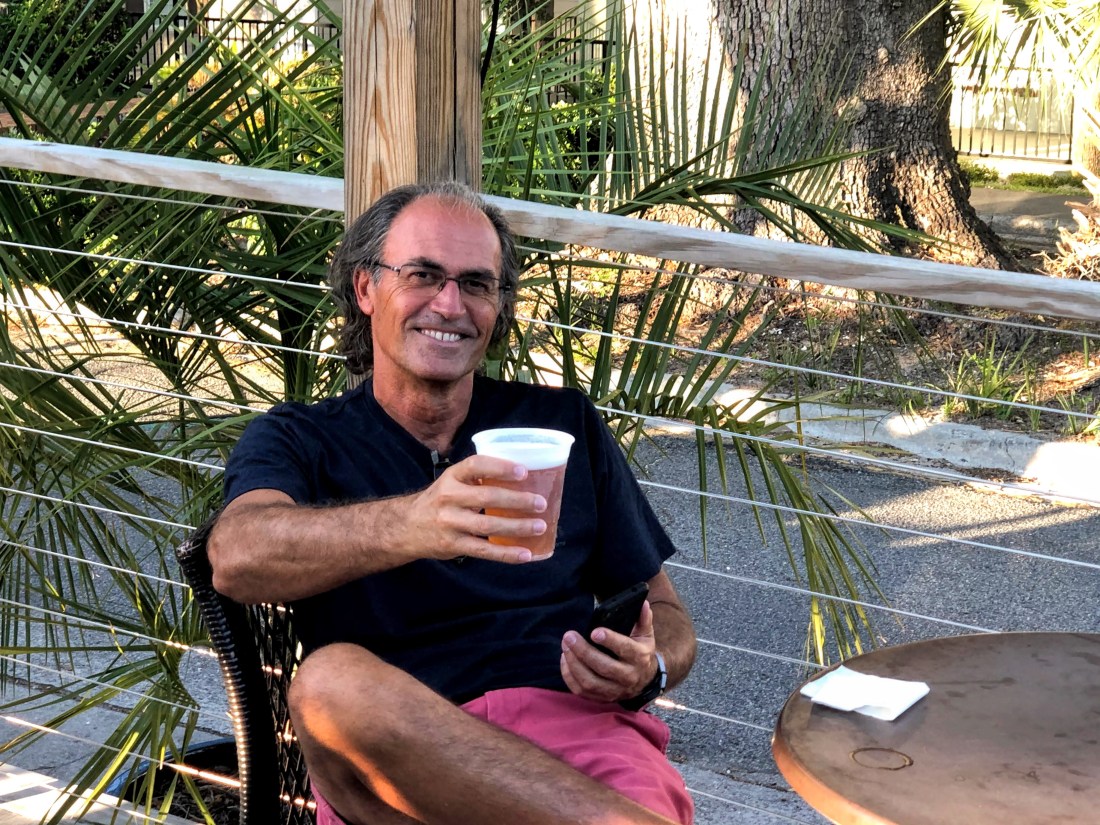
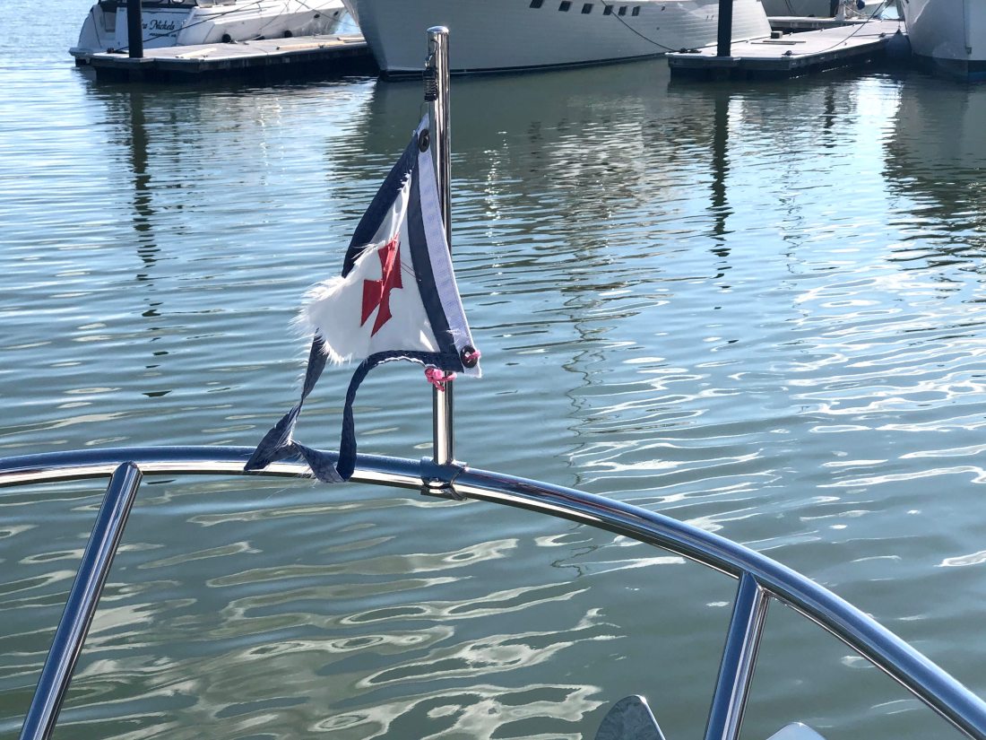
Stan enjoying a PintWhat 1,400 NM will do to a flag (Burgee). I have her proudly displayed
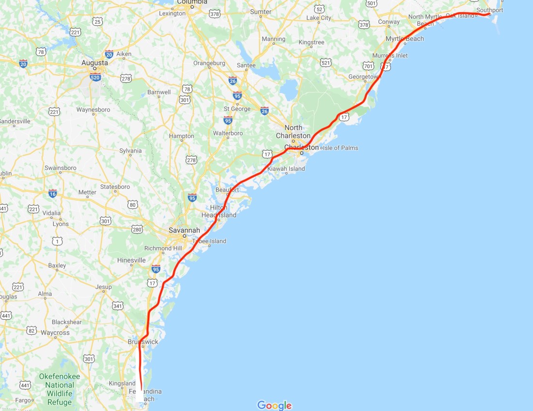
Stan and I have now cruised over 750 Miles up the Atlantic Intercoastal Waterway and the trip continues to be an adventure of a lifetime as well as a test of Stan’s and my endurance. Not with each other but with the level of concentration and diligence needed to travel close to 100 Nautical Miles a day. At least that is my perspective, Stan’s may differ.
Wakely’s average speed each day is approximately 15 knots (17 Miles per hour) and at 100 nautical miles per day, our usual travel day is 6.5 to 7 hours. Over the past four days, Stan and I have traveled from Fernandina, FL to Southport NC. As I write this post, we are docked at St. James Plantation in Southport, NC.
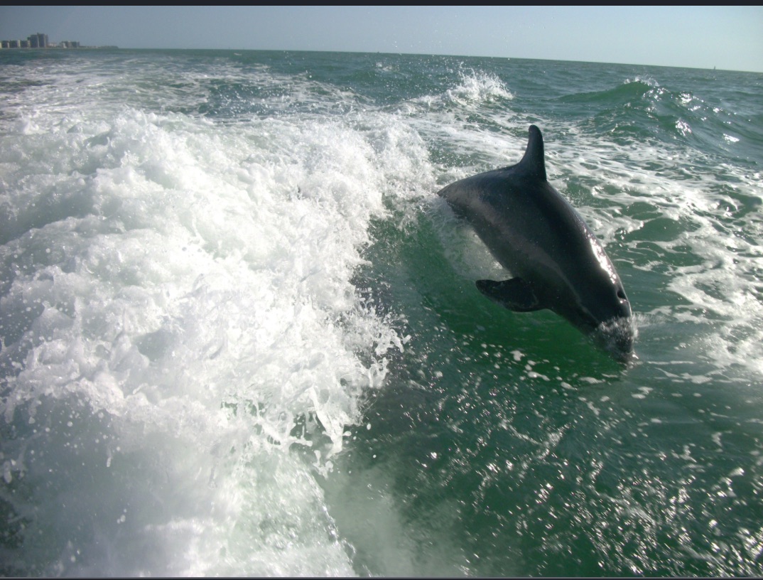
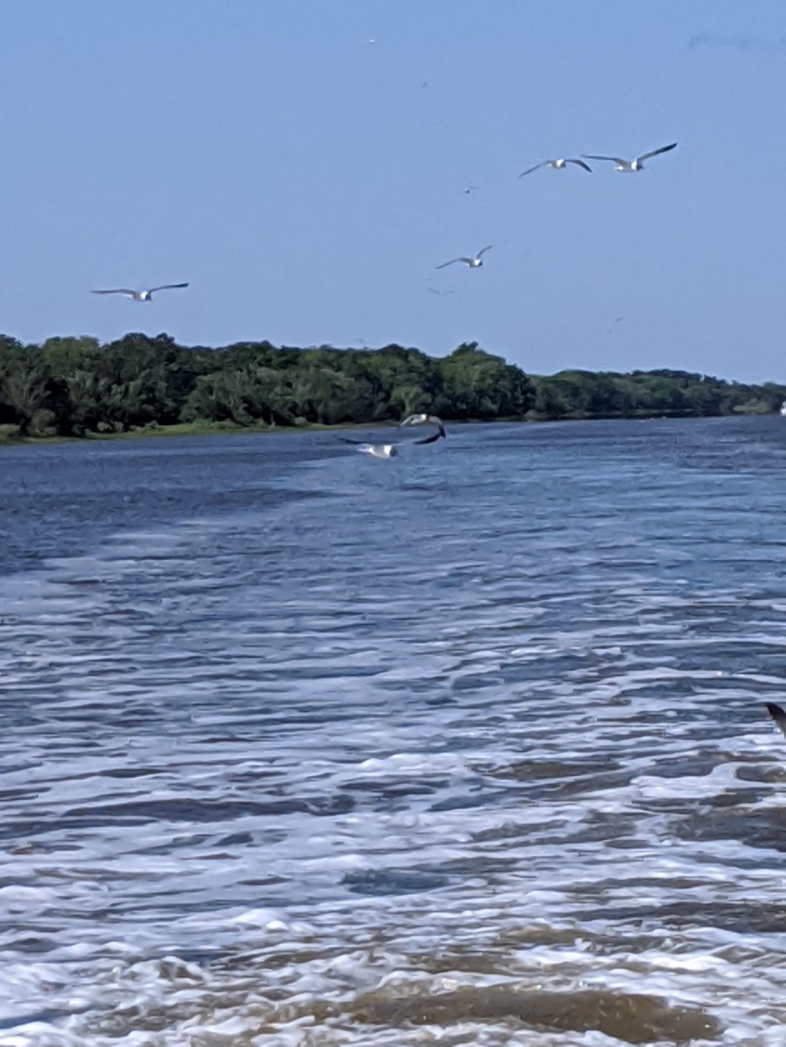
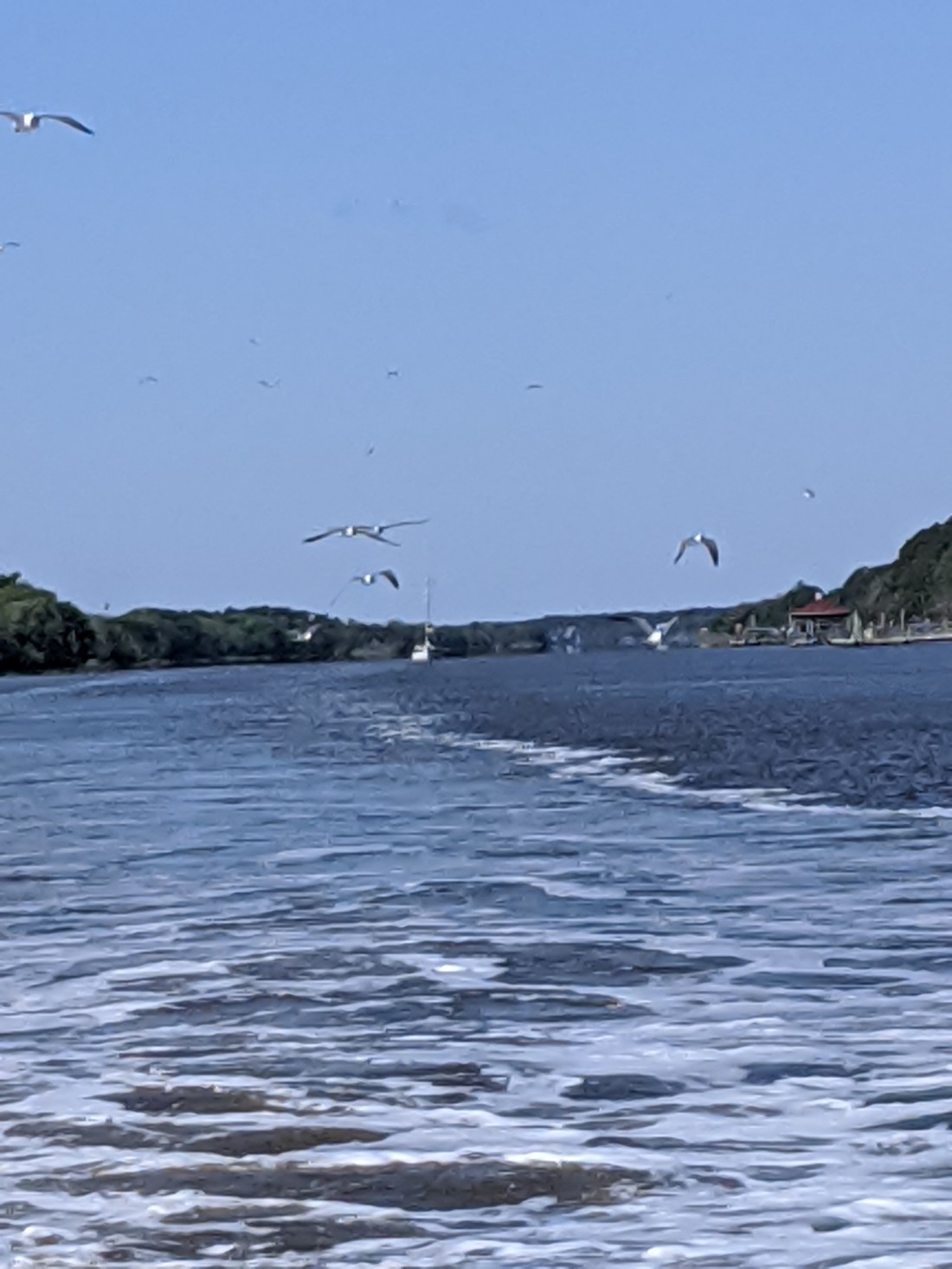
Along the way, we have had the company of dolphins, pelicans, german shepherds, and laughing gulls.
OK, we have not seen this happen, YET. But, it does not mean that this has not happened. We have seen hundreds of dolphins breaching the surface all around us. Maybe we just missed it. And, maybe, one or two did play in Wakely’s wake.
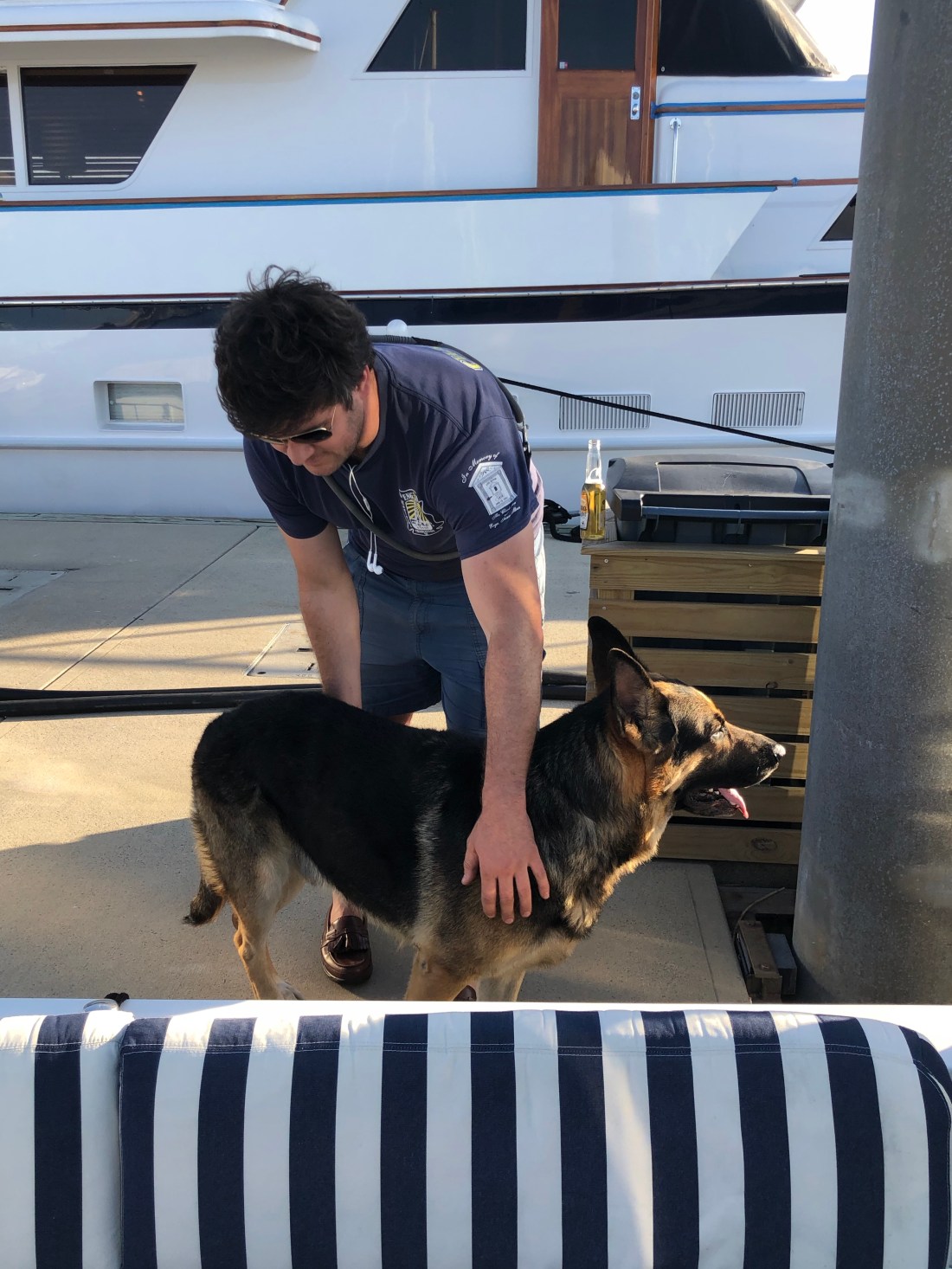
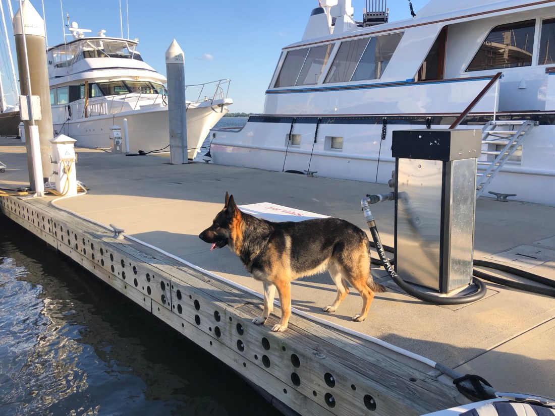
In Charleston, we stayed at the Charleston City Marina, where we met Major. For all you dog boaters, Major was the most comfortable dog I have ever seen on a boat. He literally walked down the dock with Austin, his owner, and anybody who said hello was blessed with a visit.
Austin, a Charleston City Firefighter and his dog Major, a 3 1/2-year-old German Shepherd – Who Stan and I immediately took a liking to as Major was so happy and focused on everythingNot a thing happened in the Marina that Major was not aware of.So, how could we not invite Major to come aboard for a visit? Wakely’s first, but not last, dog aboard.
On our cruise from Charleston to Myrtle Beach, we were greeted by Laughing Gulls. Their “laughter” caught our attention and Stan snapped pictures of 100’s of Laughing Gulls, well, Laughing. But, also eating the food that we stirred up in Wakely’s wake.
The Laughing Gull feeds on the water. It swoops down to the water and skims the surface for food. They were all around us.But, I got the strangest feeling they were laughing at us??
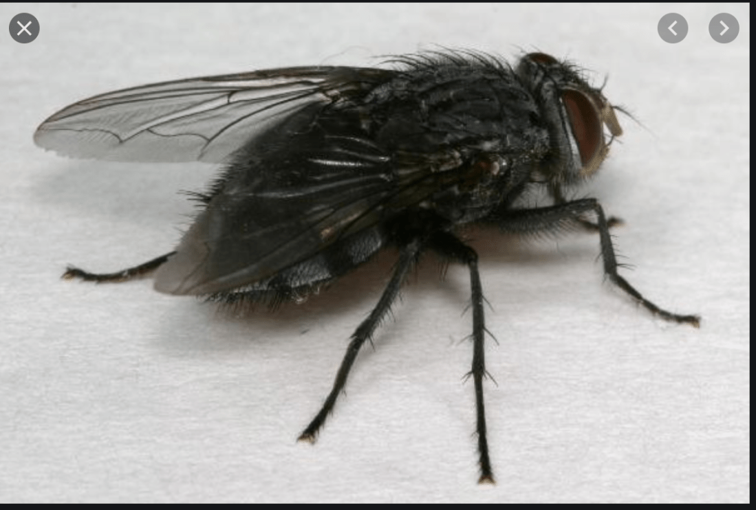
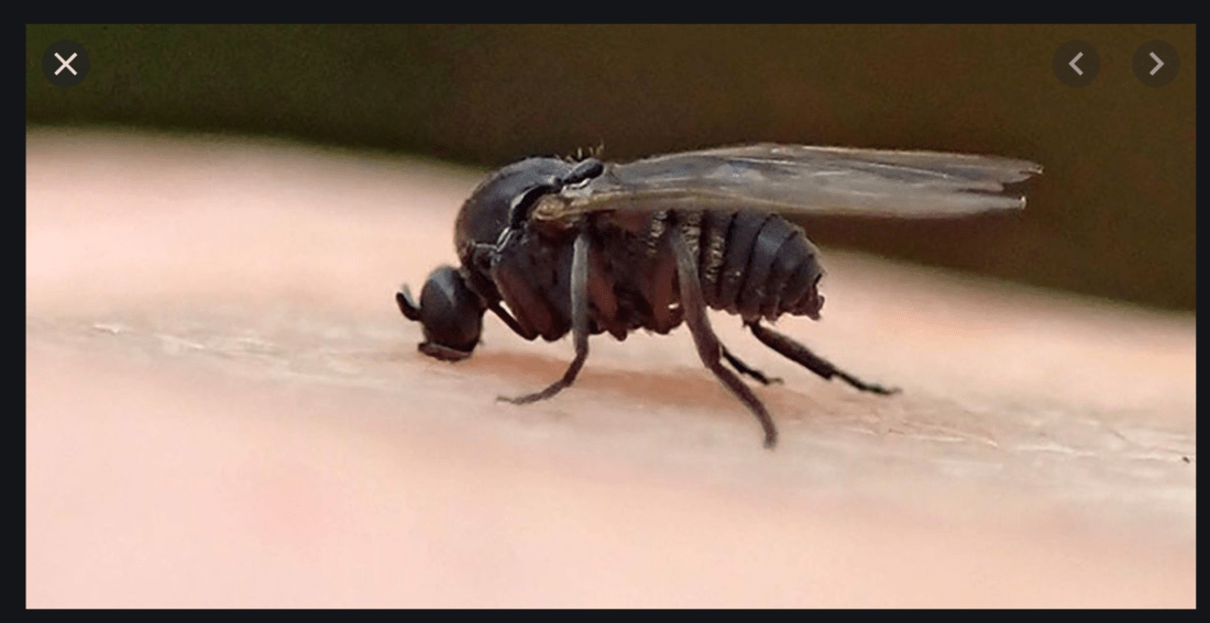
On the other side of the equation…Stan and I had just entered Georgia and we were traveling up the Mackay River with all the windows open enjoying the warm breeze and beautiful views of the marsh. When, all of a sudden, we were attacked by Black Flies. Hundreds of them.
Even though we slammed the windows and doors, we were overwhelmed and totally on the defensive. We could not concentrate on anything other than killing the $%^%% things. They were slow, so Stan was able to kill dozens, and as he needed to work fast, he just dropped them on the floor of the salon (we missed the picture). As the flies started getting rough, Wakely was lost (yes, we kissed the bottom). But, if not for the courage of the fearless crew, Wakely could have been REALLY lost.
These $%^%% things are really badAnd. if they are not ugly enough, they are also $#%$$holes. (We are so sorry we missed the picture of dozens dead on the salon floor.
But, as you now know we survived and are happily in Southport, NC at the St James Plantation Marina. A nice quiet marina on the ICW. Did I mention that the winds are howling out of the East at 25 with gusts to 40? So happy to be nice and cozy at the Marina and on Wakely.
Four days, and over 400 miles into cruising from Marco Island, Florida to Riverside, CT, it is proving to be an adventure of a lifetime. It is mentally draining, challenging, at times anxiety-ridden, and incredibly rewarding. As well as offering the opportunity to meet friends along the way.
Stan and my day start between 5:30 – 6:00AM by waking, showering, eating breakfast, checking the engine water strainer, the generator strainer, the oil level, diesel, and the general condition of the engine room. We then leave the dock between 07:00 and 08:30, at the latest, for our 100+ mile daily journey. Our days have been ending around 1700 by washing the salt off of Wakely, having dinner, and charting the next day’s course.
Our days on the water are focused on following the charts as we venture down rivers, canals, channels, past inlets, all watching the depth of the water to assure that there is a minimum of 4′ below. And, that is not always easy as the water levels on the Intercoastal Water Way can be very shallow. We have been navigating locks and bridges making sure that any bridge we approach is higher than 14′ (the height of Wakely). Stan and I are both 100% focused on following the charts (maps) assuring that we are not making a wrong turn or losing the channel and running aground (neither has happened).
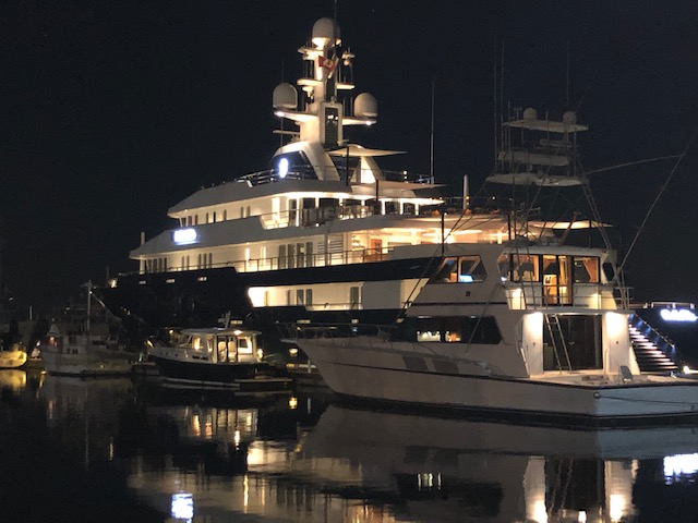
The marinas that we have stopped at have ranged from a small, backwater, marina such as Clewiston Florida (Westcoast of lake Okeechobee) to Fernandina Beach, FL on the Florida Georgia border.
Clewiston Marina, on the west coast of Lake Okeechobee, was a small, backwater marina that you enter through an open lock.Fernandina Harbor Marina is a little different as Wakely is dwarfed by Bella Vista, a 246′ Luxury Yacht – Wakely is the smallest boat in the middle
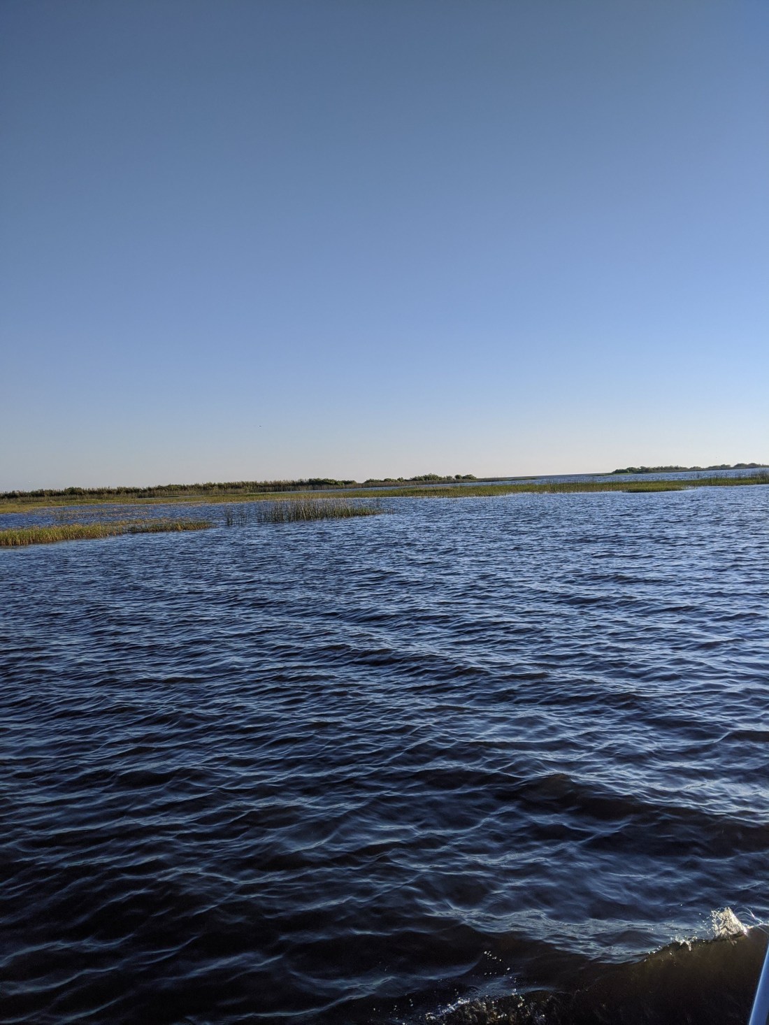
We have gone through beautiful country, and crossed Lake Okeechobee, The second-largest freshwater lake entirely within U.S. boundaries. Lake Okeechobee is also among the most shallow lakes in the country with levels less than 7′. Unless you stay in the designated channels, which are maintained by the Army Corp of Engineers, you will hit a rock or run aground.
To give you an example of high anxiety, while crossing the lake, and out of sight of land, we realized that our electronic navigation was obviously flawed (please don’t ask how that happened). We were traveling east early in the morning and the sun was directly in our eyes so that we were unable to see a thing. We were lost, surrounded by shallow waters waiting to lay Wakely aground. However, as the highly qualified crew considered all options, we gave up on the electronics and went to paper charts plotting, and a compass to move on.
Entering Lake OkeechobeeThe Big Water of Lake OkeechobeeHaving entered a lock, we wait for the water to either lift Wakely or let her down to the next level and then exit the lock
Below is a small sample of some of the beautiful country that we have traveled through.
And, in Vero Beach, Stan and I had the opportunity to spend time with my dear friend Bill Sinnott and in Daytona, Stan and I were invited by John and Denise Keundig to have a wonderful dinner at their house. However, hanging out with my friend John Keundig is a little different today.
OK – Not perfect Social Distancing – but we did wash our fists immediately
Finally, as I wrap this blog at 0015, I need to again thank Jeff Neuberth for his continued support and advice. Jeff continues to be a wealth of knowledge and encouragement. And, I cannot express my gratitude to Stan Thurley, who has been a great first mate. His enthusiasm for the trip and for Wakely is truly inspiring.
I will post as often as I can and ask you all to keep cruising.
All the planning is done. All the charting, phone calls to Marinas, preventative maintenance, engine checks, electronic checks, pump-out, water, and fuel and oil fill check, provisioning of food, all done.
As I sit on Wakely, 12 hours before launch, my stomach has butterflies. The combination of a bucket list adventure, the unknown, the anticipation of the experience, the concern that Wakely may experience mechanical challenges, the excitement of a plan that has been in the making for 7 months is here. I cannot believe that after all this time, the “virus”, the loss of crew, and the addition of a great mate in Stan Thurley, the time has arrived.
We leave tomorrow and due to the Coronavirus closing the entire Florida Keys, Stan and I will be taking the Lake Okeechobee route. This route will take us across Florida from Marco Island, up to Ft. Myers, and into the Lake Okeechobee waterway. Tomorrow evening we stay in Clewiston Florida, on the west side of the lake.
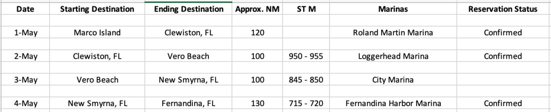
Over the next four days, our itinerary will take us over 450 Nautical Miles from Marco Island on Florida’s West Coast to Fernandina Beach, on Florida’s East Coast and Georgia Border. As you can see below, we have reservations on three of the four days but nothing in New Smyrna.
The New Smyrna City Marina is closed due to the virus and will not be open until May 15th.
This is where I must thank Jeff Neuberth. Jeff has been such a great friend and asset. Being one of the most experienced sailors and boaters that you would ever meet and having cruised the Atlantic Intercoastal Waterway numerous time, he has been incredibly generous with his time. Jeff has spent countless hours on the phone with me, helping plan the route, giving me valuable insight into where to go, which Marina’s to stop at, and giving me experienced people to talk to along the way. This trip would be much riskier without Jeff’s counsel and advice. Stan and I are so appreciative of Jeff’s input.
W will be exploring other options for New Smyrna and hopefully, we will find a place to “pull-in” for the evening. It may be a challenge, but I am confident that something will work out and we will be in a safe harbor at the end of the day.
My last post was titled “I can tell you where I’m going, I just can’t guarantee when I’ll get there.” As of today, I cannot even tell you where Wakely is going to be!
As I write this post, all the marinas in the Florida Keys are closed to all visiting boats. Period. And, many of the Florida marinas north of the keys are either closed or offering limited services. The same for many other marinas along the entire east coast.
Catherine and I remain in Naples as we were able to extend our rental lease for another month. However, at the end of April, we must vacate and head north. Catherine will be taking the train and I will be boarding Wakely for the cruise up the coast.
We lost our initial crew as Catherine and I could not ask our friends to travel. We are very disappointed. However, through exceptional luck, we found a gentleman named Stan Thurley who has offered to take the cruise with me. Stan winters in Naples and summers in Westport, CT, which is a neighboring town to us in Riverside, CT. Stan was planning on going home in May and elected to join me on this adventure. I am so happy that we found Stan as, without him, we did not know how Wakely would get home.
With Corona-19, the casual cruise of a lifetime, up the east coast, has turned into a delivery. The goal is now to move Wakely up the coast as fast as safely possible.
But, as with everything in life, and especially within the midst of the Pandemic, flexibility and patience are key.
So, as with every long journey, it begins with a small step. The first two days of the cruise will be dedicated to getting to Florida’s East Coast and as far north as we can.
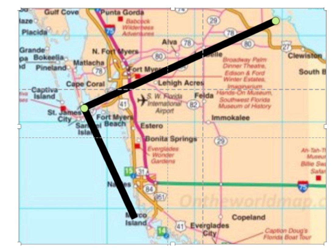
As shown in the picture below, Stan and I have two options. One, cruise south to the keys and then turn northeast, and two, cruise north to Ft Myers and enter what is called the Lake Okeechobee Waterway.
The cruise starts in Marco Island, Florida and day one and two options are South to Marathon and up the coast of Florida or North to Fort Myers and through Lake Okeechobee
Lake Okeechobee is a very shallow, narrow channel consisting of rivers and canals. This increases the chance of running aground or worse. In addition, there are numerous locks along the way that slow you down and cost time. However, we hear that the marina’s along the waterway remain open and this makes Lake Okeechobee a major possibility.
The other option is to make a straight run to Marathon which would be much easier. However, as I said earlier, the Keys are not welcoming visiting boats at this time. We are hoping that this will change over time and that in the next two weeks things will open up in the keys.
Either way, Stan and I remain in planning mode and we are charting our course, making sure we have all the safety tools and spare parts we need.
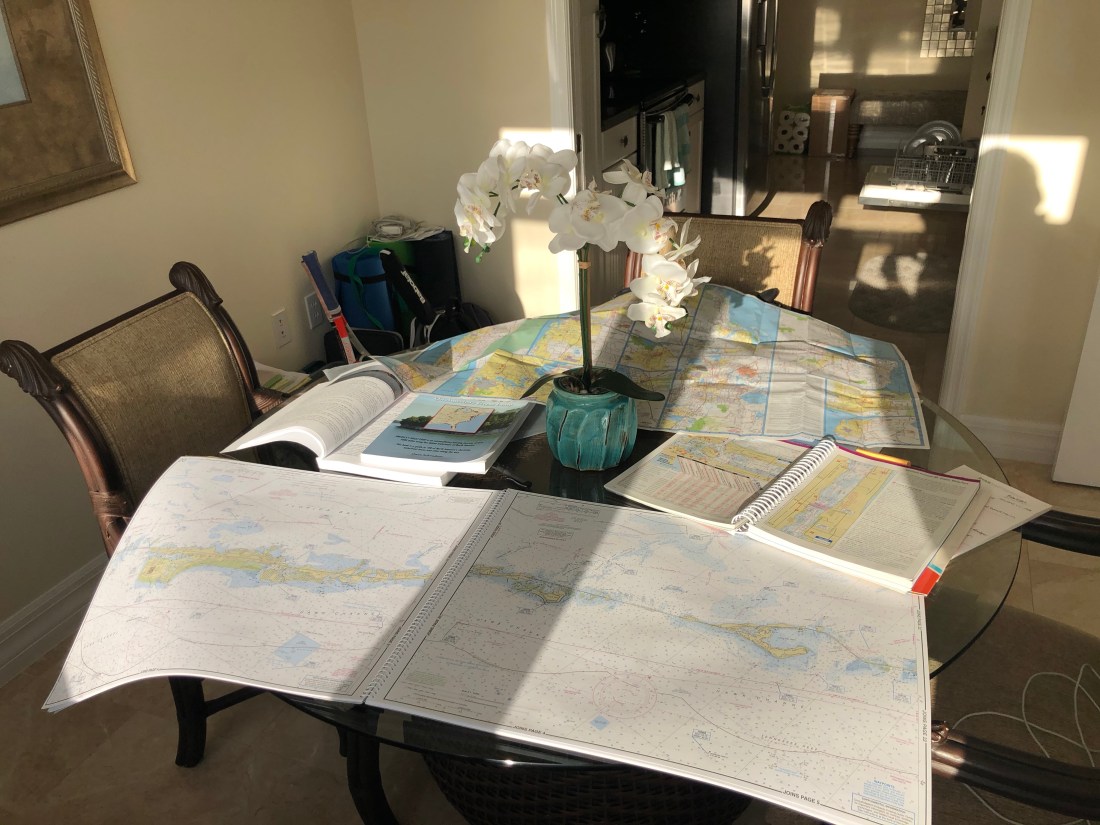
Does this look familiar? It is my “desk” filled with nautical charts, MapTech Embassy Cruising Guides, two books on cruising America’s “Great Loop” and a map of Florida.
These are just some of the items I am using to plan my cruise from Naples, FL (Actually, Wakely is in Marco Island, Florida) to Riverside, CT. This cruise is the Atlantic leg of the Intercoastal Water Way (AICW). The AICW is just one leg of America’s Great Loop, a 6,000-mile route.
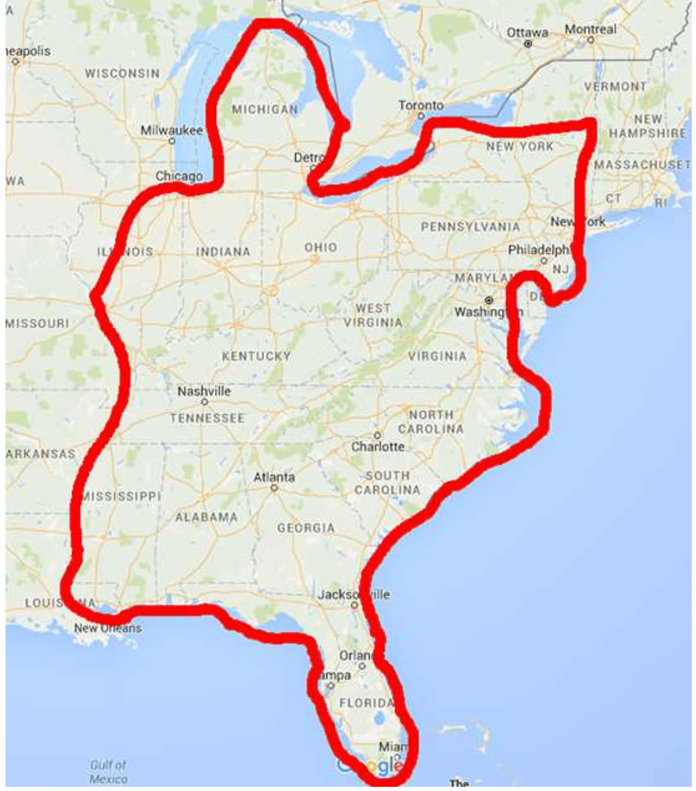
The entire Great Loop includes the Atlantic leg, that I am doing, and then continuing up the Hudson River, into the Erie Canal System, into the Great Lakes and then down the Mississippi River back into the Gulf of Mexico. Here is what the entire loop looks like:
Planning my cruise is much more complex than planning my past Motorcycle journeys. One factor is that a boat cruise is greatly affected by the weather. Rain and wind can keep you at the dock for days at a time. Hence, I can tell you where I plan on going, I just cannot guarantee when I’ll get there. Additional complexity is driven by the following:
• Maps versus Charts – Charting a cruise is not like planning a road trip. Planning a road trip calls for assuring that the road(s) you select gets you from point A to point B. You can tap into Waze or Mapquest to get the distance and time.
Charting a cruise is more complex as there are no roads. There is no Waze or Mapquest that I have found. There are Channels, Inlets, and Shipping Lanes to name a few that are designated on a chart. However, they are not as clear as a road map because the names are not familiar. We live on land and charts are based on navigating waterways.
• Roads versus Channels, Shipping Lanes and Inlets– A paved road, for the most part, is a paved road. Channels, Inlets, and Shipping Lanes can be greatly different based on their depth, width, location, and access to shelter. As I posted previously, the draft of Wakely is 3′ 9″. This means that as I chart the course from point A to B, I need to be sure that the depth along the entire route is a minimum of 5 feet. This gives me room for error as depths are constantly changing, especially in the Florida Keys.
Inlets, needed to traverse from say big water to inland waterways, can be quite treacherous as they can be narrow with very strong currents. These currents, along with wind can create large waves that can dash a boat against rocks or the shore. Selecting which inlets you choose to traverse is a careful decision
• Hotels versus Marinas – Marinas also present their own complexity versus Hotels. Hotels are either clean or not. They have a bed or not. With a Marina, you do consider the quality of the Marina, but you also look for floating docks versus fixed docks, can the marina accommodate Wakely’s 46′ length, does the dock offer diesel gas and, as a hotel, is it available. There are far fewer marinas than hotels. And, being left without a slip for even one evening can create its own problems.
Also, you can book a hotel month in advance and be confident you will arrive on time for your reservation. You cannot book a marina to far in advance as you can’t guarantee your arrival date.
• Diesel versus Gas Station – Along the road, there is always a gas station within reach, unless you are in very remote areas (I have been in these areas). On the water, Diesel marinas can be miles and miles apart. Therefore, I need to be aware of how much diesel I will use and whether I will have enough to get where I want to go and if there will be a pump when I arrive.
• Crew Versus No Crew – When I was planning my motorcycle ride, I knew that I was going to be riding alone. The planning process was simple as I needed to only take into account my needs.
Running Wakely needs a crew. A second or third set of eyes and help departing and arriving at marinas. I am lucky enough to have a great crew for the beginning of the cruise. My wife Catherine, and Bob and Maria Dwyer will be joining me for the cruise from Marco Island, Florida, to Key West and up the Florida Keys.
Catherine has been on the water her entire life and I have so much confidence and respect for her judgment on the water. And, Bob and Maria take it to an entirely new level. They are avid sailors and for years they have sailed in New England for the summer months and in the Carribean for the winter months. They know there way around the water. I am so lucky that Bob and Maria have elected to join Catherine and me.
I am in the middle of planning our route from Marco Island, down to Key West and up the Atlantic Coast. So far I have planned as far as the Florida/Georgia border. From Key West to Norfolk, VA is 1,243 miles and then I will have another ??? to go from Norfolk to Riverside, CT depending on the course I plot.
As we are planning to depart the week of Monday, April 13, I still have a little time. The rough schedule is to depart Marco Island on the Week of April 13 and arrive home the latter half of May.
Looking forward to continuing my posts and keeping you all in the “Loop”
I am sorry for the delay in getting out my first 2020 blog. But, this years marks a slight change of plans.
The past two years I have blogged about my Indian Roadmaster motorcycle adventures. First, in 2018, through the Southeast, and in 2019 through the Southwest. I have really loved my time on the open road – exploring new places and meeting new people from different walks of life. Please feel free to read past blogs.
In 2020, I am going to do something different. I am not going to explore America on two wheels. I am going to explore the Eastern Seaboard of the United States, from Key West to Riverside, CT, on a cabin cruiser. The good ship Wakely.
Wakely is a Back Cove 41. The 41 is the flagship of the Back Cove fleet and is fitted with an efficient single Cummins diesel engine. Catherine and I fell in love with the 41 last year. After a quick search, we found our Back Cove 41 in St. Petersburg, Florida.
Her name, Wakely, is a family name. It is the middle name of Catherine’s father, Peter Wakely Streich. Peter is a Navy veteran.
Right now, Wakely is located in St. Petersberg, Florida. Over the next few weeks, we are looking forward to moving her south closer to Naples where we are currently living. She will stay in Florida through March and sometime in April, we will begin our cruise up the Eastern Seaboard.
It will be a casual cruise up the Intercoastal Waterway allowing us to experience the seafaring tradition of the Eastern United States.
Oh, I have elected to keep the blog’s name “Wheeling with Kramer” as Wakely is driven by a single propeller that wheels (spins) to keep Wakely moving forward. So, “Wheeling with Kramer” is still pertinent.
I will keep you up to date on Wakely’s and our adventures starting in just a few weeks.
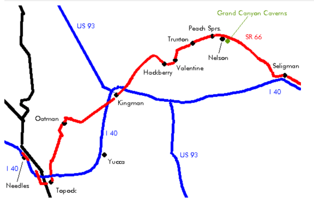
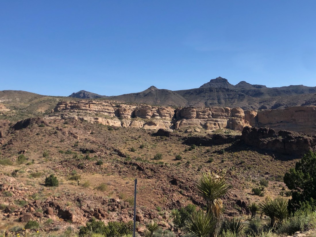
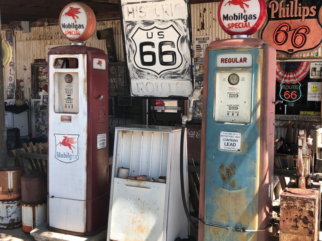
The last two days were enjoyed exploring the Arizona section of Route 66, the “Mother Road” as John Steinbeck named it in “Grapes of Wrath”. I entered US 66 from Needles, California and rode across the Topock Gorge, within the Havasu National Wildlife Refuge, and across the Black Mountains, through Oatman, Kingman, and Hackberry to Seligman, AZ.
As background, Route 66 was one of the original highways in the U.S. Highway System. The road came to be in 1926 connecting Chicago to Los Angeles through small-town midwestern and western America. At first just a dirt road.
The highway became the main thoroughfare for western migration. Dustbowl refugees raised the dust of the road on their way to California in their Model T Fords in the 30s. The road was fully paved in the late 50s and saw World War II veterans migrate to California looking for sunnier pastures and in the 60s and 70s families drove to California to visit Disneyland and other sites.
As the road became more frequently traveled, small towns along the route flourished and became communities offering all the services and amenities the travelers needed. The towns grew, businesses were started, buildings constructed and populations exploded.
Arizona benefited greatly from this river of mankind. People discovered this misunderstood state and many found their homes in the small towns Route 66 traveled through.
However, in 1978 it all came crashing down, as if a light switch was thrown, with the opening of the Interstate, I-40, through Arizona. For example, the small town of Seligman saw traffic go from 9,000 cars passing through a day to 50. The towns dried up, businesses were shuttered and people moved away. Things looked bleak.
In the 1980s there was a small resurgence of this famous highway when Historic Route 66 Associations began to spring up from small towns such as Oatman, Kingman, and Seligman. These Associations petitioned state and the federal government to label the highway a “State Historic Route” and placed on the “National Register of Historic Places.”
These towns, to tough to die, now exist on tourism and holding events and gatherings.
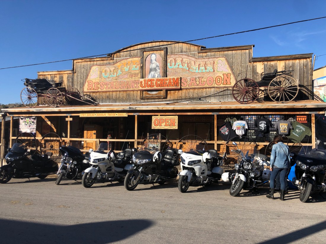
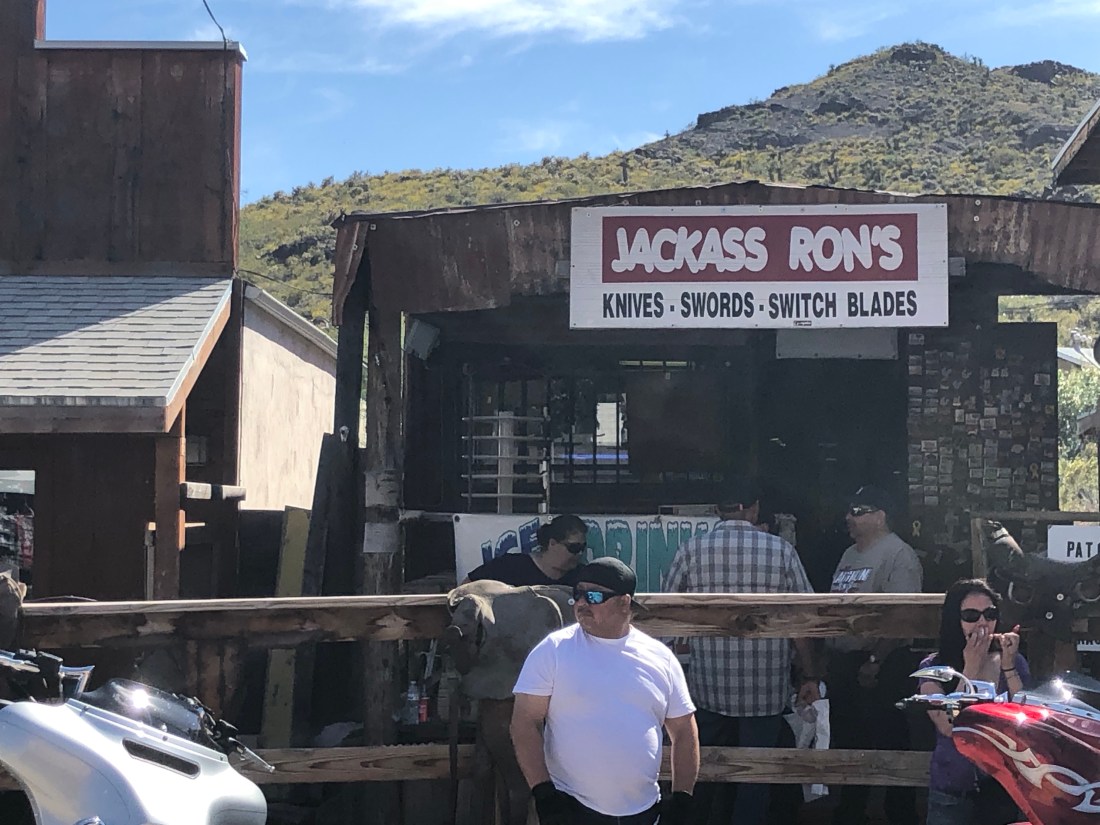
Oatman is a great example of a town too tough to die. Oatman has built a reputation for its raucous events, old west bars and wild burros who wander the town freely. The day I passed through, I was surprised to find an Oatman Motorcycle Rally.
Hundreds of Bikers descended on Oatman to take in the sites and toast the town and the Burros that freely walk the streets
Or hang in the shade when it gets too hotThe town of Oatman was named in honor of Olive Oatman – a young girl whose family was massacred by a Native American raiding party. She was kidnapped and lived with the tribe for 5 years.
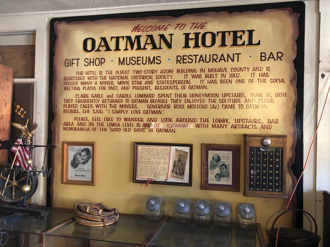
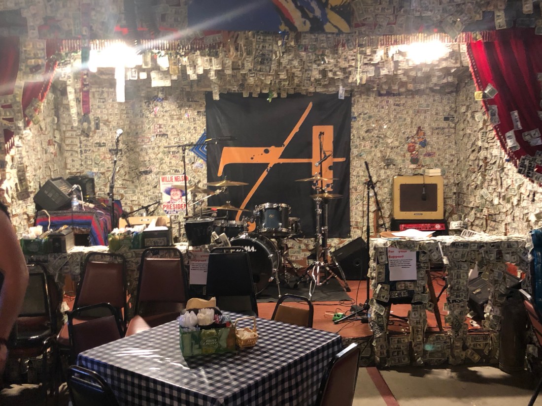
The Oatman Hotel Bar/Restaurant wall and ceiling are covered in autographed one dollar bills – I was told it could amount to $150,000
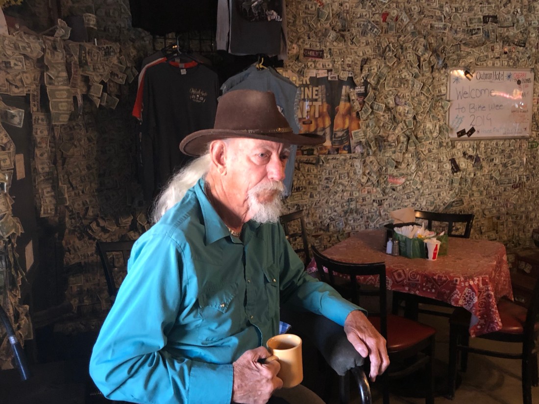
Oatman was full of characters. One gentleman I met was Fred. Fred was a miner. In the 60s and 70s, he mined gold and copper all over Arizona. Fred moved to Oatman in the 80s, to revitalize the gold mines that Oatman was known for. But, they had been played out. Fred never left and watched as Oatman made a comeback as a tourist town
Fred, one of the many characters one finds in OatmanAnd the tourist shops are appropriately named
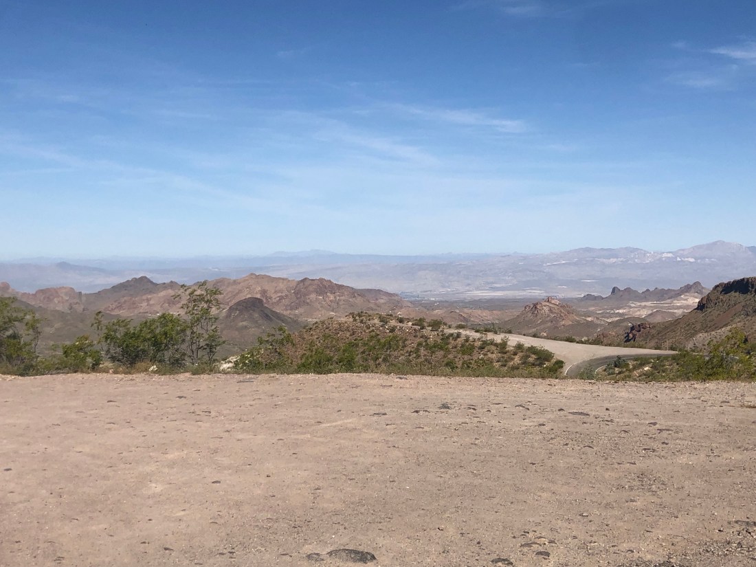
Oatman is located in the Black Mountains and the road leading out of town to the East offers great twisty roads with hairpin switchbacks and great viewsVistas that go on forever – Note the road down below and the tight, no guardrail, turn.An example of the sharp turns and switchbacks with no guardrail
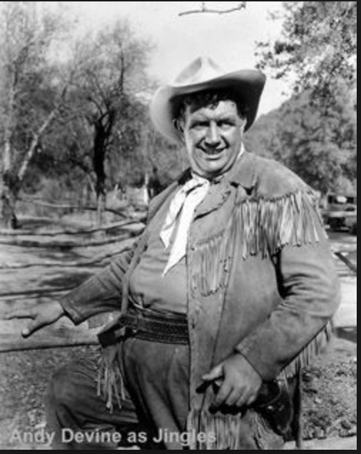
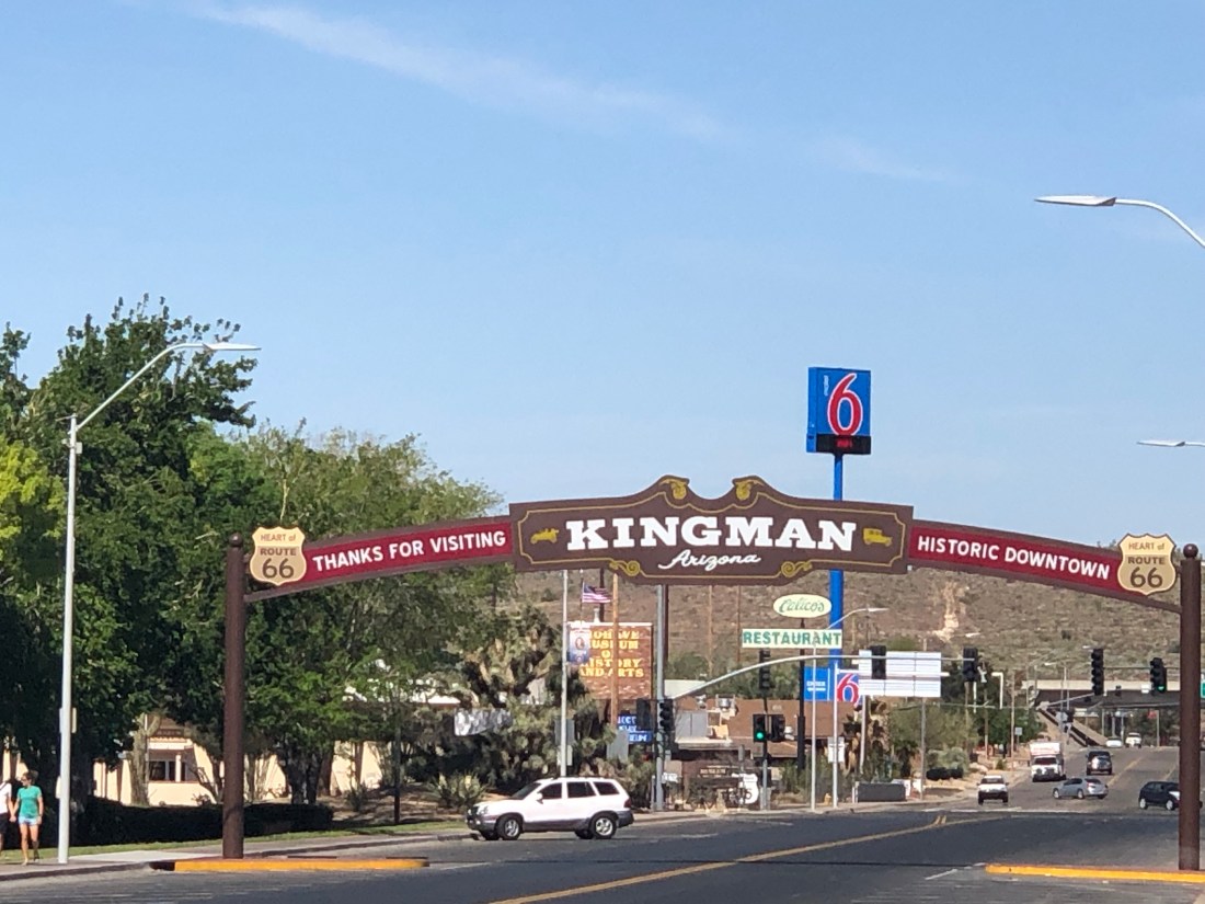
My next stop after Oatman was Kingman, Arizona. One of Kingman’s claim to fame is that it is the home of Andy Devine. Andy Devine was an American character actor known for his distinctive raspy, crackly voice and roles in Western films. He is probably best remembered for his role as Cookie, the sidekick of Roy Rogers. He also appeared alongside John Wayne in films like Stagecoach (1939), The Man Who Shot Liberty Valance and How the West Was Won (both 1962). The main street is named after him.
Today, Kingman largely exists as another US 66 tourist town
Moving on from Kingman, I stopped at the Hackberry General Store. The Hackberry General Store, located in Hackberry, AZ was a crucial gas station and store on the old Route 66 as it sat between Seligman and Kingman. Travelers needed to gas up in between the two larger towns. Today, the general store which is privately owned stands alone in the middle of nowhere. It only exists because it sits today on historic Route 66. But, it is offering one family a living and hiring people to man the store
The Hackberry General Store does not look like much. But, captures the flavor of what was America’s Main StreetGas pumps circa 1940s 1950sThe Hackberry soda fountain with a tribute to Elvis and Maralyn Monroe – I guess people are big on autographed one dollar bill.
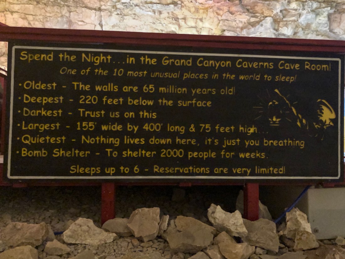
My next stop was the Grand Canyon Caverns, the largest dry cavern in the United States. This is a wild story and an example of how to turn lemons into lemonade.
The Cavern was discovered by a Walter Peek in 1927 when he nearly fell down a hole leading into the cavern. The next day, he and friends returned and they lowered Walter into the cavern to explore.
Walter thought he had found the mother load of gold. He immediately purchased the property and began plans to mine the mineral. After the purchase and getting everything ready to bring the gold home, he found that his gold was iron oxide, or more commonly known as “rust.”
Peek, being an entrepreneur, then began to charge 25¢ to lower people into the cavern and allow them to explore the cave on their own. Unfortunately, Walter forgot that Uncle Sam likes a piece of the action in income tax. Walter failed to pay and the caverns were taken away and sold to a consortium of three owners. An elevator was added to allow easy access to the cavern.
Today the cavern continues to be excavated and offers the opportunity to eat 210′ (approximately 21 floors) below the earth’s surface at the Cavern Grotto, to sleep in the cavern and even to get married. At a constant 57 °F (14 °C) with only 2 percent humidity year round, the caverns are an ideal preservation area.
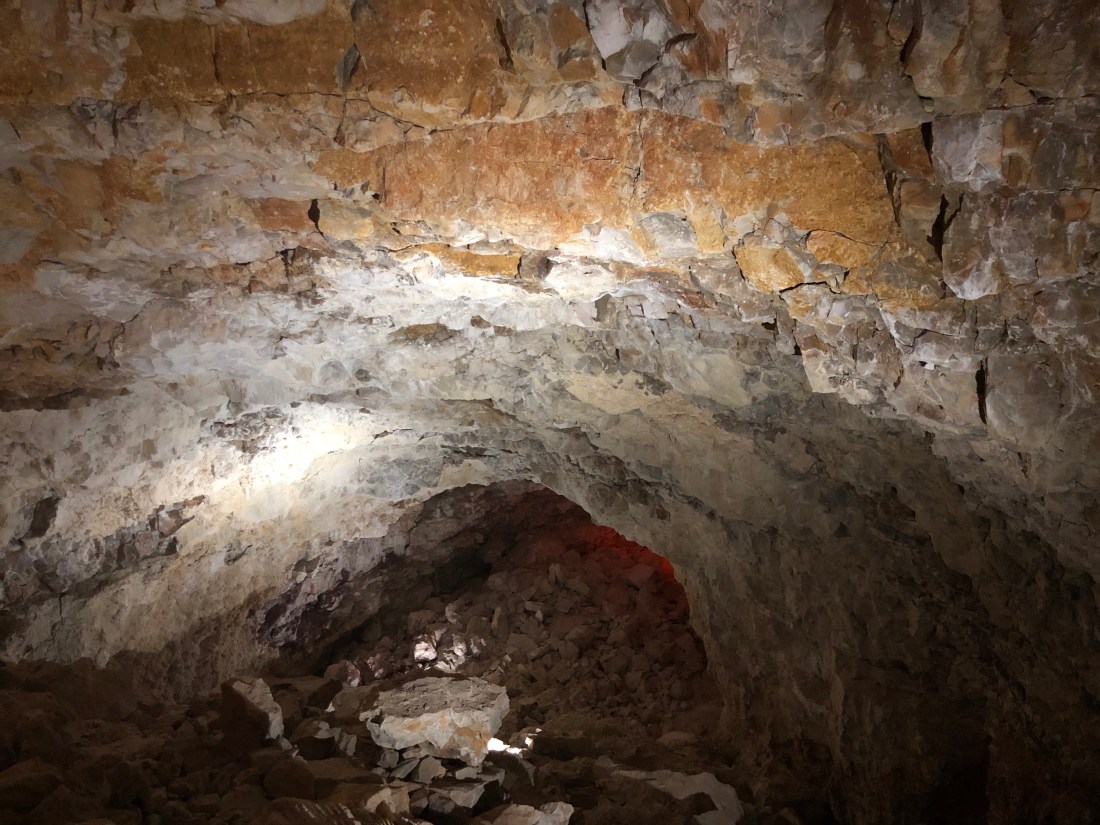
The Cavern lies 210 feet below ground level. It is among the largest dry caverns in the United States. Because of the lack of water, stalagmites and stalactites are rare in the caverns. Notice the iron oxide on the top – this is what Walter thought was gold.345 million years ago, the southwestern United States was covered by ocean. Skeletons of sea life settling to the depths created these fan “rocks”
While not many fossils have been found, they did find the remains of a giant and extinct ground sloth that lived around 11,000 years ago, when the woolly mammoth and saber-tooth cat roamed North America. Having fallen into the cavern, it was impossible for the animal to get out.
A replica of the Ground Sloth – The University of Arizona has the bones. The claw marks where the animal tried to scale the wall are still visible
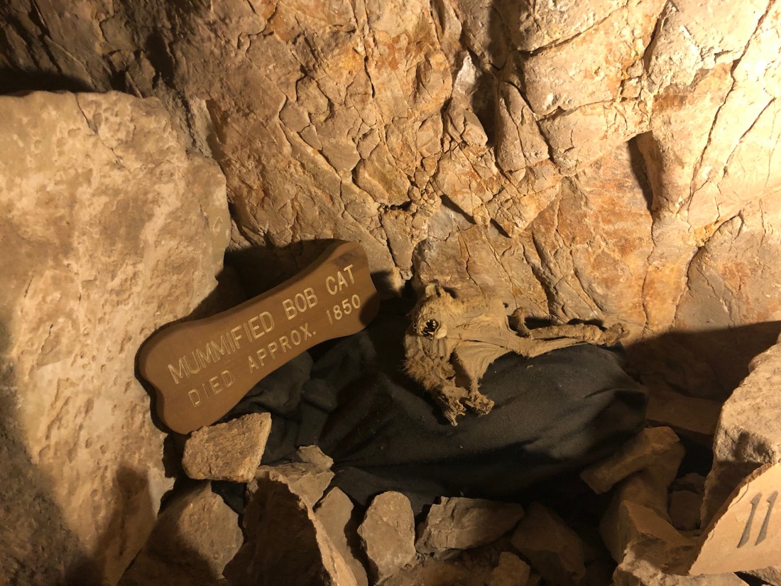
They also found a mummified Bob Cat – they did say that this was the real thing
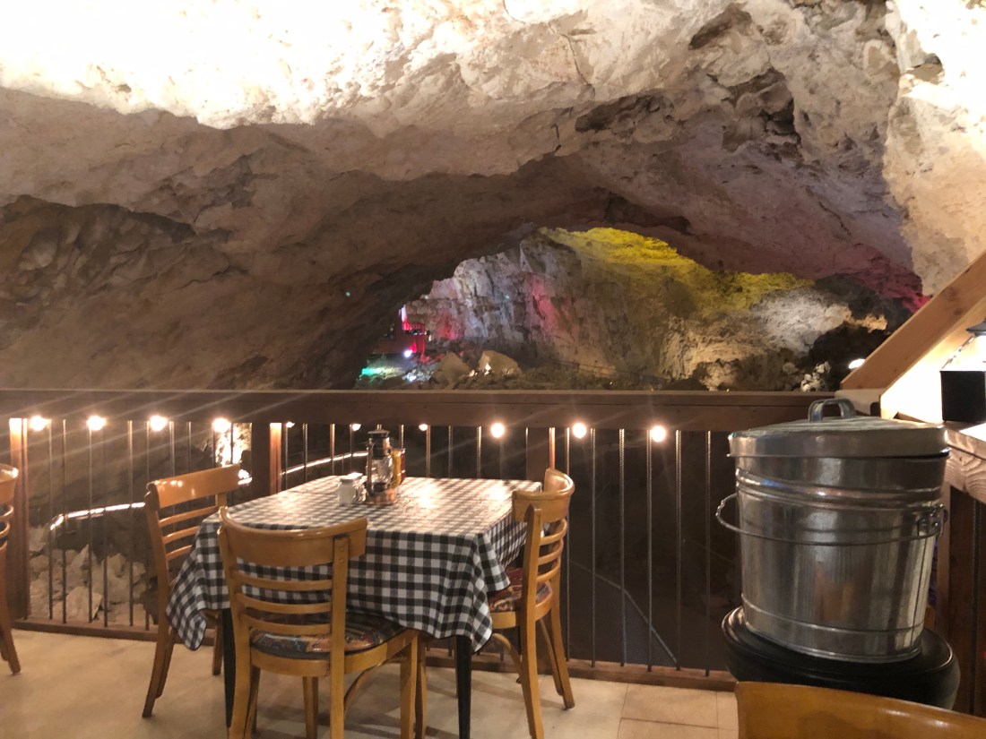
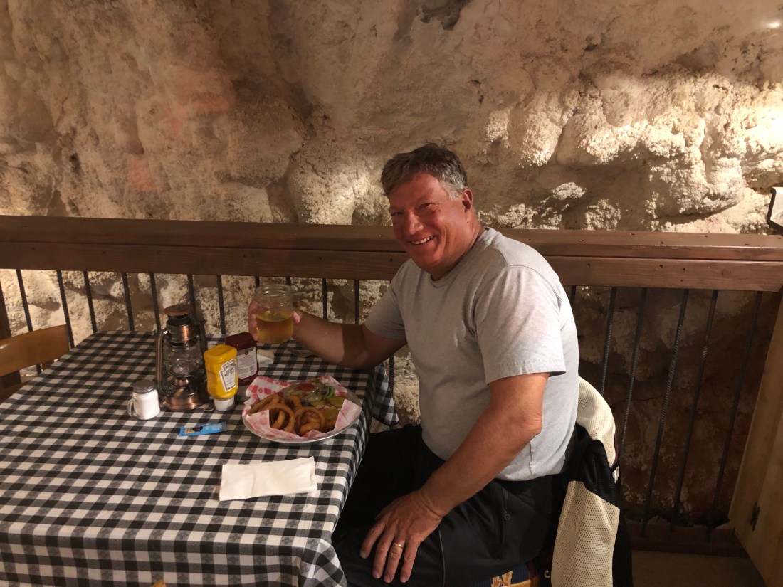
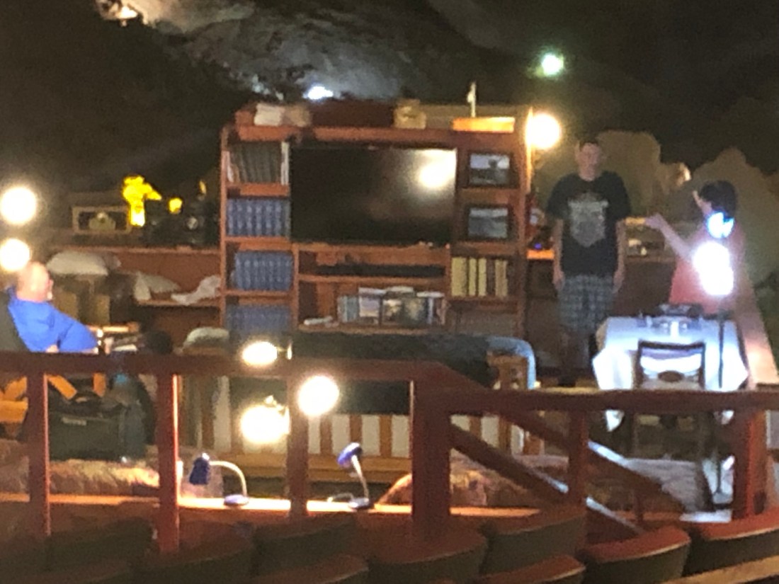
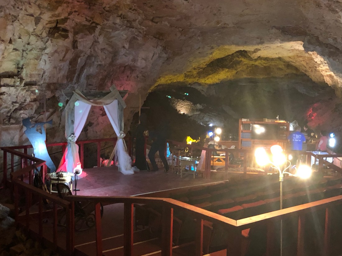
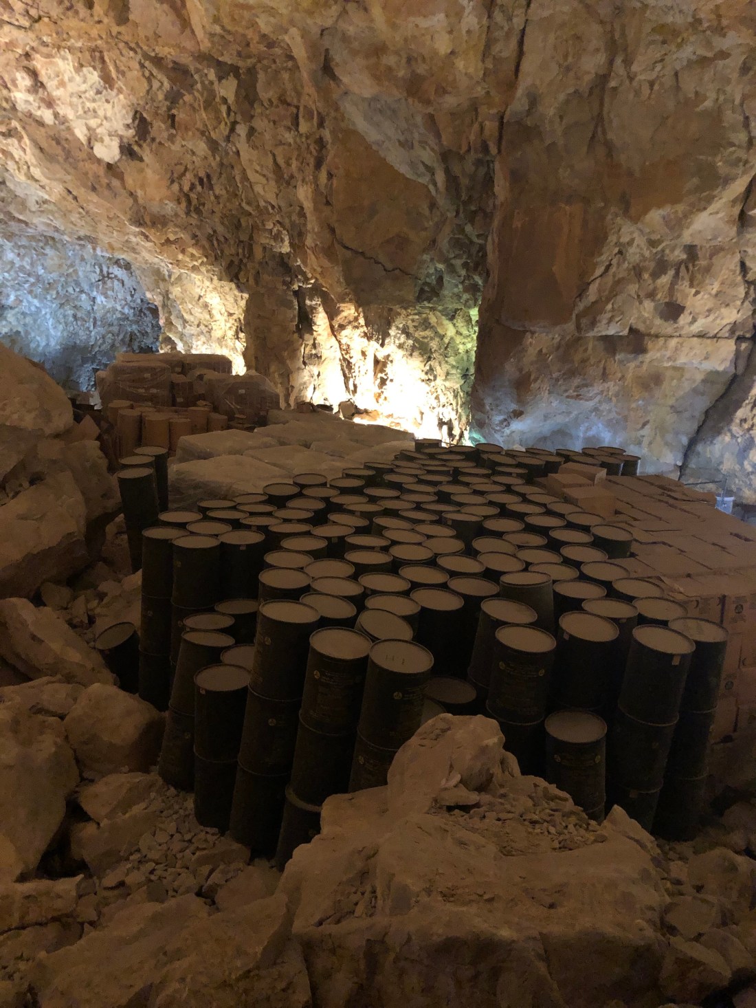
The Canyon Grotto Restaurant – 210′ below the surfaceFood is ordered on the surface and lowered in the metal tin by dumbwaiter.Enjoying a Burger 210′ below the surfaceFor $900.00 a night, you can sleep in the Grand Canyon CavernNice sitting room with Cable TV, Queen Bed and dining areaThe wedding area – with seating for approximately 50 people. The last wedding held in the cavern was in 2017 and the couple is still married.During the Cold War, the Cavern was designated as a fallout shelter. It was filled with water and foodstuff. Enough to shelter 2,000 people for weeks. The foodstuff is still in the cavern and the cavern’s temperature and humidity makes it a perfect preservation area
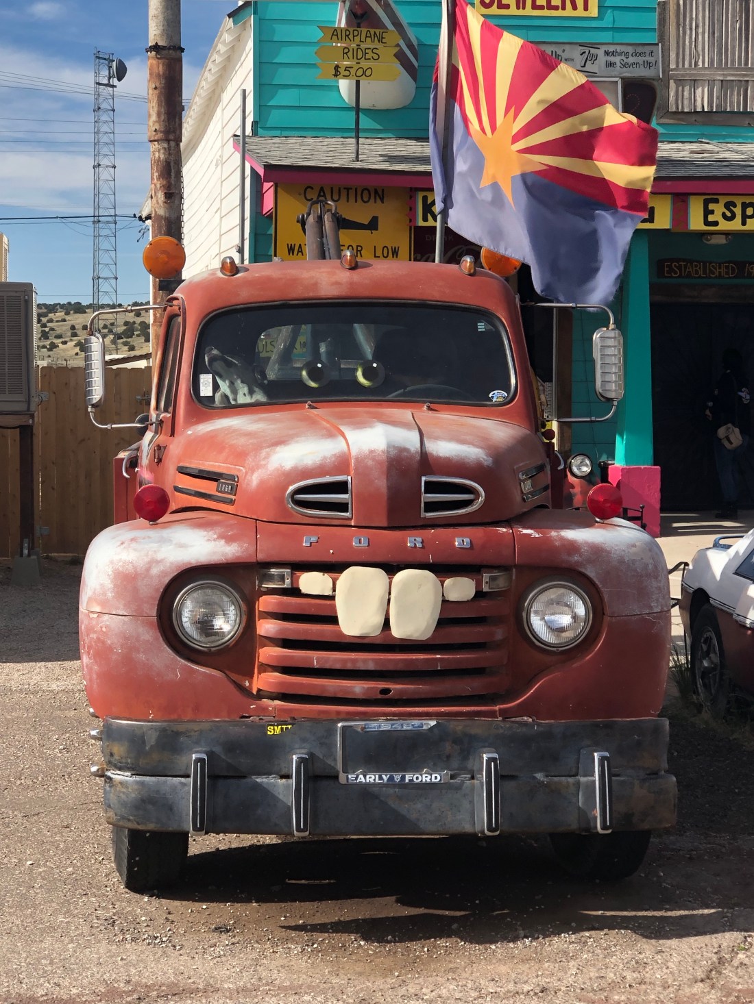
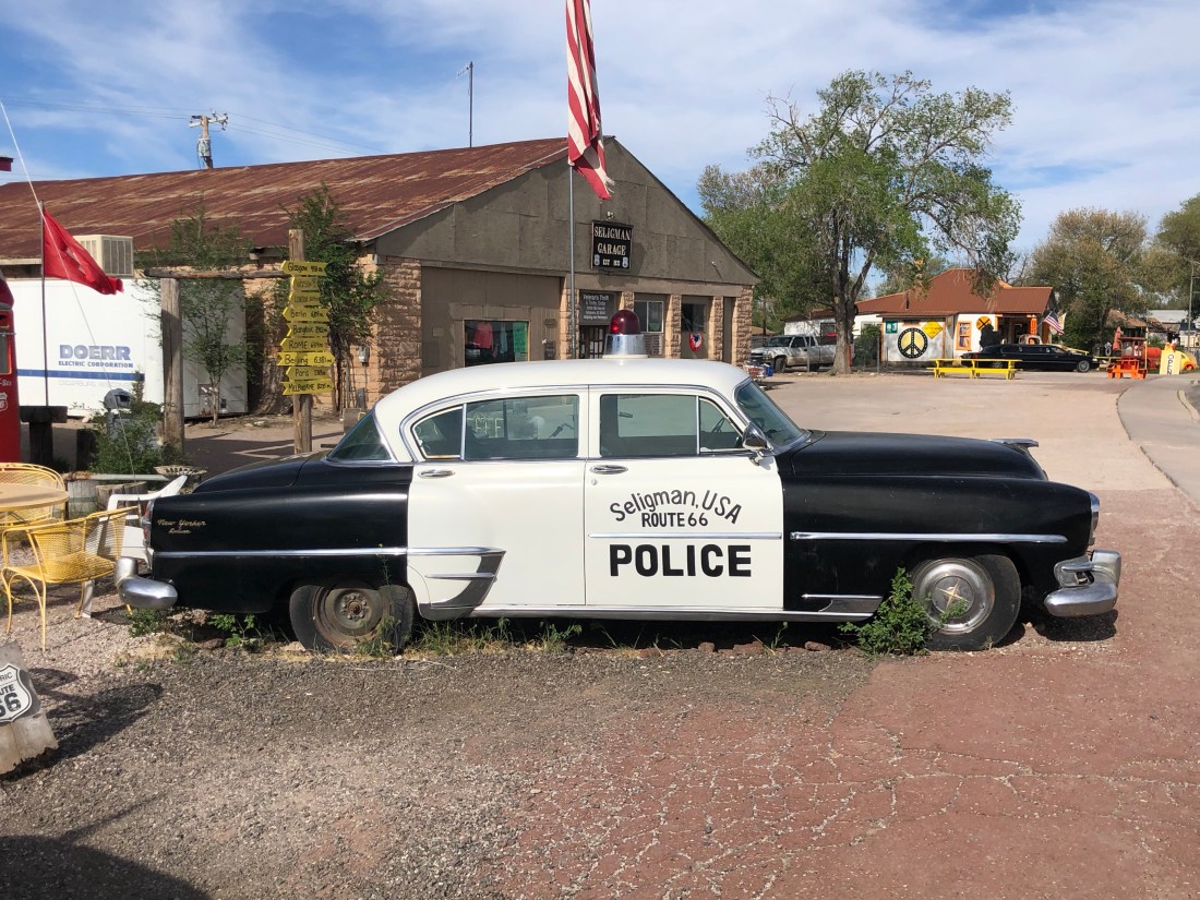
My last stop on Route 66 was the sleepy little town of Seligman, AZ. Seligman is another tourist town along Route 66, but with a twist.
In 2000, Writer and Director of Pixar’s “Cars”, John Lasseter, hatched the Cars idea while taking a cross-country trip on Route 66 with his wife and five sons. Upon returning to work, he contacted Michael Wallis, a famous Route 66 historian. Wallis then took eleven Pixar animators on two different road trips across Route 66 to research the film.
The movie’s fictional town of Radiator Springs was inspired by several real-life locations along historic Route 66, most notably Seligman. To take advantage of the opportunity they have dressed a number of cars up like the characters. And the town remains a sleepy little town on Route 66
Sleepy Seligman
Sleepy Seligman
Dressed as the character Mater in Cars (Voice of Larry the Cable Guy)A 1950s Pontiac Chief Police Car“You can trust your car to the man who wears the star”Elvis, as the Icon of the 50s and 60s, is closely linked to Route 66
Having been born in the late 50s, I can appreciate some of the nostalgia offered by Route 66. But, I think my biggest take away is the perseverance of these towns and the people who live in places like Oatman and Seligman.
These tough Americans fight for their right to exist and look for opportunity in every detail. They ask for nothing and count on one another and themselves to keep the spirit of Route 66 and their towns alive.
Seligman brought me to the end of my Route 66 adventure and pretty much the end of my ride. It has been another incredible experience. Discovering the beauty of America’s national parks. Meeting proud, spiritual, Navajos who keep the sacred lands such as Monument Valley and Canyon de Chelly. Meeting other bikers and having my faith in the kindness of people reignited.
I also found time on the trails of Bryce and Zion, back roads of Canyonlands and other areas to stop and reflect on how fortunate and blessed I am. I am blessed with a wonderful family, my wife Catherine and my two daughters Emma and Sarah. I am blessed that all my girls are happy and healthy and pursuing their lives and dreams. I am blessed with my health and the love and support I receive to pursue my adventures, such as this ride.
I am off to Tucson to catch up with some dear Cowboy and Cowgirl friends of mine. Then, back up to Phoenix to drop off my bike so that it can be trucked back to Connecticut. I fly home at the end of this week.
I have greatly enjoyed writing these blogs and I graciously thank you for sticking with me. I hope that you have enjoyed reading my blogs and at some level, you have had a visceral thrill with the pictures and stories of our great land and her people.
Thank you again, Keep Wheeling! – Until next time.
It was over 100º as I visited Lake Mead and Hoover Dam. Hoover Dam was hot as well – as in “incredibly” impressive.
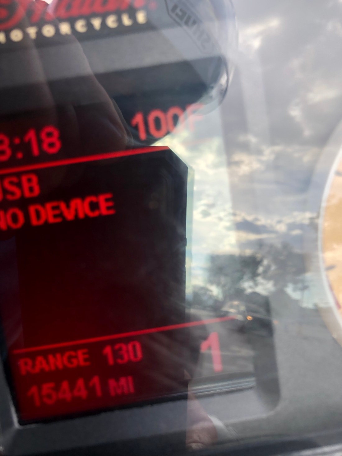
The Geen Dot was where I started. “B” is the Marina at Lake Mead I visited and the Checkered Flag is Hoover DamThat was the temperature gauge on my Indian Roadmaster in the shade.
Lake Mead is a man-made lake that lies on the Colorado River, about 24 mi (39 km) from Las Vegas, in the states of Nevada and Arizona. Formed by the Hoover Dam on September 30, 1935, the reservoir serves water to the states of Arizona, California, and Nevada, as well as some of Mexico, providing sustenance (water and electricity) to nearly 20 million people and large areas of farmland.
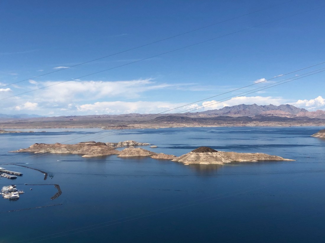
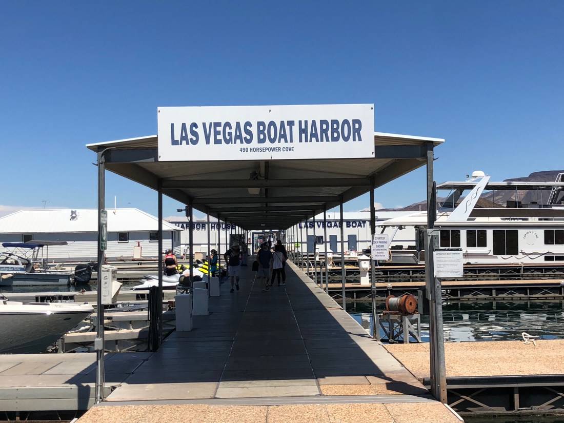
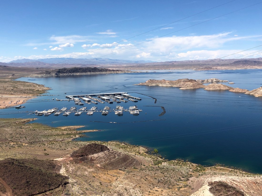
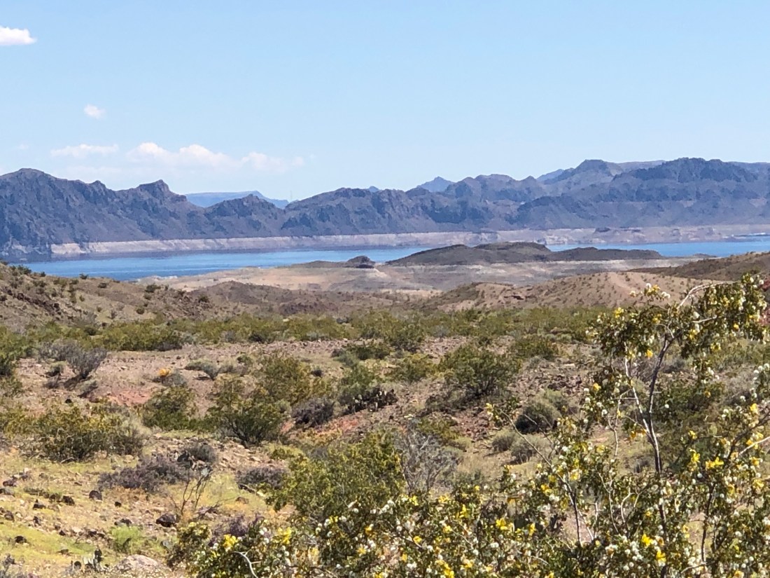
Lake Mead from an overlook. The water level is at 40% of capacityI visited this Lake Mead marina looking for ideas for Riverside Yacht ClubFirst, so many people feed the fish at the Harbor, that the fish follow people down the dock looking for food. The fish include catfish, carp, bass, bluegill, etc.
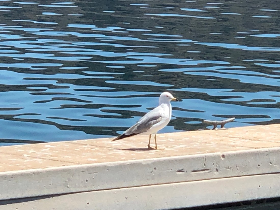
Lake Mead does have birds that look a lot like Seagulls – A little skinnier than East Coast.
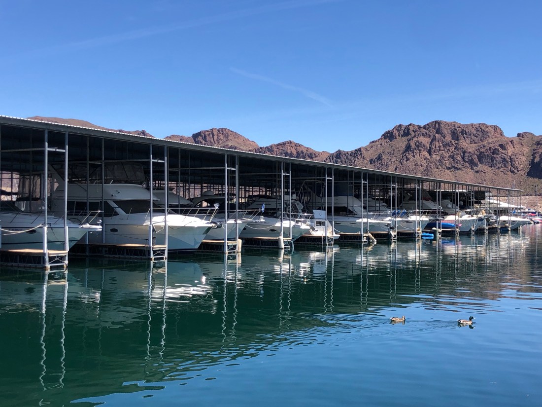
The average high temperature at Lake Mead in July is 106º. Therefore, many of the boats are undercover.You also find a lot of houseboats on the lake – Good for getting out of the heat
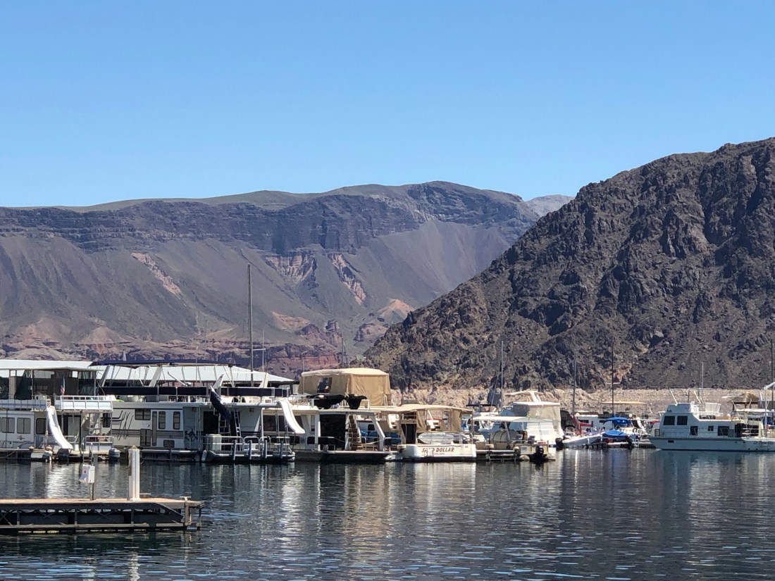
And the Desert Princess Paddle Boat that gives 90-minute tours of the lake.An overlook view of the Marina
There is a great deal of concern regarding Lake Mead’s water level and its ability to continue to serve the over 20 Million people who count on it for water and electricity. Changing rainfall patterns, climate variability, high levels of evaporation, reduced snowmelt runoff, and current water use patterns are putting pressure on water management resources at Lake Mead as the population relying on it for water, and the Hoover Dam for electricity, continues to increase.
As a nation, this will become a major focus over the next few years as the lake is so critical to the western states and the country as a whole.
One of the world’s Engineering Wonders.
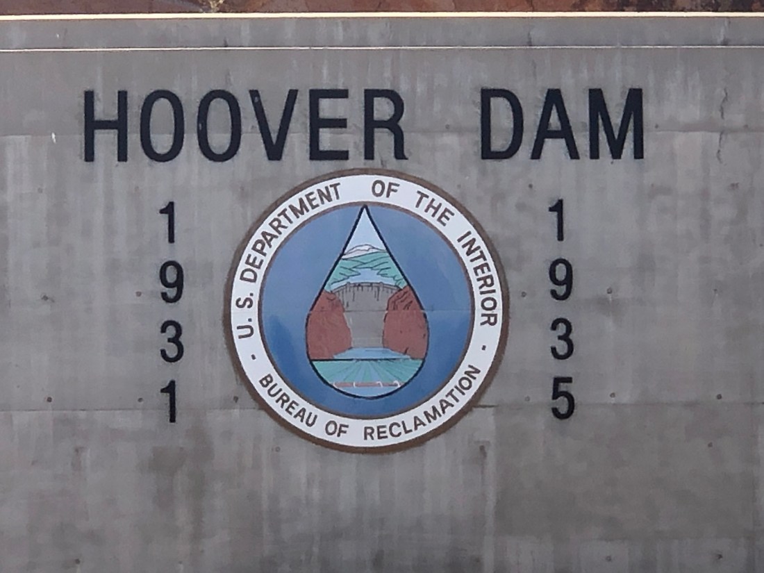
Hoover Dam was constructed in just five years, between 1931 and 1936, during the Great Depression and was dedicated on September 30, 1935, by President Franklin D. Roosevelt.
Its construction was the result of a massive effort involving thousands of workers and cost over one hundred lives. Originally known as Boulder Dam from 1933, it was officially renamed Hoover Dam, for President Herbert Hoover, by a joint resolution of Congress in 1947.
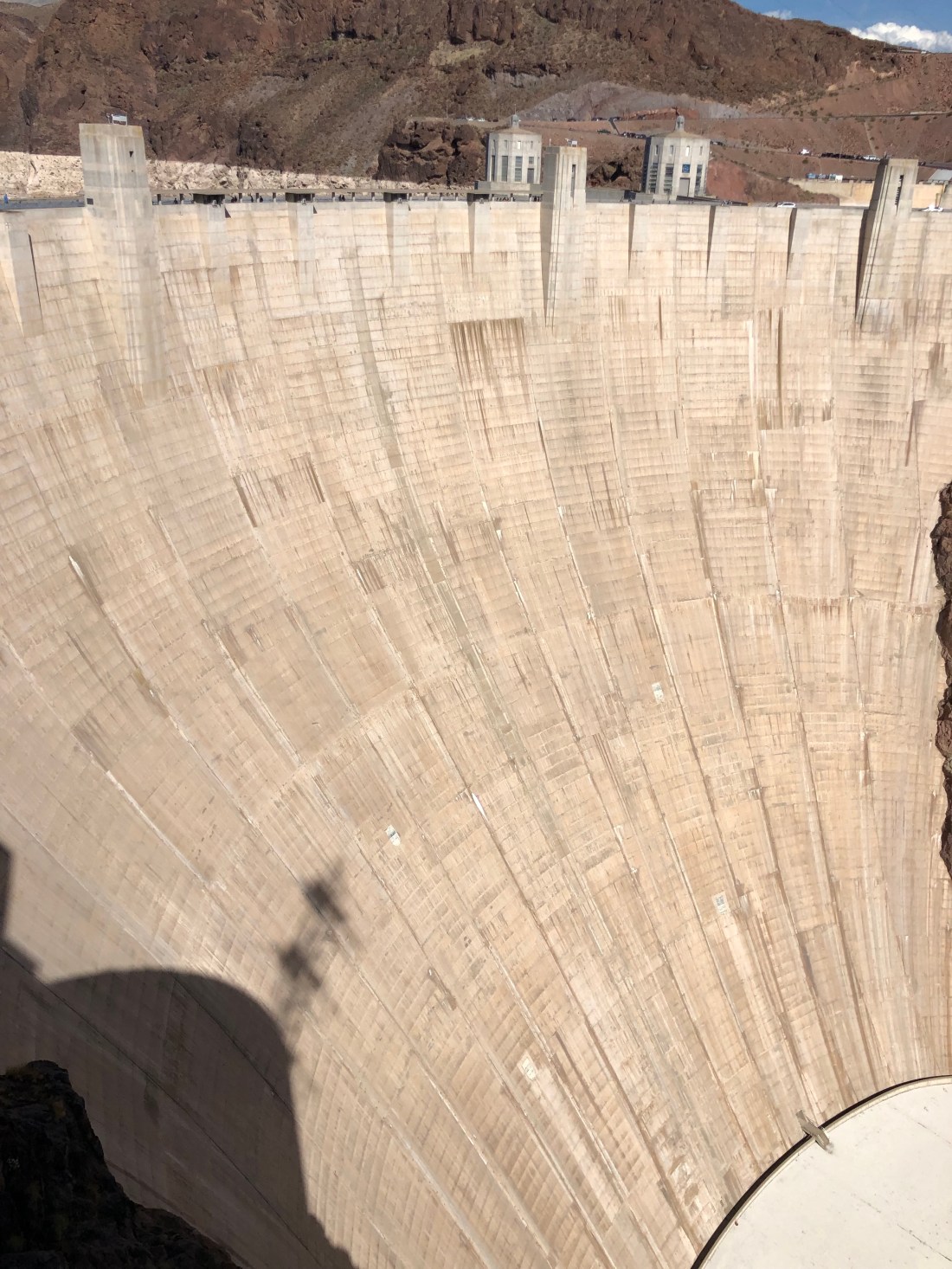
A total of 3,250,000 cubic yards (2,480,000 cubic meters) of concrete was used in the dam before concrete pouring ceased on May 29, 1935. Overall, there is enough concrete in the dam to pave a two-lane highway from San Francisco to New York. Hoover Dam is 726 ft. tall. That is 171 ft. taller than the Washington Monument in Washington D.C. At its base, Hoover Dam is as thick (660 ft.) as two football fields measured end-to-end.
The Dam is so large that it is a challenge to capture it in a photo.A view of Lake Mead from the Dam. The “Tub Ring” is minerals deposited on the rock walls when the lake’s water level was higher. The Desert Princess in the background.On the other side of the Dam, fromLake Mead is the Colorado River.
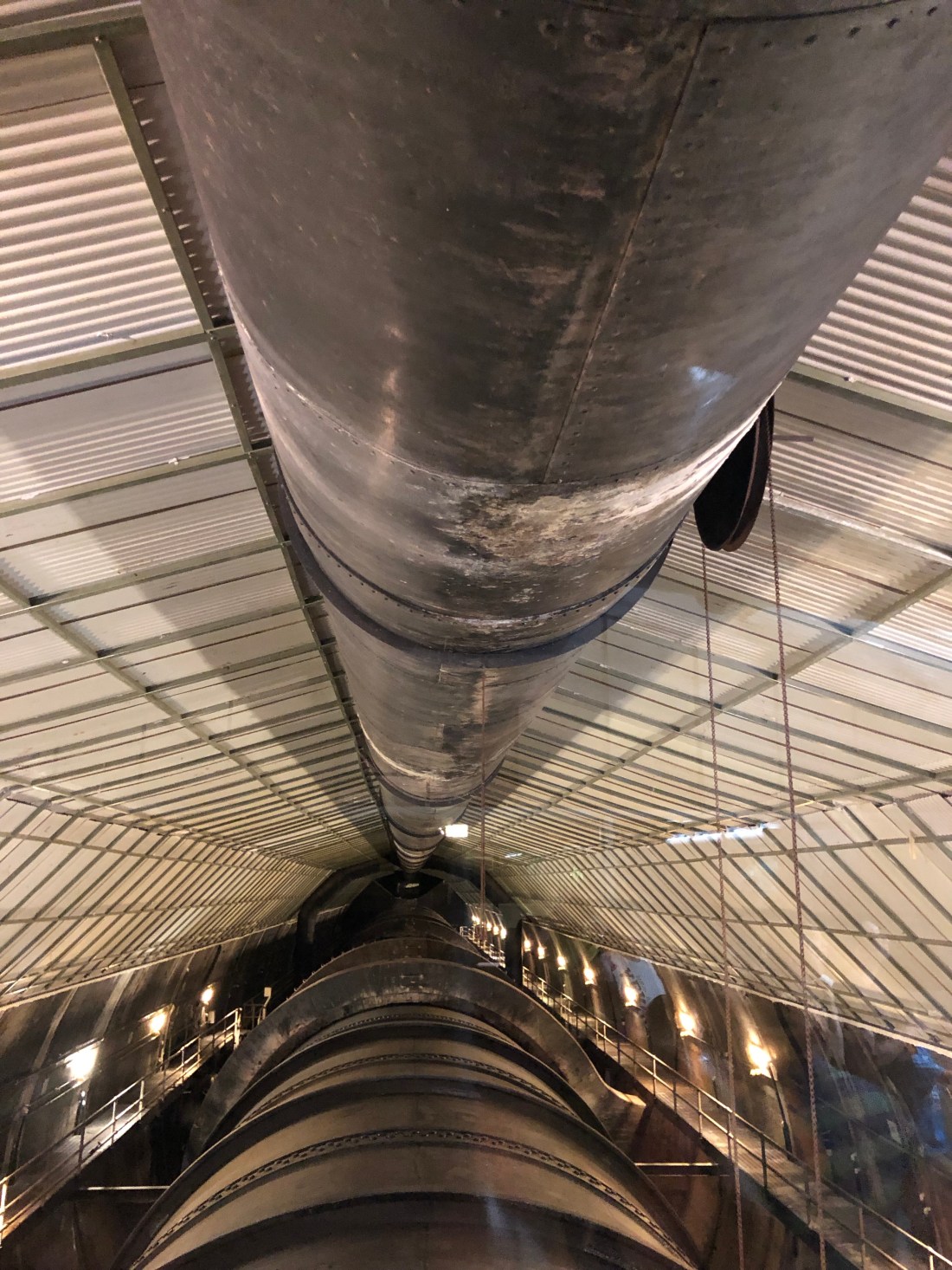
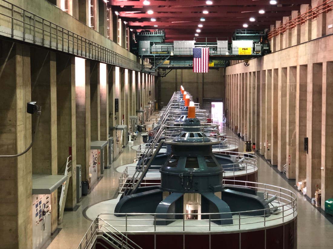
I took a tour of the Dam with focus on her power plant and tunnels. Before the dam could be built, the Colorado River needed to be diverted away from the construction site. To accomplish this, four diversion tunnels were driven through the canyon walls, two on the Nevada side and two on the Arizona side
You can see the diversion tunnels above. The outer tunnels have been closed while the inner Diversion Tunnels now carry water to the electricity power plants.We stood over one of the inner diversion tunnels and you could feel the vibration of the water under your feet.And, these are the power plants with turbines that create the electricity – A little too technical for me.
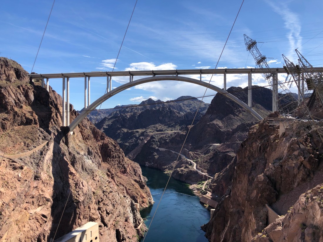
The traffic crossing the Hoover Dam had become so intense that another bridge needed to be built to ease the congestion. The newly-completed Mike O’Callaghan-Pat Tillman Memorial Bridge is the world’s tallest concrete arch bridge, it is the first concrete-steel arch composite bridge in the United States and towers 880 feet over the Hoover Dam.
The 1,905-foot-long bridge connects both Nevada and Arizona roadways, so it’s fitting that it’s named the Mike O’Callaghan-Pat Tillman Memorial Bridge, as it honors a hero from each state. With 30,000 cubic yards of concrete and 16 million pounds of steel, the massive engineered wonder is the widest of its kind in the Western Hemisphere. The bridge was opened, October 16, 2010 (to pedestrians); October 19, 2010 (regular traffic).
A view of the Mike O’Callaghan-Pat Tillman Memorial Bridge from Hoover Dam
The Hoover Dam was a great engineering accomplishment…..a tribute to America’s ability to design and execute a monumental project during the Great Depression. The construction of the Dam was in the 1930s what reaching the moon was in the 1960s. It was a project that united the country and brought tremendous pride in America’s ability to tame the wild Colorado River.
It will take another great American effort to save Lake Mead and the Hoover Dam. Because without American ingenuity, Lake Mead and the Hoover Dam will not be able to supply our Western states with the water and electricity necessary to not only survive but to thrive.
I’m betting on us. Tomorrow I am off to explore what is known as the Mother Road, The Main Street of America or The Will Rogers Highway. Route 66 from Needles, CA to Seligman, AZ.
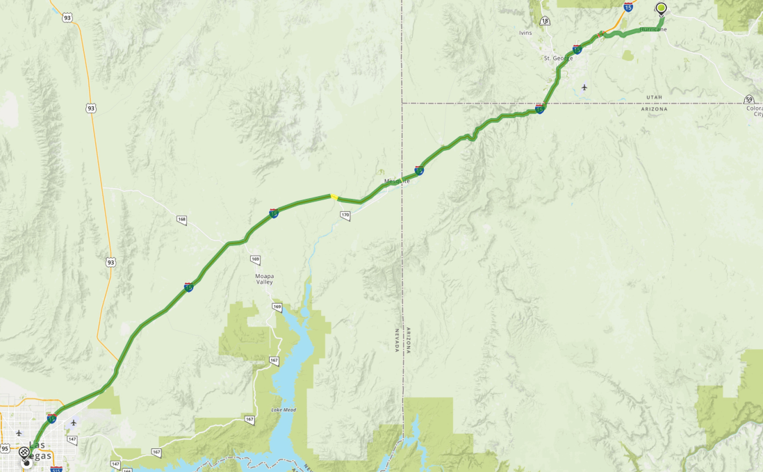
I had few expectations regarding yesterdays’ ride from Zion National Park to Las Vegas. There was nothing on any social media that I saw referencing interesting roads.
The conventional route, as seen below, is to get on I-15 and ride 80 MPH for 141 miles.
Look closely and you will see Moapa Valley, Nevada Route 169, converting to Nevada Route 167 and connecting with Nevada Route 147. Finding this detour, I immediately saw hope for an interesting ride.
The minute I left I-15 I knew I was in for fun. The sign below was at the intersection of I-15 and Rt 169 just as I started down the road.
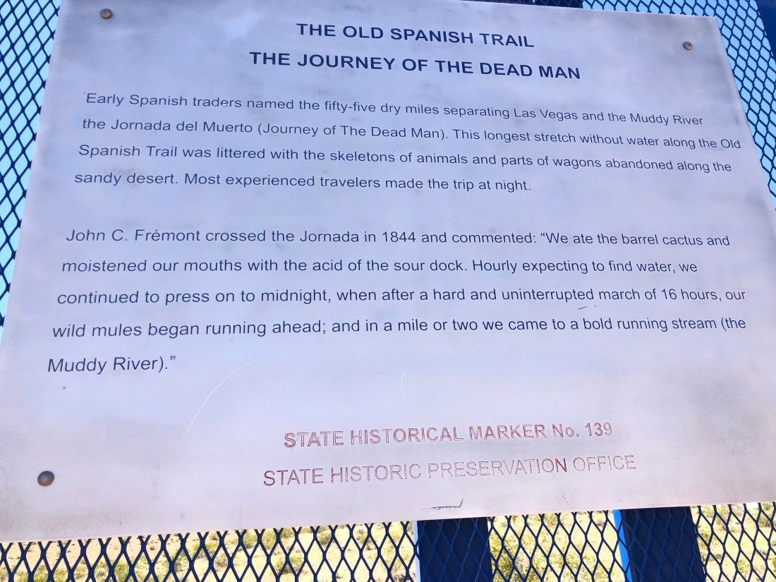
Even on a motorcycle, reading this gives you pause.
I looked at my surroundings and saw the exact same sight those early Spanish traders saw. Untouched dry land for miles and miles. Unchanged in hundreds of years.
Dry Desert for as far as the eye can see – not much use even today – But beautifulAgain, very few cars on this unconventional route.
I drove south approximately an hour and was surprised to find this sign encouraging me to continue.
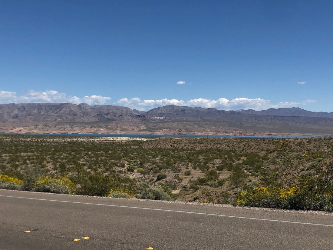
My first view of Lake MeadI was informed that the white rim around the lake is the level the water used to be just a few years ago.
After spotting Lake Mead, I continued on and found a Red Rock Wonderland – an area with rocks so red that they glowed. I apologize as again the pictures do not do justice to the deep red they featured. This area is near the Valley of Fire State Park, but I do not believe that I entered the Park.
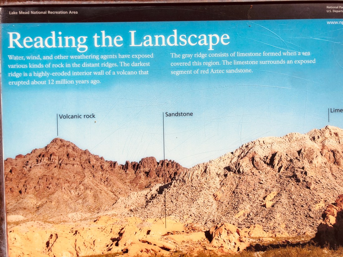
There was a sign that called out the vista I was seeing in front of me. Read below how the farthest out and darkest ridge is a highly eroded interior wall of a volcano that erupted about 12 MILLION years ago. Which means that I was standing inside the volcano as I read the sign.
It also calls out limestone coloration and what the sign calls my red stone as red Aztec sandstone. Look at the following two pictures, I have attempted to duplicate the sign so that you can see clearly what the sign refers to.
Line up the tallest peak just left of center with the picture above.
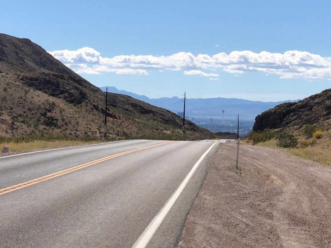
Returning to the road, I continued to pass red rocks, Limestone, and desert until I crested a hill and there was Las Vegas. When you hear that Las Vegas was built in the middle of the desert, they are telling the truth.
Look closely and you can see the Stratosphere – 1,149′ tall observation tower
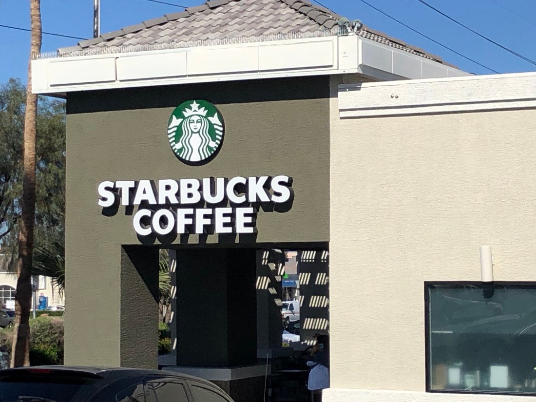
Just a few minutes later I found the first Starbucks I had seen in over two weeks, since I left Phoenix on April 7th. I did not miss Starbucks and I was 100% happy without them, but I did immediately run in and had an iced coffee.
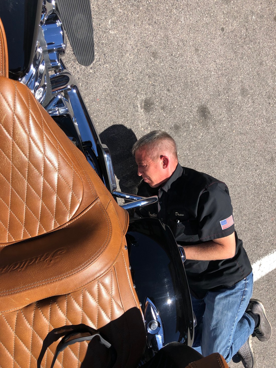
As a quick reminder and an update on my Indian. I came to Las Vegas to first and foremost have my Indian Motorcycle checked out. She has been through a lot over the last few weeks, “ridden hard and put up wet.” She had developed a whine in her drive belt, the kickstand was slightly loose, her power was down and some other minor issues.
Sin City Indian is a great Indian dealership and their manager Drew was really attentive. Knowing that they may never see me again, they still gave me, what I consider to be, 100% attention. Below is Drew, the manager, helping me clean the drive belt and checking my shock pressure.
I am happy to report that the whine in the drive belt has been fixed, the belt needed aligning. The kickstand, something I use many times a day, is tightened, the air filter has been changed and the power is back up. Over the past weeks, I have ridden through so much dust the air intake was clogged. I am happy to report that the Indian is now happy.
OK, I am also in Las Vegas to lay down a few bets – $30 on the Yankees to beat the Angels tonight – Straight money bet. Go Yankees and…


 At 14:45 (2:45 PM) we arrived at our final destination, Riverside Yacht Club in Riverside, CT.


 Wakely is a Back Cove 41. The 41 is the flagship of the Back Cove fleet and is fitted with an efficient single Cummins diesel engine. Catherine and I fell in love with the 41 last year. After a quick search, we found our Back Cove 41 in St. Petersburg, Florida.
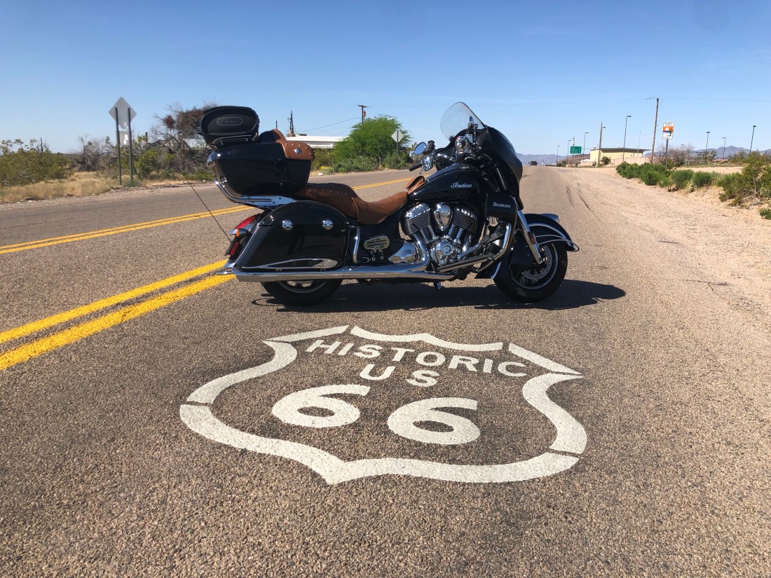


 The Cavern was discovered by a Walter Peek in 1927 when he nearly fell down a hole leading into the cavern. The next day, he and friends returned and they lowered Walter into the cavern to explore.